Davis Lake Volcano
Updated: 20. Apr. 2024 00:16 GMT -
volcanic field 2163 m / 7,096 ft
Oregon (Canada and USA (mainland)), 43.57°N / -121.82°W
Aktueller Status: normal / ruhend (1 von 5)
Oregon (Canada and USA (mainland)), 43.57°N / -121.82°W
Aktueller Status: normal / ruhend (1 von 5)
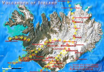
Davis Lake area in Oregon, USA, is a volcanic field with 3 cinder cones and lava flows of three cinder cones and associated lava flows.
[smaller] [larger]
Ausbrüche des Davis Lake: 2790 BC (?) (radiocarbon dated)
Letzte Erdbeben in der Nähe
| Uhrzeit | Mag. / Tiefe | Entfernung / Ort | |||
Beschreibung
The cinder cones of the Davis Lake field are on a N-S line at the feet of a group of older basaltic-andesite shield volcanoes east of the crest of the Cascade Range and south of the Mount Bachelor volcanic chain.The northernmost lava flow built a natural barrier forming Davis Lake. It lies at the western base of the Pleistocene Davis Mountain shield volcano and at the SW end of the Wickiup Reservoir.
The two southern flows are located in a plain straddling Crescent Creek between Hamner and Odell Buttes.
The middle lava flow erupted from a small cinder cone on the lower southern flank of Hamner Butte and appears to be the youngest of the lava flows in the field.
The southernmost lava flow was erupted from a cone at the ENE base of Odell Butte.
---
Source: GVP
Latest satellite images