Douglas Volcano
Updated: 25. Apr. 2024 04:36 GMT -
Stratovolcano 2140 m / 7,021 ft
United States, Alaska Peninsula, 58.86°N / -153.54°W
Aktueller Status: normal / ruhend (1 von 5)
United States, Alaska Peninsula, 58.86°N / -153.54°W
Aktueller Status: normal / ruhend (1 von 5)
Last update: 10 Apr 2013
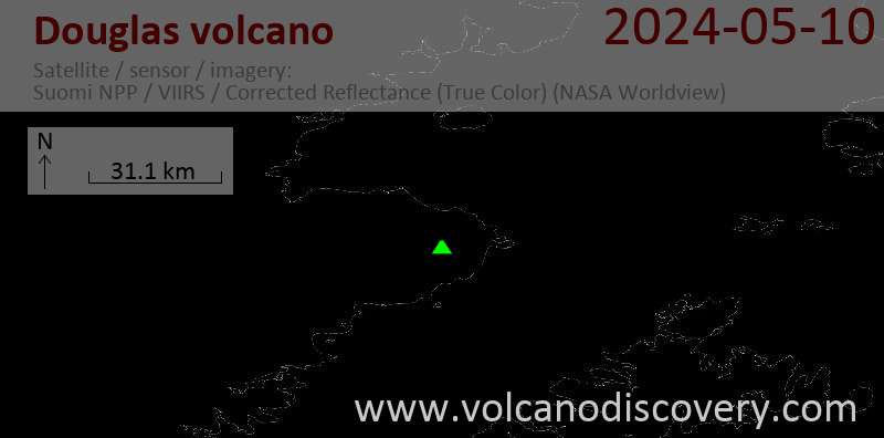
Glacier-covered, dissected Mount Douglas stratovolcano is located at the northern end of the Alaska Peninsula south of Kamishak Bay. The volcano, the NE-most in Katmai National Park, contains a small, ice-free summit crater lake and an active fumarole field.
[smaller] [larger]
Ausbrüche des Douglas: unknown, no recent eruptions
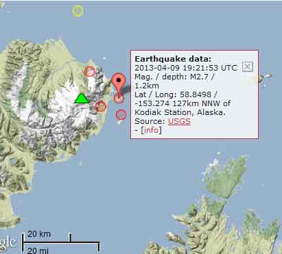
Letzte Erdbeben in der Nähe
| Uhrzeit | Mag. / Tiefe | Entfernung / Ort | |||
| 15. Apr. 23:32 (Anchorage) | 1.9 68 km | 22 km nordöstlich | Info | ||
| 15. Apr. 19:30 (GMT -8) | 1.8 19 km | 29 km östlich | Info | ||
Beschreibung
The volcano was constructed above Cretaceous and Jurassic sedimentary rocks. A lake temperature of 25 degrees Centigrade and a pH of 1 were measured in 1982. The fumaroles, which are actively depositing sulfur, were all at the pressure boiling point in 1982 and heated up to 114-118 degrees in 1991. The fumaroles are located on the NE wall of the 160 x 200 m wide crater lake; some fumaroles are subaqueous and produce turbulence on the surface of the blue-green lake. Unglaciated and relatively uneroded lava flows are found on the NW flank of the volcano. The age of the most recent eruptions from Douglas is not known, but Nye et al. (1998) considered activity to have occurred during the Holocene.---
Smithsonian / GVP volcano information
Latest satellite images