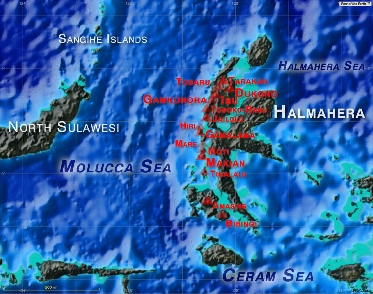
(stratovolcano 1030 m / 3,379 ft)
Amasing volcano lies off the southern coast of Halmahera Island, Indonesia, on the small island of Bacan (Palau Batjan). Bukit Amasing (Amasing Hill) is the largest and NW most of 3 small andesitic volcanoes, the other two being Cakasuanggi and Dua Saundara. No recent activity is... [
mehr Infos]
(stratovolcano 900 m / 2,953 ft)
Bibinoi volcano (Bukit Bibinoi, Bibinoi Hill) on the SE tip of Bacan Island is the largest and SE most of 3 volcanoes on the island, located off the south coast of Halmahera Island, Indonesia. Two other, smaller volcanic centres are Songsu and Lansa.
Binibnoi is separated ... [
mehr Infos]
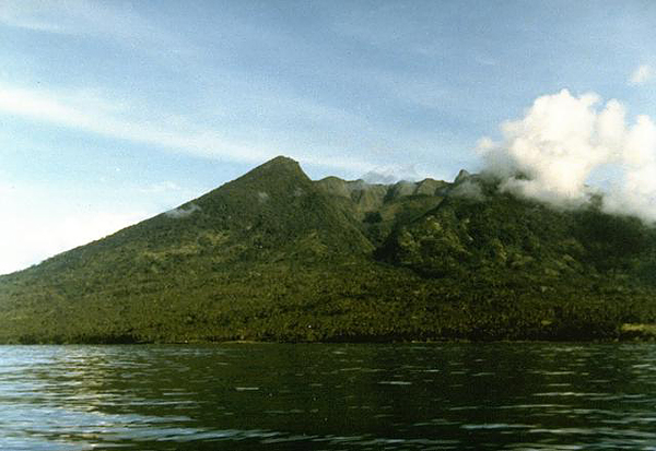
(Complex volcano 1185 m (3,888 ft))
Ash emission from Dukono volcano
Dukono is a remote volcano on the island of Halmahera (Indonesia). There is not much information available due to its remote position, but Dukono is one of the world's most active volcanoes and has been in persistent activity since 1933. [
mehr Infos]
(Stratovolcano 1715 m / 5,627 ft)
Gamalama (Peak of Ternate) is a near-perfect conical stratovolcano that forms the entire island of Ternate off the western coast of Halmahera. It is one of Indonesia's most active volcanoes. [
mehr Infos]
(Stratovolcano 1635 m / 5,364 ft)
The 1635 m high stratovolcano fo Gamkonora is the highest peak on Halmahera.
It has had shifting shifting eruption centers that have produced an elongated series of summit craters along a N-S trending rift. Young-looking lava flows originate near the cones of Gunung Alon a... [
mehr Infos]
(stratovolcano 630 m / 2,067 ft)
Hiri is a small 3-km-wide forest covered island immediately north of Ternate Island and the tip of a mostly submerged stratovolcano. It forms the northernmost of a volcanic chain off the western coast of Halmahera. There are no known historic eruptions. [
mehr Infos]
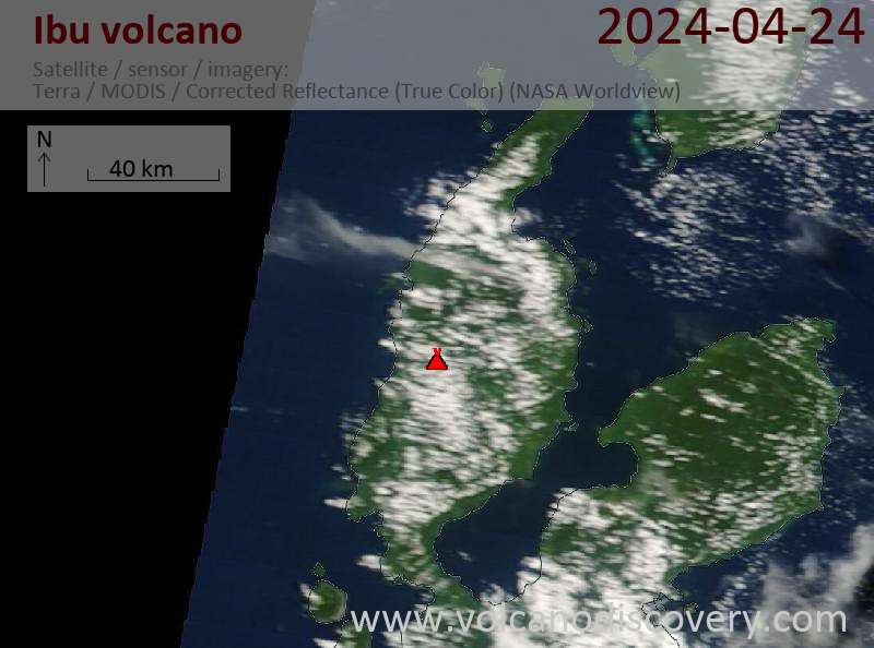
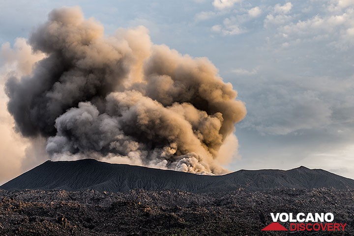
(Stratovolcano 1325 m / 4,347 ft)
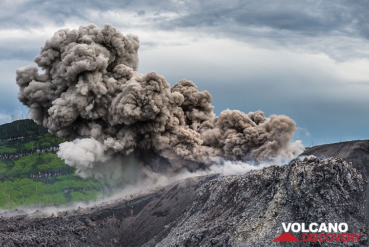
Strombolian explosion from the active vent in Ibu's lava dome (Dec 2014)
Only a few eruptions have been recorded from Ibu in historical time, the first was a small explosive eruption from the summit crater in 1911. An eruption producing a lava dome that eventually covered much of the floor of the inner summit crater began in December 1998. [
mehr Infos]
(stratovolcano 1130 m / 3,707 ft)
Jailolo stratovolcano is in the center of a volcanic complex forming a peninsula west of Jailolo Bay on the western coast of Halmahera Island. Jailolo stratovolcano has not erupted in historic times, but there are young lava flows on the eastern flank. [
mehr Infos]
(Stratovolcano 1357 m / 4,452 ft)
Kiebesi volcano (Makian Island) seen from the NW with the prominent Ngopagita gully (image: Ruska Hadian, 1985, Volcanological Survey of Indonesia)
Makian volcano is one of Inondesia's most destructive volcanoes. It has had infrequent, but violent eruptions that have devastated villages on the island. Its eruption have been recorded since about 1550; the major eruptions in 1646, 1760-61, 1861-62, 1890, and 1988 caused extens... [
mehr Infos]
(stratovolcano 308 m / 1,010 ft)
Mare volcano forms a small 2x3 km wide island off the west coast of Halmahera, Indonesia. It belongs to the active volcanic chain off the western coast of Halmahera. Mare volcano has a breached crater at the SW end. There are no known historic eruptions. [
mehr Infos]
(stratovolcano 950 m / 3,117 ft)
Moti (also spelled Motir) volcano forms a 5 km wide island surrounded by coral reefs north of Makian volcano. It is part of the N-S aligned chain of volcanoes off the W coast of Halmahera Island, Indonesia. [
mehr Infos]
(stratovolcano 318 m / 1,043 ft)
Tarakan is a twin volcano 16 km NE of more active Dukono. There is no known historic activity from the two large cinder cones Tarakan Lamo and Tarakan Itji ("big and small Tarakan"). [
mehr Infos]
(stratovolcano 1730 m / 5,676 ft)
Tidore volcanic complex forms a conisits of 2 volcanoes, the beautiful and conical Kiematabu peak (1730 m) in the south and the lower, broad volcano of Sabale volcano in north, containing a caldera and two cinder cones. Kiematabu peak is the highest volcano of the North Maluku is... [
mehr Infos]
(stratovolcano 422 m / 1,384 ft)
Gunung Tigalalu (Mount Tigalalu) at the northern end of Kayoa Island lies almost exactly on the equator and is the southernmost of the volcanic chain off the W coast of Halmahera. The volcano has not erupted in historic times. [
mehr Infos]
(stratovolcano 1035 m / 3,396 ft)
Gunung Tobaru (also known as Gunung Lolodai) is a small and little known andesitic volcano in northern Halmahera WSW of Dukono volcano and NNE of Ibu volcano. It is believed it is still active, although no recent eruptions are known. [
mehr Infos]
(complex volcano 979 m / 3,212 ft)
Todoko-Ranu Volcano in north-western Halmahera 15 km SW of Gamkonora volcano is a part of a larger volcanic complex, which contains 2 calderas. One of the calderas, Ranu caldera, contains a crater lake. [
mehr Infos]