Kukak Volcano
Updated: 23. Apr. 2024 21:11 GMT -
Stratovolcano 2043 m / 6,703 ft
United States, Alaska Peninsula, 58.45°N / -154.36°W
Aktueller Status: normal / ruhend (1 von 5)
United States, Alaska Peninsula, 58.45°N / -154.36°W
Aktueller Status: normal / ruhend (1 von 5)
[smaller] [larger]
Ausbrüche des Kukak: unknown, no recent eruptions
Letzte Erdbeben in der Nähe
| Uhrzeit | Mag. / Tiefe | Entfernung / Ort | |||
| 22. Apr. 23:44 (Anchorage) | 2.3 70 km | 21 km östlich | Info | ||
| Sonntag, 21. April 2024 GMT (1 Beben) | |||||
| 21. Apr. 14:23 (Anchorage) | 2.1 104 km | 16 km westlich | Info | ||
| Freitag, 19. April 2024 GMT (1 Beben) | |||||
| 19. Apr. 01:30 (Anchorage) | 2.4 4.1 km | 20 km südwestlich | Info | ||
| Mittwoch, 10. April 2024 GMT (1 Beben) | |||||
| 9. Apr. 20:19 (Anchorage) | 2.0 93 km | 18 km südöstlich | Info | ||
| Sonntag, 21. April 2024 GMT (2 Beben) | |||||
| 20. Apr. 19:21 (Anchorage) | 1.9 74 km | 25 km südöstlich | Info | ||
| 21. Apr. 04:29 (Anchorage) | 1.4 89 km | 17 km nördlich | Info | ||
Beschreibung
The almost completely ice-covered Kukak volcano lies west of Hallo Bay near the NE end of a glacier-mantled range extending from Mount Katmai. Kukak volcano contains a vigorous fumarole field at the southern base of the hydrothermally altered northern summit and is the only one of the Denison-Steller-Kukak chain of volcanoes to display geothermal activity. Two reports of historical eruptions at Kukak from Hantke (1959) appear to be erroneous. The report of a 1951 eruption is an apparent reference to a July 22, 1951 ashfall at Kukak Bay, which was attributed by Muller et al. (1954) to Martin volcano. A 1953 explosive "eruption" was single large puff of steam followed by steaming from caverns in Hook Glacier (Muller et al., 1954).---
Smithsonian / GVP volcano information
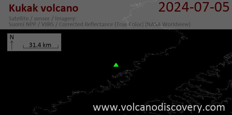
Latest satellite images