Kontakt | RSS | EN | DE | EL | ES | FR | IT | RU

E-san (Volcano)

E-san (恵山(えさん) in Japanese) is the southernmost active volcano on Hokkaido. It is a small andesitic stratovolcano located in the southeast of the Kameda-hanto Peninsula extending into the Pacific Ocean from the south of Hokkaido across the Tsugaru Strait from Honshu.
It has a lava dome forming its summit and another lava dome to the NW. Both have been active within the past 10,000 years, the summit lava dome forming about 9000 years ago.
The only known historic eruptions were a small phreatic eruption in 1846 which produced a lahar with many fatalities, and a small explosion in 1874.
E-san has many active fumaroles in a thermal area on the upper NW flank.
Fumaroles are located on the upper NW flank. At the foot of Mt. E-san is the Esan-onsen Hot Spring, a popular attraction since the latter half of the 19th century, it is renowned for its distinctive wine-red colored water.

Eagle Lake (Volcano)

Eagle lake is a volcanic field at the junction of the Sierra Nevada, Cascades, and Basin Range in California, USA. It contains 15 small cinder cones, fissures and lava flows.

Ebeko (Volcano)

Ebeko is one of the most active volcanoes in the Kurile Islands, located in northern Paramushir Island south of Kamchatka.
Ebeko volcano has a flat top with 3 summit craters aligned SSW-NNE. The eastern part of the southern crater contains a large boiling spring. The middle crater has a hot lake with solfataras along its shore. The lower northern crater has a small, cold lake and is separated from the middle crater by a narrow ridge.
Historical activity has been recorded since the late 18th century and consisted in small to moderate explosive eruptions from the summit craters. Intense fumarolic activity occurs in the summit craters of Ebeko and on the outer flanks of the cone, as well as inside lateral explosion craters.

Ebulobo (Volcano)

Ebulobo (also called Amburombu or Keo Peak), is a symmetrical stratovolcano in central Flores Island. It has a flat summit lava dome and contains a 250 m summit crater, breached on 3 sides. In 1830, a lava flow (known as Watu Keli lava flow) descended from the northern breach on the summit and reached 4 km length.
A small summit eruption occurred on 28th February 1969, where "fire", steam and ash were reported.

Edziza (Volcano)

Mount Ediziza in NW British Columbia, Canada is a large, complex stratovolcano about 1 million years old forming the most recently active of a group of overlapping basaltic shields, lava domes, flows, and central stratovolcanoes. Mount Edziza contains a 2-km-wide, ice-filled summit caldera with a central summit crater and several flank vents. The volcano's lavas range from basalt to rhyolite.
Frequent volcanic activity of the complex has been going on for about 8 million years, but the last eruptions occurred only about 1000 years ago.
After the Level Mountain Range to the north, Edziza is Canada's second largest young volcano.
Volcanic activity of the Edziza complex is caused by extension structures in the underlying basement and the volcano lies along a zone of north-south normal faults east of the Coast Crystalline Complex.

Active or recently active warm springs are found in several areas along the western flank of the volcanic plateau, including Elwyn springs (36°C), Taweh springs (46°C), and inactive springs near Mess Lake. All 3 hydrothermal areas are near the youngest lava fields on the plateau and are probably associated with the most recent volcanic activity at Mount Edziza.
The vast plateau has also been an important cultural resource. The Tahltan people, who now live largely near Telegraph Creek, British Columbia, used volcanic glass (obsidian) from Mount Edziza to make tools and for trading material.
More recently, most of the plateau has been made into a provincial park to preserve the volcanic and culture treasures unique to the northern British Columbia area.
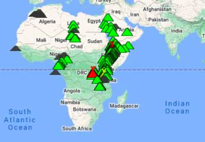
effusiv (Volcanology: effusiver (Vulkan)ausbruch)

Effusiv bedeutet Ausströmen, Ausfließen von Magma (->Lavaströme)

Egon (Volcano)

1703-m-high Gunung Egon volcano is one of the active volcanoes of Flores. After about a century of being dormant, the volcano came suddenly back to live in 2004, triggering the evacuation of about 7000 people.

Ekarma (Volcano)

Ekarma stratovolcano forms a small 5 x 7.5 km island 8.5 km north of Shiashkotan Island in the northern Kurile Islands, Russia.
The volcano belongs to an E-W-trending volcanic chain extending westward from the central part of the main Kuril Island arc. It contains two overlapping basaltic-andesite to andesitic volcanoes, with the western one showing historical activity. Lava flows have flown 3 km in all directions from the summit of the younger cone to the sea, forming a sinuous shoreline.
The island summit is formed by a lava dome which formed in the first historic eruption of Ekarma between 1767-69.

El Aguajito (Volcano)

El Aguajito volcano (also known as Santa Ana caldera) is a large 10 km wide caldera at the coast of the Gulf of California, northwest of the older La Reforma caldera. The caldera formed during massive eruptions about 760,000 years ago in what would be called a super-volcano eruption, and its rim is no longer exposed. A series of lava domes that formed about 500,000 years ago, occupy its northern edge. There is an active geothermal system with hot springs along the southern side of the caldera.

El Chichón (Volcano)

El Hierro (Volcano)

The triangular island of El Hierro is the SW-most and least studied of the Canary Islands.
Following intense earthquake swarms since July 2011, a new submarine eruption started in Oct 2011 at a vent ca. 1 km south of La Restinga off the southern tip of the island. The eruption, which could even start to build a new island, is ongoing at the time of updating. Follow the El Hierro news page for the latest events.

El Misti (Volcano)

The majestic El Misti volcano is Peru's most known and one of its most active volcanoes. It is an andesitic symmetrical stratovolcano that dominates the town of Arequipa, only 16 km to the SW, and its proximity to Peru's second largest city as well its history of explosive eruptions make it one of the world's most dangerous volcanoes.

El Negrillar (Volcano)

El Negrillar (Negros de Aras) is a group of cinder cones and andesitic lava flows in northern Chile about 20 km north of Socompa volcano. The age of volcanic activity from the field is unknown. The major Holocene debris avalanche from Socompa volcano overlies (= is younger than) some youthful-looking lava flows at the western margin of the El Negrillar field.
Note: A volcano called La Negrillar is located nearaby.

El Solo (Volcano)

El Solo volcano is large stratovolcano in Argentina at the border with northern Chile and west of Nevados del Ojos de Salado and SE of Tres Cruces volcano.
Is comprises 9 eruptive centers. The age of its last eruptions is unknown, but was during the Holocene (less than 11,700 years ago), when it produced thick rhyodacitic pyroclastic-flow deposits that fill adjacent valleys.

El Tatio (Volcano)

El Tatio is one of the most impressive thermal areas of the Andes. The geothermal field is located in northern Chile within a depression east of a chain of older volcanoes, Cerro Deslinde, Cerro Volcán, Cerros del Tatio, and Volcán Tatio.
The Hoyada de Los Geisers del Tatio geothermal field covers 30 sq km and contains 85 fumaroles and solfataras, 62 hot springs, 40 geysers, 5 mud volcanoes, and extensive sinter terraces. It is the world's third largest geyser field and the largest geothermal area in the southern hemisphere.
It has been tried to install geothermal energy plants, but the remoteness of the area and difficulty in providing infrastructure prohibited its development.

El Valle (Volcano)

El Valle volcano is a (perhaps still active) stratovolcano 80 km SW of Panama City. The volcano has a broad shape and is cut by the 6 km wide El Valle de Antón caldera, which formed about 56,000 years ago.
Lava domes that grew inside the caldera include the Cerro Pajita, Cerro Gaital, and Cerro Caracoral dome complex.

Elbrus (Volcano)

Elbrus volcano is a large stratovolcano in the western Caucasus of SW Russia. It is the highest mountain of Europe (although some argue that it belongs already to Asia) and the highest volcano of the northern hemisphere.
Elbrus has not erupted for about 2000 years, but is considered an active volcano. There is weak solfataric activity near the summit and hot springs are present on the volcano's flanks.

Emperor of China (Volcano)

The "Emperor of China" is an questionable submarine volcano in the western part of the Banda Sea and rises 1500 m above the sea floor. The mountain has a flat shield shape and there are unconfirmed reports about possible eruptions in 1927 and before 1927. (Source: GVP)

Endut (Volcano)

Endut volcano is one of a complex of 3 closely located old stratovolcanoes known as the Perbakti-Gagak or Kiaraberes-Gagak volcanic complex situated immediately SW of Salak volcano and near Bogor town. The 3 volcanoes of the group are, from S to N, Gunung Endut (1474 m), Gunung Perbakti (1699 m), and Gunung Gagak (1511 m).

Erciyes Dağ (Volcano)

Erciyes Dağ or Erciyes Dagi volcano is a massive, eroded stratovolcano that dominates the northern end of the Sultansazligi Basin in central Anatolia. It covers an area of about 1300 sq km.

Erebus (Volcano)

Mount Erebus stratovolcano is the highest and most active volcano of Antarctica, one of the Volcanic Seven Summits, and the largest of 4 volcanoes that form the roughly triangular Ross Island (Mt Erebus, and the extinct Mt. Bird to the north, Mt. Terra Nova and Mt. Terror to the east).
Hut Point Peninsula to the south is the location of McMurdo Station (the main US base) and Scott Base (the main New Zealand base).
Mount Erebus volcano, located on the western half of Ross Island, Antarctica, is the world's southernmost historically active volcano and famous for its active boiling lava lake.
Its summit temperature averages between -20 (summer) and -50 deg C (winter) and it is covered by glaciers. It was discovered by explorer Caption James Ross in 1841 and climbed 1908 by members of Ernest Shackleton's expedition. Since then it was visited only very rarely in the following 100 years.

Erta Ale (Volcano)

Escorial (Volcano)

Cerro Escorial volcano is a small andesitic-dacitic stratovolcano in northern Chile on the border with Argentina. The volcano contains a 1 km wide well-preserved summit crater of possible Holocene age. There are young-looking lava flows mostly towards the Chilean side, but they are probably more than 300,000 years old.
A large sulfur mine active until around 1978, La Casualidad or Mina Julia, is located 4 km SW of the volcano in an area of extensive hydrothermal alteration. A present, the volcano has warm springs (frozen at the surface), mud vents, and fumaroles, suggesting that the volcano is still active.

Esjufjöll (Volcano)

The subglacial Esjufjöll volcano at the SE part of the Vatnajökull icecap, north of Öræfajökull volcano, may contain a central caldera. A minor eruption in 1927 that produced a large jökulhlaup is the only known historical activity from Esjufjöll.

Esteli (Volcano)

Esteli volcano is a group of young fissure vents, cones and lava flows located 36 km south of Honduras in the northern interior highlands between the town of Estelí and the border. The volcanic center is not on the main volcanic front of Nicaragua, but 70 km NE of the main volcanic arc.
Some of the lava flows and cones near Esteli town could be less than 10,000 years old.

explosiv (Volcanology: explosiver (Vulkan)ausbruch)

Wenn Magma beim Austritt als Fragmente (Asche, Lapilli, Bomben) in die Luft geschleudert wird, spricht man von einem explosiven Ausbruch (im Gegensatz zu effusiv).

Eyjafjallajökull (Volcano)

Eyafjallajökull volcano (its name meaning Island-Mountain under a glacier) under the small homonymous glacier in southern Iceland erupted spectacularly on 20 March 2010, after having been dormant for almost 200 years. During its most violent phase, the subglacial eruption produced large ash plumes that drifted over Europe and forced an unprecedented closure of airspace over most of Europe for several days in mid April 2010.
App herunterladen
Volcanoes & Earthquakes - new app for Android
Android | iOS-Version

Mehr auf VolcanoDiscovery

Warum gibt es Werbung auf dieser Seite?

Unterstützen Sie unsere Arbeit!

Diese Webseite und die dazugehörigen Apps und Tools instandzuhalten und kostenlos Nachrichten zu Vulkanen, Erdbeben und anderen Themen bereitzustellen, verschlingt enorm viel Zeit und auch Geld.
Wenn Sie die Infos mögen und uns in der Arbeit dazu unterstützen wollen, würden wir uns über eine Spende (über PayPal oder mit Kreditkarte) sehr freuen.
Online Zahlung (Kreditkarte)
Damit können wir Ihnen auch in Zukunft neue Features entwickeln und Bestehende laufend verbessern.Vielen Dank!
Sources: VolcanoDiscovery / VolcanoAdventures and other sources as noted.
Use of material: Most text and images on our websites are owned by us. Re-use is generally not permitted without authorization. Contact us for licensing rights.
Volcanoes & Earthquakes
VolcanoDiscovery Home
Vulkane | Erdbeben | Fotos | News | App
Adventure & Study Travel
Reisen zu Vulkanen und Vulkangebieten: Wanderreisen, Studienreisen, Fotoreisen
Tours & Dates | FAQ | About us
Get our newsletter!
Company info
Kontakt | Impressum | AGB
Follow us
Follow us on facebook Follow us on Instagram Follow us on Twitter Visit our Youtube channel
EN | DE | EL | ES | FR | IT | RU
VolcanoDiscovery GmbH, Germany, Reg. nr.: HRB 103744, EU Tax Id: DE 297 465 123 owned and created by
Dr. Tom Pfeiffer, volcanologist, volcano photographer, tour organizer member of
IAVCEI
IAVCEI
Vulkanologische Gesellschaft
Volcanological Society
Ecotourism Greece
Ecotourism Greece
RUV insurance
Insured by R+V
VolcanoDiscovery © 2004- All Rights Reserved | Datenschutz - Cookie Einstellungen