Kontakt | RSS | EN | DE | EL | ES | FR | IT | RU

Okmok Volcano

Updated: 25. Apr. 2024 03:50 GMT -
Central shield complex with nested caldera 1073 m (3520 ft)
Fox Islands, Aleutian Islands, USA, 53.4°N / -168.17°W
Aktueller Status: normal / ruhend (1 von 5)
Last update: 10 Dez 2021 (changes in ground deformation pattern)

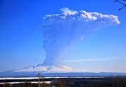
Okmok is one of the most active volcanoes in the Aleutian island chain (Alaska). It consists of a complex of shields truncated by a caldera and several active vents inside the caldera, which have built small cones and lava flows.

[smaller] [larger]
Typische Aktivität: Explosive and effusive
Ausbrüche des Okmok: 1817, 1824, 1878(?), 1899, 1931, 1935, 1936, 1938, 1943, 1945, 1958, 1960, 1981, 1983, 1986, 1997, 2008

Letzte Erdbeben in der Nähe

UhrzeitMag. / TiefeEntfernung / Ort
15. Apr. 20:00 (Anchorage)
1.0

20 km
4.6 km südlich 65 km NE of Nikolski, Alaska
Info
Montag, 15. April 2024 GMT (1 Beben)
14. Apr. 20:26 (Anchorage)
1.0

2.8 km
3.9 km westlich 66 km NE of Nikolski, Alaska
Info
Samstag, 13. April 2024 GMT (1 Beben)
13. Apr. 03:58 (Anchorage)
0.6

4.9 km
1.4 km südöstlich 69 km NE of Nikolski, Alaska
Info

Beschreibung

Okmok's caldera was formed by at least two collapses following catastrophic pyroclastic eruptions, at around 8200 y B.P. and 2400 y. B.P.
Within the caldera, the oldest volcanic deposits are brecciated pillow lavas and pyroclastic rocks once deposited in a caldera lake. The lake attained a maximum depth of about 150 m and the upper surface reached an elevation of about 475 m, at which point it overtopped the low point of the caldera rim. A small shallow lake near the outlet of the caldera is all that remains today. Three dissected tuff cones may have been produced by eruptions beneath the former caldera lake. Other cinder cones occur atop pillow lavas; such cones apparently breached the surface of the former lake. Cinder cones and associated lava flows that are younger than the caldera lake are identified by structures and textures characteristic of subaerial eruption. The documented eruption of 1945 occurred at a cinder cone near the southwest caldera wall; this cone may have been the site of all historical activity of Okmok volcano. Hot springs and fumaroles occur both within Okmok caldera and at Hot Springs cove, 20 km to the southwest.
---
Source: Alaska Volcano Observatory

Latest satellite images

Okmok satellite image sat1Okmok satellite image sat2
Fr, 10. Dez 2021, 03:57

Okmok volcano (Aleutian Islands, USA): changes in ground deformation pattern

A long-term ground deformation change has been detected at the volcano by Global Navigation Satellite Systems (GNSS) stations during September and November. ... Read all
Mi, 18. Mär 2009, 06:00

Okmok volcano (Fox Islands, USA) - Smithsonian / USGS Weekly Volcanic Activity Report for 18 March-24 March 2009 (Continuing Activity)

On 20 March, AVO lowered the Volcano Alert Level for Okmok to Normal and the Aviation Color Code to Green. Seismic activity had been at low to near background levels and satellite views showed no activity during the previous two weeks. The last confirmed ash emission at Okmok occurred on 19 August 2008. ... Read all
map showing location of Mount Okmok. Image source: Cameron, Cheryl, courtesy of the Alaska Volcano Observatory / Alaska Division of Geological & Geophysical Surveys

Auf dieser Seite:

App herunterladen
Volcanoes & Earthquakes - new app for Android
Android | iOS-Version

Mehr auf VolcanoDiscovery

Warum gibt es Werbung auf dieser Seite?

Unterstützen Sie unsere Arbeit!

Diese Webseite und die dazugehörigen Apps und Tools instandzuhalten und kostenlos Nachrichten zu Vulkanen, Erdbeben und anderen Themen bereitzustellen, verschlingt enorm viel Zeit und auch Geld.
Wenn Sie die Infos mögen und uns in der Arbeit dazu unterstützen wollen, würden wir uns über eine Spende (über PayPal oder mit Kreditkarte) sehr freuen.
Online Zahlung (Kreditkarte)
Damit können wir Ihnen auch in Zukunft neue Features entwickeln und Bestehende laufend verbessern.Vielen Dank!
Sources: VolcanoDiscovery / VolcanoAdventures and other sources as noted.
Use of material: Most text and images on our websites are owned by us. Re-use is generally not permitted without authorization. Contact us for licensing rights.
Volcanoes & Earthquakes
VolcanoDiscovery Home
Vulkane | Erdbeben | Fotos | News | App
Adventure & Study Travel
Reisen zu Vulkanen und Vulkangebieten: Wanderreisen, Studienreisen, Fotoreisen
Tours & Dates | FAQ | About us
Get our newsletter!
Company info
Kontakt | Impressum | AGB
Follow us
Follow us on facebook Follow us on Instagram Follow us on Twitter Visit our Youtube channel
EN | DE | EL | ES | FR | IT | RU
VolcanoDiscovery GmbH, Germany, Reg. nr.: HRB 103744, EU Tax Id: DE 297 465 123 owned and created by
Dr. Tom Pfeiffer, volcanologist, volcano photographer, tour organizer member of
IAVCEI
IAVCEI
Vulkanologische Gesellschaft
Volcanological Society
Ecotourism Greece
Ecotourism Greece
RUV insurance
Insured by R+V
VolcanoDiscovery © 2004- All Rights Reserved | Datenschutz - Cookie Einstellungen