Upolu Volcano
Updated: 25. Apr. 2024 00:45 GMT -
Shield volcano 1100 m / 3,609 ft
Samoa, Samoan Islands, -13.94°S / -171.72°W
Aktueller Status: normal / ruhend (1 von 5)
Samoa, Samoan Islands, -13.94°S / -171.72°W
Aktueller Status: normal / ruhend (1 von 5)
[smaller] [larger]
Ausbrüche des Upolu: unknown, no recent eruptions
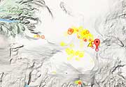
Letzte Erdbeben in der Nähe
| Uhrzeit | Mag. / Tiefe | Entfernung / Ort | |||
Beschreibung
The massive, basaltic shield volcano forming 75-km-long Upolu Island in Samoa is elongated in an E-W direction and was constructed during two periods of extensive eruptions during the Pliocene and Pleistocene. The most extensive activity during the Pleistocene took place along a 20-km segment along the central axis of the island. Following a lengthy period of erosion, the latest lava flows, at least three of which were estimated to be as young as a few hundred to a few thousand years old, were erupted from vents near the crest of the island at its center and western side (Stearns, 1944). One of the youngest flows reached the north-central coast along a roughly 1.5-km-wide front east of Vailele Bay, and another traveled down the Lefaga River channel and reached the SW coast at Lefaga Bay. Apolima Island off the western tip of Upolu is a Holocene tuff cone too young to be fringed by a coral reef, and other reef-free areas along the coastline may be formed by Holocene lava flows.---
Smithsonian / GVP volcano information
Latest satellite images