Tacana Volcano
Updated: 25 abr. 2024 05:33 GMT -
stratovolcano 4060 m / 13,320 ft
Mexico / Guatemala, 15.13°N / -92.11°W
Current status: normal or dormant (1 out of 5)
Mexico / Guatemala, 15.13°N / -92.11°W
Current status: normal or dormant (1 out of 5)
Last update: 29 feb 2020
Tacaná volcano on the Mexican-Guatemalan border is a symmetrical stratovolcano rising 1800 m above its base and forms the NW end of the Central American Volcanic Belt.
Tacana consists of overlapping volcanic edifices, reflecting a migration of vents from the NE to the SW over time. The youngest vent is the San Antonio lava dome in a crater on the upper SW flank, which was the site of most recent activity.
Historic eruptions of Tacaná were small phreatic explosions in 1855, 1878, 1949–1950 and 1986, from both Tacaná and San Antonio. The eruption in 1950 was the largest and produced pyroclastic flows.
Active fumaroles are found at 3600 m altitude and hot springs in various locations at the base of the volcano.
[smaller] [larger]
Erupciones del volcán Tacana: 1986, 1949-50, 1878, 1855
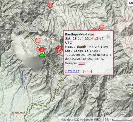
Latest nearby earthquakes
| Fecha / Hora | Revista / Prof. | Distancia / Ubicación | |||
| 13 abr 16:25 (Mexico City) | 3.7 117 km | 24 km al suroeste | Más | ||
Background
Tacaná contains a complex elongated summit area with 3 large calderas breached to the south, occupied by a series of lava domes intruded along a NE-SW trend. Viscous lava flow complexes are found on the north and south flanks, and lobate lahar deposits fill many valleys.Radial drainages on the Guatemalan side are deflected by surrounding mountains into the Pacific coastal plain on the SW side of the volcano.
Tacana Volcano Photos
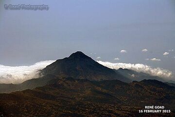
Volcán Tacana visto desde el aire. A 4064 m snm marca la frontera entre México y Guatemala. El volcán entró en erupción por última vez en 1986. (Photo: RGoadPhotography)...
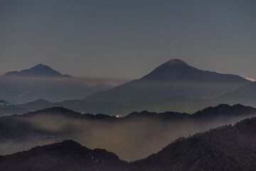
Vista hacia la parte occidental del frente volcánico de Guatemala con las siluetas de Tacana (al fondo a la izquierda), en la frontera con México, y el volcán Tacomulco (...
Erupciones del volcán Tacana
1986 eruption
Following months of increased seismic activity, a seismic swarm with quakes every minute started on 7 May, and was followed by a small phreatic explosion the next day. The vent was on the upper NW flank at an elevation of 3,800 m. It ejected a small amount of fine ash and partially destroying vegetation in an area 200 x 100 m, but otherwise caused no damage. New fumaroles were later found above 8 May crater. ...más info
Following months of increased seismic activity, a seismic swarm with quakes every minute started on 7 May, and was followed by a small phreatic explosion the next day. The vent was on the upper NW flank at an elevation of 3,800 m. It ejected a small amount of fine ash and partially destroying vegetation in an area 200 x 100 m, but otherwise caused no damage. New fumaroles were later found above 8 May crater. ...más info
Latest satellite images