Cayambe Volcano
Equateur, 0.03°N / -77.99°W
Condition actuelle: normal / en sommeil (1 sur 5)
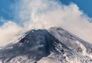
Nevado Cayambe is a massive volcanic complex in northern Ecuador, 60 km NE of the city of Quito and only 15 km E of the 20,000 inhabitants city of Cayambe. The equator passes through its southern flank. The andesitic-dacitic volcano is located on the isolated western edge of the Cordillera Real in the Ecuadorian Andes, east of the Inter-Andean Valley.
The volcano is capped by extensive glaciers, which descend to 4200 m on the eastern Amazonian side. It contains 2 summit lava domes located about 1.5 km apart, the western of which is the highest. Several other lava domes are located on the upper flanks and have been the source of pyroclastic flows down the lower flanks of the volcano.
La Virgen is a prominent young cinder cone on the lower eastern flank, which erupted thick andesitic lava flows that reached 10 km to the east.
There is only one confirmed historic eruption, during 1785-86, but recent studies have shown that the volcano has produced frequent explosive eruptions during the past 4000 years.
Eruptions du volcan Cayambe: 1785-86, 1700(?), 1590(?), 1570(?), 1440(?), 1290(?), 1270(?), 1040(?), 880(?), 260 AD (?), 200 AD (?), 170 AD (?), 10 AD (?), 180 BC (?), 230 BC (?), 260 BC (?), 460 BC, 510 BC (?), 560 BC (?), 1300 BC (?), 1650 BC (?), 1800 BC (?)
Derniers séismes proches
| Heure | Mag. / Profondeur | Distance / Lieu | |||
| 2 avril 18:18 (Guayaquil) | 2.9 13 km | 28 km à l'est | Info | ||
Introduction
Geography of the Cayambe Volcanic Complex:Cayambe volcano is belongs to the Cayambe Volcanic Complex (CVC), which has has a roughly rectangular base (24 km E-W, 18 km N-S), and is located at an altitude of 2800-3000 m in the west and at 3400-3800 m asl in the eastern part.
The upper part of the complex is elongated in E-W direction and consists of the main summit of Nevado Cayambe (5790 m). A secondary summit (5487 m) of Nevado Cayambe is located 1.5 km E of the first.
Above 4800 m asl, the complex is covered by a major ice cap that covers an area approximately 22 km2 and reaches a thickness of 30-50 m near the summit. On the eastern flank, its glaciers descend to 4400 m altitude, while in the western flank, the driest, the glaciers reach an altitude of 4600-4800 m.
Geological evolution of Cayambe:
The evolution of the Cayambe Volcanic Complex can be divided into 4 main stages:
1) Basal volcano or "Viejo Cayambe" (1.1-1.0 million years ago)
"Old Cayambe" was built during the Pleistocene years ago in the western part of the volcanic complex and is now eroded.
2) The Angureal cone (around 400,000 years ago)
After a possibly 500,000 years long repose interval, a new cone consisting of thick lava flows and breccias was built from a new vent 2 km east of the old volcano (ca 3 km west of the current summit). This intermediate cone suffered sector collapse and reated the horseshoe-shaped
scar in the upper Rio Blanco valley.
3) The Nevado Cayambe Main Summit (250,000 - 100,000 years ago)
To the east of the Angureal cone, a new massive stratovolcano started to form about 250,000 years ago. The stratovolcano contains about 130-170 cubic kilometers of lava and is the most voluminous part of the complex. This part of the volcano itself had a complex history, which has been divided into 2 main stages:
The first episode (250,000- less than 200,000 years ago) erupted andesitic and dacitic lava flows and domes, which are well represented on the southern flank, around the Refuge and Pucara peaks. Large explosive eruptions occurred in between effusive periods, and include the deposition of The Hierba Buena ignimbrite, which is an up to 150-200 m thick sheet of welded ignimbrite sheet in the northwestern part of the complex. Debris avalanche deposits were produced as well from partial cone and dome collapse.
The second episode (around 100,000 years ago) erupted at least 3 over 100 -m-thick lava flows of andesite on the north side, and 250 m thick lava flows on the southern side. A large explosive eruption ended this epoch of dome construction and produced the 60-80 m thick welded La Chimba ignimbrite. The event occurred more than around 15,000 years ago as the ignimbrite is covered by large moraines emplaced during the last glacial maximum (11–14,000 years ago).
4) The Nevado Cayambe secondary summit and the recent activity (ca. 4000 years ago - present)
A younger and smaller stratovolcano formed a secondary summit on the eastern side of Nevado Cayambe in the Holocene and historic times. It has been producing large lava flows towards the east. The "Cono La Virgen" is a probably a Holocene satellite cone from this recent activity period. It has a diameter of 1.5 km and a height of 400 m located at a distance of 8 km from the main summit on the lower eastern slope of the complex.
Sources:
- Smithsonian / GVP volcano information
- Samaniego et al (2005) "Temporal Evolution of Magmatism in the Northern Volcanic Zone of the Andes: The Geology and Petrology of Cayambe Volcanic Complex (Ecuador)", J Petrology, v 53, pp 1-18
Eruptions du volcan Cayambe
Increased seismic activity was recorded at the volcano between 2003 and 2005.
The only certain historical eruption of Cayambe volcano started in February 1785 from a vent high on the southeast flank. It produced a 13 mm thick ashfall at Cayambe town. Ash emissions were also noted in July 1785, and a lava flow (or possibly a mud flow) was reported in March 1786.
Latest satellite images