


Chaitén Volcano
Updated: 23 avril. 2024 14:46 GMT -
Caldera, lava dome 1122 m
Argentine/Chili (sud) (Amérique du Sud), -42.83°S / -72.65°W
Condition actuelle: normal / en sommeil (1 sur 5)
Argentine/Chili (sud) (Amérique du Sud), -42.83°S / -72.65°W
Condition actuelle: normal / en sommeil (1 sur 5)
Last update: 11 déc. 2021
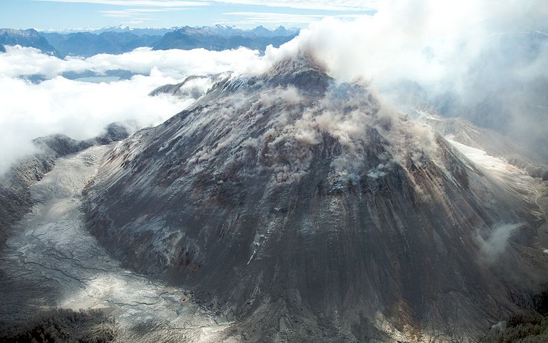
Image of the rhyolitic lava dome of Chaitén Volcano during its 2008-2010 eruption (photo: Sam Beebe)
Chaiten is a caldera volcano in southern Chile that had its first historic eruption on May 2, 2008 when it erupted violently. Ash fall and lahars during the eruption largely damaged the town of Chaitén, which had been evacuated as the eruption started.
[smaller] [larger]
Eruptions du volcan Chaitén: 2 May 2008 (plinian eruption) - 2011
Derniers séismes proches
| Heure | Mag. / Profondeur | Distance / Lieu | |||
Introduction
Chaitén is a small, glacier-free late-Pleistocene caldera with a Holocene lava dome located 10 km NE of the town of Chaitén on the Gulf of Corcovado. The north side of the rhyolitic, 962-m-high obsidian lava dome occupying the 3.5-km-wide caldera is unvegetated. Obsidian cobbles from this dome found in the Blanco River are the source of prehistorical artifacts from archaeological sites along the Pacific coast as far as 400 km away from the volcano to the north and south. The caldera is breached on the SW side by a river that drains to the bay of Chaitén, and the high point on its southern rim reaches 1,122 m. Two small lakes occupy the caldera floor on the west and north sides of the lava dome. Moreno (1985 pers. comm.) noted that the nearby volcano of Yelcho listed by the International Association of Volcanology and Chemistry of the Earth's Interior (1973) does not exist.---
Source: Global Volcanism Program at www.volcano.si.edu/world/volcano.cfm
Chaitén Volcano Photos
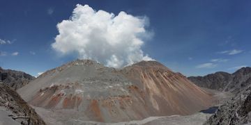
Dôme de lave du volcan Chaiten vu depuis le bord nord de la caldeira le 6 décembre 2009 (image panoramique cousue). Le dôme était en phase de dégazage et d'extrusion à fa...
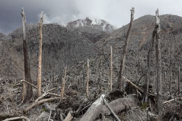
Des coulées pyroclastiques ont détruit la forêt du côté nord du dôme de lave du volcan Chaiten. (Photo: Richard Roscoe)
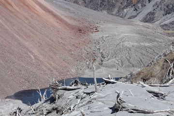
Le pied du dôme de lave du volcan Chaiten et la végétation endommagée sur le bord de la caldeira environnante. (Photo: Richard Roscoe)
Latest satellite images


