Reventador Volcano
Updated: 23 avril. 2024 06:44 GMT -
Stratovolcano 3562 m (11,686 ft)
Equateur, -0.08°S / -77.66°W
Condition actuelle: en éruption (4 sur 5)
Equateur, -0.08°S / -77.66°W
Condition actuelle: en éruption (4 sur 5)
Last update: 19 avril 2024 (Volcanic Ash Advisory)
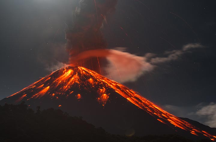
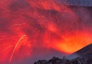
Vulcanian explosion at Reventador volcano in Jan 2020
Reventador, a 3562 m high stratovolcano, is one of Ecuador's most active volcanoes.
[smaller] [larger]
Eruptions du volcan Reventador: 1541, 1590, 1691, 1748, 1797, 1802, 1843, 1843, 1844, 1856, 1871, 1894, 1898-1906, 1912, 1926, 1929, 1936, 1944, 1955, 1957, 1960, 1972, 1973-74, 1976, 2002 (large eruption), 2004 (Nov) - 2005 (Jan), 2005 (June) - 2006 (March), 2008 (July) - ongoing
Derniers séismes proches
| Heure | Mag. / Profondeur | Distance / Lieu | |||
Introduction
Reventador had a major eruption on 3 November 2002, when it produced a 17-km-high eruption column, pyroclastic flows that traveled distances of up to 8 km, as well as lava flows from summit and flank vents.Reventador volcano belongs to a chain of volcanoes in the Cordillera Real, well east of the principal volcanic axis. The volcano is densely covered by forests and rises above the remote jungles of the western Amazon basin. The volcano has a 4-km-wide caldera that is widely breached to the east, which formed by collapse of the volcanic edifice. It is partially was formed by edifice collapse and is partially filled by a young, unvegetated stratovolcano rising about 1300 m above the caldera floor to a height above the caldera rim.During historical times, Reventador has produced numerous lava flows and explosive eruptions that could even be seen from Quito. Rainfalls frequently produce mud-flows (lahars) that have accumulated a large debris plain on the eastern floor of the caldera.
Geologic History of Reventador volcano
Reventador volcano was constructed during 3 principal phases:
1) Basal Volcanic Complex
A stratovolcano began its construction ca. 350,000-400,000 years ago. The volcano suffered major collapse and produced an avalanche deposit of about 20 cubic km volume, about 30,000 years ago.
2) The intermediate volcano, called Volcán Paleo Reventador, is a stratovolcano which grew inside the caldera left by the collapse of the Basal Volcanic Complex. It, too, was destroyed by a large collapse of the east flank. The debris avalanche of this event is easily recognizable in topography and has a volume of 8 cubic km. The age of this collapse is estimated at 20,000 years ago.
3) The present volcano Reventador, one of the most active in Ecuador, followed the collapse of the intermediate volcano. It has been particularly active during the twentieth century. Significant eruptions occurred in 1922, 1926, 1929, 1936, 1944, 1955, 1958, 1960, 1972, 1973-1974 and 1976.
Source: Samaniego et al (2005) "Temporal Evolution of Magmatism in the Northern Volcanic Zone of the Andes: The Geology and Petrology of Cayambe Volcanic Complex (Ecuador)", J. Petrology, v. 46 (11), pp. 2225-2252
Lahars were observed at the volcano in June 2007, after ash emissions in May 2007.
Eruptions du volcan Reventador
2008 eruptions
On 8 November 2008, residents of El Chaco village about 35 km SE of the volcano heard explosion sounds from Reventador. On 9 November, strombolian explosions and 2 lava flows were observed descending the north and south flanks of the central cone.
On 8 November 2008, residents of El Chaco village about 35 km SE of the volcano heard explosion sounds from Reventador. On 9 November, strombolian explosions and 2 lava flows were observed descending the north and south flanks of the central cone.
2002 eruption
Reventador volcano erupted suddenly on 3 November 2002 after 26 years of inactivity. Lava flows descended along the Montana, Marquez and Piedra Fina ravines, destroying roads and highways between Quito and Lago Agrio and damaged local farms.
At 09h12 local time, the main phase of the eruption began, producing an ash column rising to 16-17 km height above the summit. 3-4 hours later, the ash cloud reached the Inter-Andean Valley and the capital Quito ca. 100 km away from the volcano, where it caused almost total darkness in the late afternoon. The ash plume left a layer of fine gray ash up to 3-5 mm thick everywhere.
Over 2 million people were directly affected by the eruption, most of them by ash fall in areas up to 100-200 km distance. Near the volcano, pyroclastic flows devastated the flanks, reaching 8 km from the breached caldera, flowing down steep slopes to reach the Quijos river.
Heavy ashfall occurred in the provinces of Pichincha, Napo and Sucumbios and caused the closing of the international airport of Quito. The Trans Ecuadorian oil pipeline was shut down as precautionary measures.
2 people were seriously injured by impacts of falling tephra. 22 people from surrounding rural areas were evacuated. The Government of Ecuador declared a local emergency and made preparations for the potential evacuation of 3,000 people from the areas closest to the volcano, specifically from the village of El Reventador.
---
Source: Smithsonian / GVP monthly reports
Latest satellite images
Reventador Volcano Tours
Ecuador
Reventador Volcano Special
5 days expedition to Ecuador to observe volcanic activity from close
7 days / 6 nights - Facile-Modérée
Prix $ 1680
Prix $ 1680
pas de groupe programmé pour le moment


