Contact | RSS | EN | DE | EL | ES | FR | IT | RU

Savo Volcano

Updated: Apr 16, 2024 12:23 GMT -
stratovolcano 485 m / 1,591 ft
Central Province, Solomon Islands, -9.13°S / 159.82°E
Current status: normal or dormant (1 out of 5)
Last update: 22 Dec 2021 (Smithsonian / USGS Weekly Volcanic Activity Report)

Savo volcano is a forested andesitic to dacitic stratovolcano that forms the 6x7 km wide Savo Island, located 14 km north of Guadalcanal.
The volcano contains a shallow, elliptical 1x1.5 km wide summit crater.
Savo volcano has had dangerous explosive eruptions in the past centuries reflected in local legends. The first historic eruption was in 1568, when Spanish explorers arrived at the island. Oral traditions preserve the memory that pyroclastic flows killed almost all inhabitants, and that the island grew in size (by deposits of pyroclastic flows) on the northern size.
Due to its proximity to the capital Honiara and its frequent explosive eruptions, Savo is probably the most dangerous volcano of the Solomon Islands.
Savo Island is also known for its megapode population.

[smaller] [larger]
Typical eruption style: explosive
Savo volcano eruptions: 1865 ± 20 years (?), 1835 ± 5 years - around 1847, 1650 ± 20 years, around 1568

Latest nearby earthquakes

No recent earthquakes
TimeMag. / DepthDistance / Location

Background

Savo volcano contains lava domes of historical age on the crater floor and its NE rim. Older domes occur on the flanks of the volcano. Pyroclastic flows and mudflows that traveled down valleys from the summit crater form large debris fans along the coast.
Savo has a very active and large hydrothermal system with many thermal areas, located in the summit crater, on the S to SE flanks, and offshore. They include areas of steaming ground, fumaroles, small geysers, and hot springs, many of high pH and sulphate-rich. Precipitates around hot springs include sinter, travertine and mixed silica-carbonate, often enriched in gold and tellur.
Well-known thermal areas include: Fisher Voghala (hot sulfurous water), Mbiti Voghala (boiling mud pots and geysers), Pipisala (crater fumarole), the Tanginakula river near Mbokiaka (having both cold and hot waters), Vutusuala (hot springs and heated ground), Reoka, Mbulika and Tavoka (hot springs near Sesepi, heating the Kolika River), Talughau and Toakomata (remote hot springs in the bush).
---
Sources:
- Smithsonian / GVP volcano information
- Smith, D.J. (2009) "From Slab to Sinter: The Magmatic-Hydrothermal System of Savo Volcano, Solomon Islands", PhD. thesis, Dept. of Geology, Univ Leicester

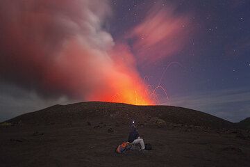
Savo Volcano Photos

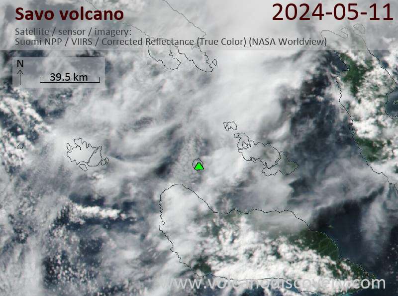
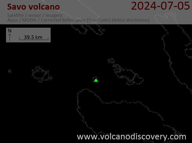
Latest satellite images

Savo satellite image sat1Savo satellite image sat2
Wed, 28 Jul 2021, 06:00

Savo volcano (Solomon Islands) - Smithsonian / USGS Weekly Volcanic Activity Report for 28 July-3 August 2021 (New Activity / Unrest)

According to a news source, residents on Savo in the Solomon Islands reported increased seismicity to authorities on 28 July. Two days later a team from the Geological Survey Division (GSD) and the National Disaster Management Office (NDMO) investigated the volcano. They saw steam-and-gas emissions rising from an area in the crater, possibly indicating an active fissure, and interviewed residents. ... Read all

On this page:

Try our free app!
Volcanoes & Earthquakes - new app for Android
Android | iOS version

More on VolcanoDiscovery

Why is there advertising on this site?

Support us - Help us upgrade our services!

We truly love working to bring you the latest volcano and earthquake data from around the world. Maintaining our website and our free apps does require, however, considerable time and resources.
We need financing to increase hard- and software capacity as well as support our editor team. We're aiming to achieve uninterrupted service wherever an earthquake or volcano eruption unfolds, and your donations can make it happen! Every donation will be highly appreciated. If you find the information useful and would like to support our team in integrating further features, write great content, and in upgrading our soft- and hardware, please make a donation (PayPal or Online credit card payment).

Planned features:Thanks to your past donations, these features have been added recently:
Download and Upgrade the Volcanoes & Earthquakes app to get one of the fastest seismic and volcano alerts online:
Android | IOS
Thank you!
Sources: VolcanoDiscovery / VolcanoAdventures and other sources as noted.
Use of material: Most text and images on our websites are owned by us. Re-use is generally not permitted without authorization. Contact us for licensing rights.
Volcanoes & Earthquakes
VolcanoDiscovery Home
Volcanoes | Earthquakes | Photos | Volcano News | App
Adventure & Study Travel
Tours to Volcanoes and Volcanic Areas: walking tours, photo tours, study tours
Tours & Dates | FAQ | About us
Get our newsletter!
Company info
Contact | Legal info | Terms & conditions
Follow us
Follow us on facebook Follow us on Instagram Follow us on Twitter Visit our Youtube channel
EN | DE | EL | ES | FR | IT | RU
VolcanoDiscovery GmbH, Germany, Reg. nr.: HRB 103744, EU Tax Id: DE 297 465 123 owned and created by
Dr. Tom Pfeiffer, volcanologist, volcano photographer, tour organizer member of
IAVCEI
IAVCEI
Vulkanologische Gesellschaft
Volcanological Society
Ecotourism Greece
Ecotourism Greece
RUV insurance
Insured by R+V
VolcanoDiscovery © 2004- All Rights Reserved | Privacy - Cookie Settings