Karangetang Volcano
Updated: Apr 18, 2024 10:39 GMT -
Stratovolcano 1784 m (5,853 ft)
Siau Island, Sangihe Islands, Indonesia, 2.78°N / 125.4°E
Current status: minor activity or eruption warning (3 out of 5)
Siau Island, Sangihe Islands, Indonesia, 2.78°N / 125.4°E
Current status: minor activity or eruption warning (3 out of 5)
Last update: 13 Dec 2023 (Smithsonian / USGS Weekly Volcanic Activity Report)
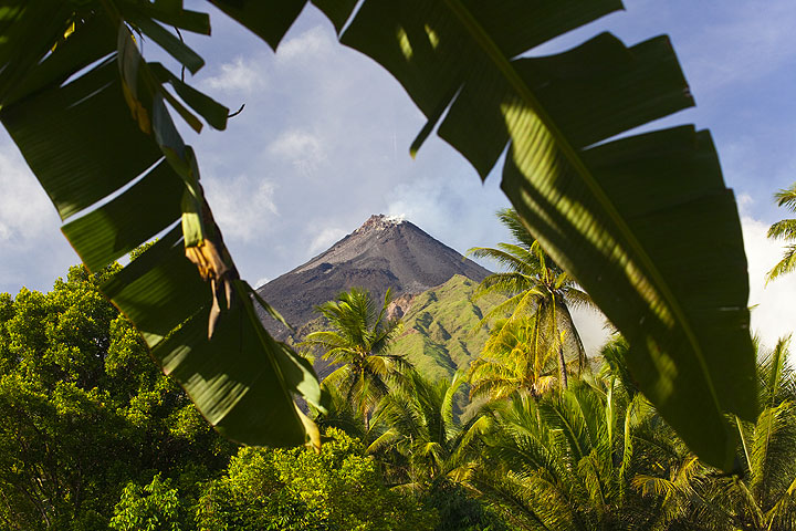
Karangetang volcano on Api Siau Island
Karangetang (Api Siau) volcano is one of Indonesia's most active volcanoes. Located on the remote Api Siau Island north of N Sulawesi, it is notorious for building lava domes and producing dangerous pyroclastic flows.
[smaller] [larger]
Karangetang volcano eruptions: 1675, 1712, 1825, 1864, 1883, 1886, 1887, 1892, 1899, 1900, 1905, 1921, 1922, 1924, 1926, 1930, 1930, 1935, 1940, 1940, 1941, 1947, 1947, 1948, 1949, 1952, 1953, 1961, 1961, 1962-62, 1965-67, 1967, 1970-71, 1972-76, 1976-77, 1978, 1979, 1980, 1982, 1983-88, 1989, 1991-93, 1995, 1996-97, 1998, 1999-2003, 2004-2005. 2008-9, 2010, 2011, 2012, 2013, 2014, 2015, 2016, 2018-ongoing
Latest nearby earthquakes
| Time | Mag. / Depth | Distance / Location | |||
| Apr 11, 12:56 pm (Makassar) | 3.9 172 km | 7.8 km (4.9 mi) to the E | Info | ||
Background
Karangetang (or Api Siau) volcano lies at the northern end of the island of Siau, north of Sulawesi. The 1784-m-high stratovolcano contains five summit craters along a N-S line. Karangetang is one of Indonesia's most active volcanoes, with more than 40 eruptions recorded since 1675 and many additional small eruptions that were not documented.Twentieth-century eruptions have included frequent explosive activity sometimes accompanied by pyroclastic flows and lahars. Lava dome growth has occurred in the summit craters; collapse of lava flow fronts has also produced pyroclastic flows.
5 eruptions in the 20th century (1940, 1972, 1976, 1983 and 1991) caused fatalities.
---
Source: GVP, Smithsonian Institution
Karangetang Volcano Photos
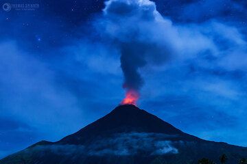
Karangetang side lit by the setting moon (Photo: Thomas Spinner)
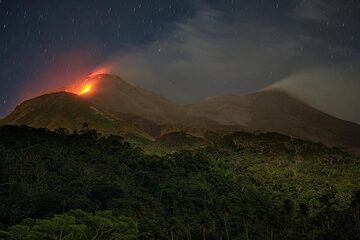
The active northern crater of Karangetang in Feb 2019. (Photo: Thomas Spinner)
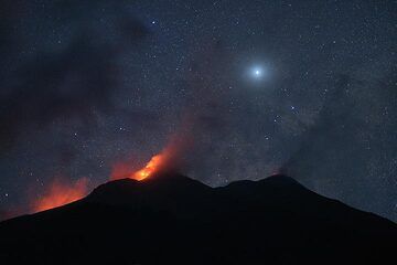
Night-time view of Karangetang with Venus. (Photo: Thomas Spinner)
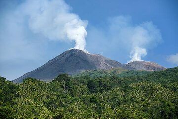
Steam plumes from the north (l) and south (r) craters of Karangetang volcano. (Photo: Thomas Spinner)
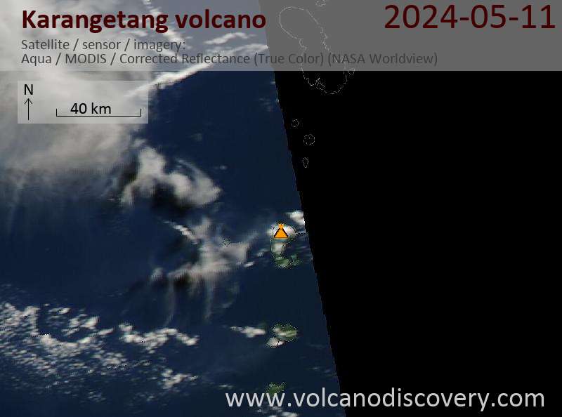
Latest satellite images
Karangetang Volcano Tours
Sulawesi/Halmahera (Indonesia)
Volcanoes and Spices
17-day volcano trekking tour to the Molucca Sea: N-Sulawesi, Karangetang and Halmahera