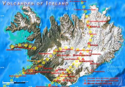
Askja Volcano
Updated: Apr 23, 2024 06:46 GMT -
Stratovolcano 1516 m (4,974 ft)
Central Iceland, 65.03°N / -16.75°W
Current status: normal or dormant (1 out of 5)
Central Iceland, 65.03°N / -16.75°W
Current status: normal or dormant (1 out of 5)
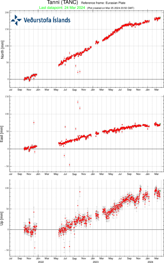
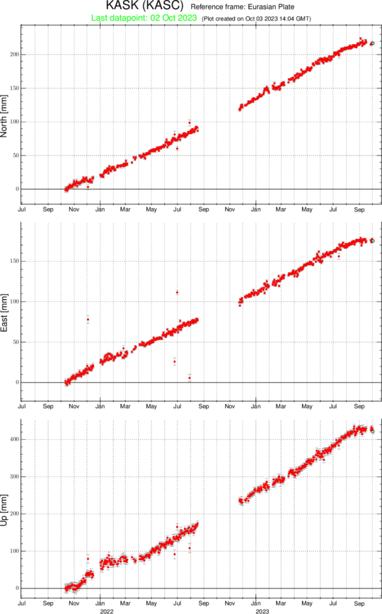
Last update: 27 Mar 2024 (seismic swarm yesterday)
Askja is a large basaltic central volcano that forms the Dyngjufjöll massif. It is truncated by three overlapping calderas, the largest of which is 8 km wide and may have been produced primarily from subglacial ring-fracture eruptions rather than by subsidence.
[smaller] [larger]
Askja volcano eruptions: 1797(?), 1875, 1919, 1921, 1922, 1923, 1924(?), 1926, 1938, 1961
Latest nearby earthquakes
| Time | Mag. / Depth | Distance / Location | |||
| Apr 21, 11:33 pm (Reykjavik) | 1.5 4.6 km | 21 km (13 mi) to the NE | Info | ||
| Monday, April 15, 2024 GMT (1 quake) | |||||
| Apr 15, 03:22 am (Reykjavik) | 1.7 4.5 km | 28 km (17 mi) to the NE | Info | ||
| Saturday, April 13, 2024 GMT (1 quake) | |||||
| Apr 13, 11:38 pm (Reykjavik) | 1.7 5.2 km | 29 km (18 mi) to the NE | Info | ||
| Tuesday, April 9, 2024 GMT (1 quake) | |||||
| Apr 9, 09:00 am (Reykjavik) | 1.6 3.9 km | 3.8 km (2.4 mi) to the E | Info | ||
| Monday, April 15, 2024 GMT (1 quake) | |||||
| Apr 15, 04:34 am (Reykjavik) | 1.4 4.2 km | 21 km (13 mi) to the NE | Info | ||
| Saturday, April 13, 2024 GMT (1 quake) | |||||
| Apr 13, 08:04 pm (Reykjavik) | 1.4 4.9 km | 28 km (17 mi) to the NE | Info | ||
Background
A major rhyolitic explosive eruption from Dyngjufjöll about 10,000 years ago was in part associated with the formation of Askja caldera. Many postglacial eruptions also occurred along the ring-fracture. A major explosive eruption on the SE caldera margin in 1875 was one of Iceland's largest during historical time. It resulted in the formation of a smaller 4.5-km-wide caldera, now filled by Öskjuvatn lake, that truncates the rim of the larger central caldera. The 100-km-long Askja fissure swarm, which includes the Sveinagja graben, is also related to the Askja volcanic system, as are several small shield volcanoes such as Kollatadyngja. Twentieth-century eruptions at Askja have produced lava flows from vents located mostly near Öskjuvatn lake.---
Source: GVP, Smithsonian Institution
Askja Volcano Photos
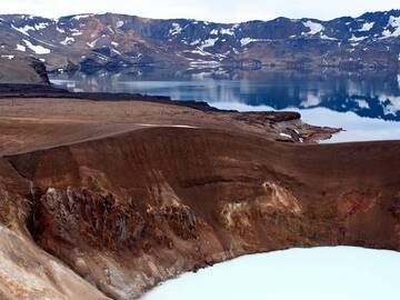
Viti crater and lake Öskjuvatn fill only a part of the enormous Askja caldera in Iceland. (Photo: Janka)
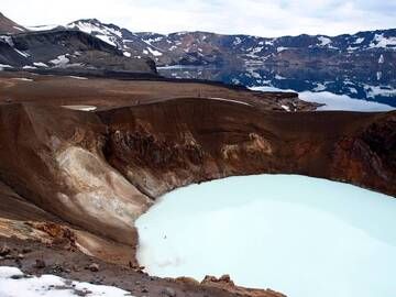
Askja caldera with its sulphurous Viti crater and the deep lake of Öskjuvatn in the background, Iceland (Photo: Janka)
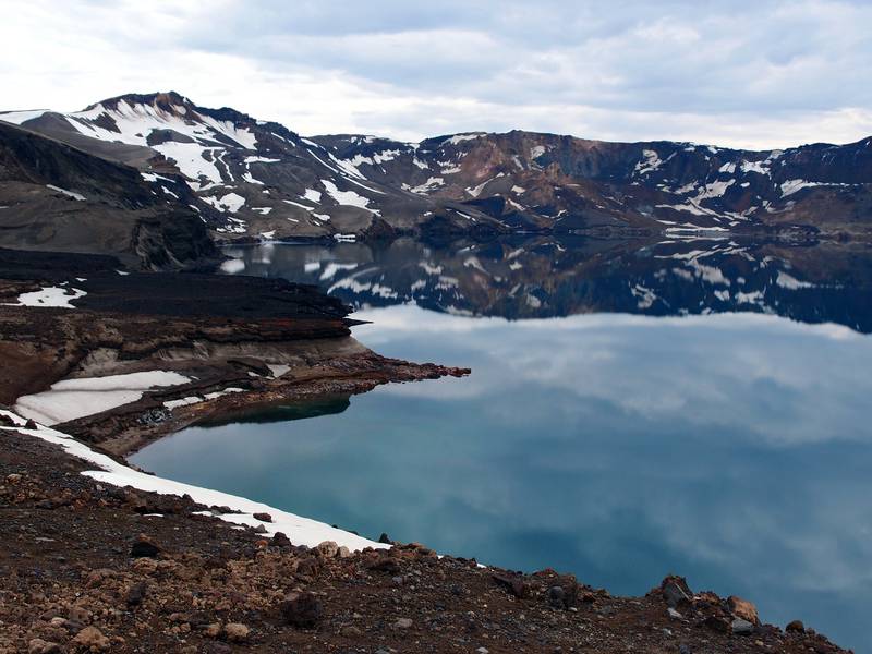
View on the exceptionally clear waters of lake Öskjuvatn, Askja caldera, Iceland (Photo: Janka)
Latest satellite images