Ambrym Volcano
Updated: Apr 19, 2024 11:46 GMT -
shield volcano 1334 m (4,377 ft)
Vanuatu, -16.25°S / 168.12°E
Current status: restless (2 out of 5)
Vanuatu, -16.25°S / 168.12°E
Current status: restless (2 out of 5)
Last update: 7 Feb 2024 (Smithsonian / USGS Weekly Volcanic Activity Report)
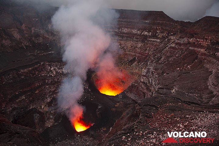
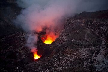
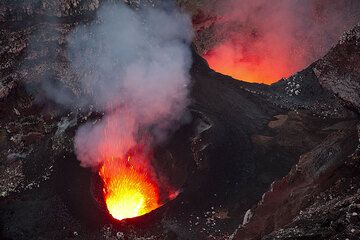
The crater of Benbow (Ambrym)
Ambrym is a large basaltic volcano with a 12-km-wide caldera. It is not only one of the most active volcanoes of Vanuatu, but in the world. Its most active craters often contain small lava lakes.
[smaller] [larger]
Ambrym volcano eruptions: 1774, 1820(?), 1863, 1870(?), 1871, 1883, 1884, 1886, 1888, 1894, 1898, 1908, 1909(?), 1910, 1912, 1913, 1915, 1929, 1935, 1937, 1938, 1942, 1950, 1952, 1953, 1954, 1955, 1957, 1958, 1960, 1961, 1963, 1964, 1967, 1971, 1972, 1973, 1977 (2x), 1979 (2x), 1980, 1981, 1983, 1984, 1986, 1988, 1989, 1990, 1994, 1996, 2006, 2008, 2009 -ongoing
Latest nearby earthquakes
| Time | Mag. / Depth | Distance / Location | |||
Background
Ambrym is a large basaltic volcano with a 12-km-wide caldera. It is not only one of the most active volcanoes of Vanuatu, but also in the world.Ambrym's caldera is a wide, impressive moon-like landscape containing an ash plain, cut by innumerable erosion gullies and containing several active craters and recent lava flows.
The caldera is believed to have formed during a major plinian eruption with dacitic pyroclastic flows about 1900 years ago. Activity after the caldera formation was concentrated around two vents that have become large complex craters called Marum and Benbow. Often, both Marum and Benbow (as well as other craters) contain small lava lakes, which occasionally erupt lava flows onto the caldera floor, or even exit the caldera through erosion gaps.
The post-caldera eruptions have also formed a series of scoria cones and maars along a fissure system oriented ENE-WSW. Eruptions have apparently occurred almost yearly during historical time from cones within the caldera or from flank vents. However, from 1850 to 1950, reporting was mostly limited to extra-caldera eruptions that would have affected local populations.
Occasionally, explosive eruptions occur from the craters, mostly because of water-magma interaction. Such eruptions produce tall clouds of ash, and can cause serious health problems in the local population because the ash contaminates ground water.
Ambrym Volcano Photos
An usually clear view of the interior of Benbow's crater in the evening. (Photo: Tom Pfeiffer)
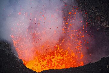
Highly fluid lava bursts from the vent of Benbow, Ambrym volcano, Vanuatu (Photo: Tom Pfeiffer)
The south (l) and north (r) pit craters containing little lava lakes. Strong spattering from the south pit. (Photo: Tom Pfeiffer)
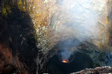
The deep second crater of Benbow (Photo: Yashmin Chebli)
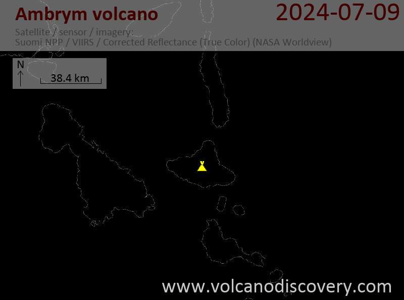
Latest satellite images

Ambrym Volcano Tours
15-day volcano and photo expedition to Ambrym and Yasur volcanoes, Vanuatu
15 days / 14 nights - Moderate
Price 4490 €
Price 4490 €
2-16 Jul 2024