


Cap-Vert Volcano
Updated: Apr 25, 2024 07:10 GMT -
Volcanic field unknown
Senegal, 14.77°N / -17.4°W
Current status: (probably) extinct (0 out of 5)
Senegal, 14.77°N / -17.4°W
Current status: (probably) extinct (0 out of 5)
[smaller] [larger]
Cap-Vert volcano eruptions: None during the past 10,000 years
Less than 2.58 million years ago (Pleistocene)
Latest nearby earthquakes
| Time | Mag. / Depth | Distance / Location | |||
Background
Volcanism on the Cap-Vert Peninsula took place in five episodes from the Oligocene to the Pleistocene, ending about 600,000 years ago. The volcanic field covers an area of about 100 km2 on the peninsula hosting the capital city of Dakar.---
Source: Smithsonian / GVP volcano information
Cap-Vert Volcano Photos
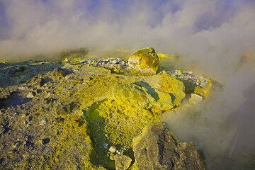
Sulfur deposits and escaping gas from fumaroles on Vulcano volcano's La Fossa crater rim. (Photo: Tom Pfeiffer)
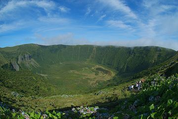
Faial's summit Caldeira seen from Canto dos Saquinhos viewpoint: note the neck at left and the cinder cone at center. The last phreatic activity occurred during the Capel...
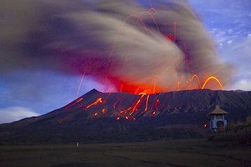
Dense ash clouds are produced by vulcanian-type explosions. In this long exposure night time shot, the ash cloud is blurred against the moon-lit landscape. Bromo's Hindu ...
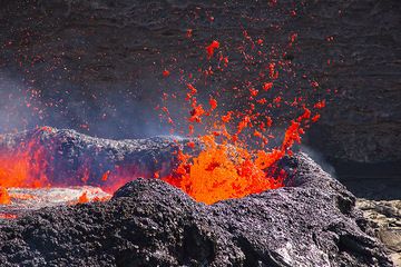
Magmatic gas escapes from the lava lake and creates spectacular fountains. The liquid lava is thrown many meters into the air, bursting into thousands of fragments. When ...
Latest satellite images


