Kontakt | RSS | EN | DE | EL | ES | FR | IT | RU

Karthala Volcano

Updated: 19. Apr. 2024 20:17 GMT -
Shield volcano 2361 m (7,746 ft)
Comores, western Indian Ocean, -11.77°S / 43.36°E
Aktueller Status: unruhig (2 von 5)
Last update: 5 Okt 2022 (Smithsonian / USGS Weekly Volcanic Activity Report)
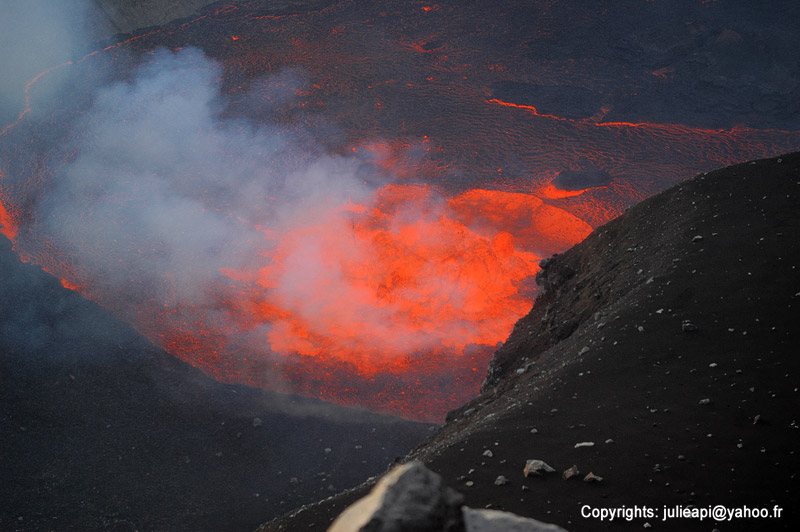
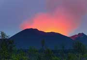
Karthala with the lava lake in the summit crater (2006 eruption)

Karthala is a large shield volcano with a summit caldera on La Grande Island of the Comores in the western Indian Ocean. It erupts every few years and often produces voluminous lava flows and sometimes has a lava lake in the crater of the caldera.

[smaller] [larger]
Typische Aktivität: Effusive. Temporary lava lakes.
Ausbrüche des Karthala: 1808, 1814, 1821, 1828, 1830, 1833, 1848, 1850, 1855, 1857, 1858, 1859, 1860, 1862(?), 1872, 1876, 1880, 1883-84, 1904, 1910, 1918, 1928, 1948, 1952, 1956, 1965, 1972, 1977, 1991, 2005, 2005, 2006

Letzte Erdbeben in der Nähe

No recent earthquakes
UhrzeitMag. / TiefeEntfernung / Ort

Beschreibung

Karthala, a typical and very active shield volcano, forms the southern part of the Comores island La Grande Comore (also known as Ngazidja Island). It erupted twice in 2005 and caused major problems due to extensive ash fall and contamination of drinking water.

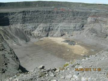
Karthala has an elongated 3 x 4 km summit caldera created by repeated collapse, and has elongated rift zones extend to the NNW and SE from the summit. Historical eruptions both from summit and flank vents have repeatedly modified the shape of the caldera. Many lava flows have reached the sea on both sides of the island. A lava flow during the euption in 1860 traveled from the summit caldera about 13 km to the NW, reached the sea at the western coast north of the capital city of Moroni.

Karthala Volcano Photos
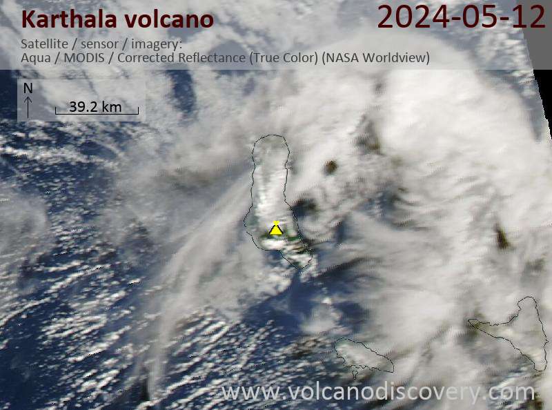
Latest satellite images

Karthala satellite image sat1Karthala satellite image sat2

Background:

[Translate to Deutsch:]
Karthala, a typical and very active shield volcano, forms the southern part of the Comores island La Grande Comore (also known as Ngazidja Island). It erupted twice in 2005 and caused major problems due to extensive ash fall and contamination of drinking water.

Karthala has an elongated 3 x 4 km summit caldera created by repeated collapse, and has elongated rift zones extend to the NNW and SE from the summit. Historical eruptions both from summit and flank vents have repeatedly modified the shape of the caldera. Many lava flows have reached the sea on both sides of the island. A lava flow during the euption in 1860 traveled from the summit caldera about 13 km to the NW, reached the sea at the western coast north of the capital city of Moroni.
Mi, 5. Okt 2022, 14:00

Karthala volcano (Grand Comore Island) - Smithsonian / USGS Weekly Volcanic Activity Report for 28 September-4 October 2022 (Continuing Activity)

According to the Direction Générale de la Sécurité Civile (DGSC) – Comores on 4 October, the Observatoire Volcanologique du Karthala (OVK) reported that activity at Karthala had significantly declined during the previous few days. OVK recommended that the Alert Level remain at Yellow (the second lowest level on a four-level scale). ... Read all
Do, 29. Sep 2022, 10:00

Karthala volcano (Grand Comore Island) - Smithsonian / USGS Weekly Volcanic Activity Report for 28 September-4 October 2022 (Continuing Activity)

According to the Direction Générale de la Sécurité Civile (DGSC) – Comores on 4 October, the Observatoire Volcanologique du Karthala (OVK) reported that activity at Karthala had significantly declined during the previous few days. OVK recommended that the Alert Level remain at Yellow (the second lowest level on a four-level scale). ... Read all

Auf dieser Seite:

App herunterladen
Volcanoes & Earthquakes - new app for Android
Android | iOS-Version

Mehr auf VolcanoDiscovery

Warum gibt es Werbung auf dieser Seite?

Unterstützen Sie unsere Arbeit!

Diese Webseite und die dazugehörigen Apps und Tools instandzuhalten und kostenlos Nachrichten zu Vulkanen, Erdbeben und anderen Themen bereitzustellen, verschlingt enorm viel Zeit und auch Geld.
Wenn Sie die Infos mögen und uns in der Arbeit dazu unterstützen wollen, würden wir uns über eine Spende (über PayPal oder mit Kreditkarte) sehr freuen.
Online Zahlung (Kreditkarte)
Damit können wir Ihnen auch in Zukunft neue Features entwickeln und Bestehende laufend verbessern.Vielen Dank!
Sources: VolcanoDiscovery / VolcanoAdventures and other sources as noted.
Use of material: Most text and images on our websites are owned by us. Re-use is generally not permitted without authorization. Contact us for licensing rights.
Volcanoes & Earthquakes
VolcanoDiscovery Home
Vulkane | Erdbeben | Fotos | News | App
Adventure & Study Travel
Reisen zu Vulkanen und Vulkangebieten: Wanderreisen, Studienreisen, Fotoreisen
Tours & Dates | FAQ | About us
Get our newsletter!
Company info
Kontakt | Impressum | AGB
Follow us
Follow us on facebook Follow us on Instagram Follow us on Twitter Visit our Youtube channel
EN | DE | EL | ES | FR | IT | RU
VolcanoDiscovery GmbH, Germany, Reg. nr.: HRB 103744, EU Tax Id: DE 297 465 123 owned and created by
Dr. Tom Pfeiffer, volcanologist, volcano photographer, tour organizer member of
IAVCEI
IAVCEI
Vulkanologische Gesellschaft
Volcanological Society
Ecotourism Greece
Ecotourism Greece
RUV insurance
Insured by R+V
VolcanoDiscovery © 2004- All Rights Reserved | Datenschutz