Kontakt | RSS | EN | DE | EL | ES | FR | IT | RU

Chiginagak Volcano

Updated: 19. Apr. 2024 23:44 GMT -
Stratovolcano 2221 m / 7,287 ft
United States, Alaska Peninsula, 57.14°N / -156.99°W
Aktueller Status: normal / ruhend (1 von 5)
Last update: 13 Dez 2021 (Smithsonian / USGS Weekly Volcanic Activity Report)

[smaller] [larger]
Typische Aktivität: unspecified
Ausbrüche des Chiginagak: 1998 

Letzte Erdbeben in der Nähe

UhrzeitMag. / TiefeEntfernung / Ort
8. Apr. 09:11 (Anchorage)
2.4

0 km
24 km westlich 50 km S of Ugashik, Alaska
Info

Beschreibung

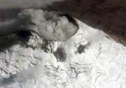
The symmetrical, calc-alkaline Chiginagak stratovolcano located about 15 km NW of Chiginagak Bay contains a small summit crater, which is breached to the south, and one or more summit lava domes. Satellitic lava domes occur high on the NW and SE flanks of the glacier-mantled volcano. An unglaciated lava flow and an overlying pyroclastic-flow deposit extending east from the summit are the most recent products of Chiginagak. They most likely originated from a lava dome at 1687 m on the SE flank, 1 km from the summit of the volcano, which has variably been estimated to be from 2075 to 2221 m high. Brief ash eruptions were reported in July 1971 and August 1998. Fumarolic activity occurs at 1600 m elevation on the NE flank of the volcano, and two areas of hot-spring travertine deposition are located at the NW base of the volcano near Volcano Creek.
---
Smithsonian / GVP volcano information

Latest satellite images

chiginagak satellite image sat1chiginagak satellite image sat2
News
Mi, 24. Aug 2005, 06:00

Chiginagak volcano (United States) - Smithsonian / USGS Weekly Volcanic Activity Report for 24 August-30 August 2005 (New Activity / Unrest)

AVO reported that a 400-m-wide "melt-water lake" formed in the snow-and-ice filled summit crater of Chiginagak sometime after the previous observation in August 2004. Earlier this summer, the southern crater rim of Chiginagak was breached, allowing a portion of the lake to drain. The resulting lahar left a deposit on a glacier draining the crater to the S and caused flooding of 1-2 m above normal at Indecision Creek. ... Read all

Auf dieser Seite:

App herunterladen
Volcanoes & Earthquakes - new app for Android
Android | iOS-Version

Mehr auf VolcanoDiscovery

Warum gibt es Werbung auf dieser Seite?

Unterstützen Sie unsere Arbeit!

Diese Webseite und die dazugehörigen Apps und Tools instandzuhalten und kostenlos Nachrichten zu Vulkanen, Erdbeben und anderen Themen bereitzustellen, verschlingt enorm viel Zeit und auch Geld.
Wenn Sie die Infos mögen und uns in der Arbeit dazu unterstützen wollen, würden wir uns über eine Spende (über PayPal oder mit Kreditkarte) sehr freuen.
Online Zahlung (Kreditkarte)
Damit können wir Ihnen auch in Zukunft neue Features entwickeln und Bestehende laufend verbessern.Vielen Dank!
Sources: VolcanoDiscovery / VolcanoAdventures and other sources as noted.
Use of material: Most text and images on our websites are owned by us. Re-use is generally not permitted without authorization. Contact us for licensing rights.
Volcanoes & Earthquakes
VolcanoDiscovery Home
Vulkane | Erdbeben | Fotos | News | App
Adventure & Study Travel
Reisen zu Vulkanen und Vulkangebieten: Wanderreisen, Studienreisen, Fotoreisen
Tours & Dates | FAQ | About us
Get our newsletter!
Company info
Kontakt | Impressum | AGB
Follow us
Follow us on facebook Follow us on Instagram Follow us on Twitter Visit our Youtube channel
EN | DE | EL | ES | FR | IT | RU
VolcanoDiscovery GmbH, Germany, Reg. nr.: HRB 103744, EU Tax Id: DE 297 465 123 owned and created by
Dr. Tom Pfeiffer, volcanologist, volcano photographer, tour organizer member of
IAVCEI
IAVCEI
Vulkanologische Gesellschaft
Volcanological Society
Ecotourism Greece
Ecotourism Greece
RUV insurance
Insured by R+V
VolcanoDiscovery © 2004- All Rights Reserved | Datenschutz