Eldey Volcano
Updated: 24. Apr. 2024 17:30 GMT -
submarine volcano 70 m / 230 ft
Reykjanes Ridge, Iceland, 63.73°N / -23°W
Aktueller Status: normal / ruhend (1 von 5)
Reykjanes Ridge, Iceland, 63.73°N / -23°W
Aktueller Status: normal / ruhend (1 von 5)
Last update: 12 Okt 2023 (Smithsonian / USGS Weekly Volcanic Activity Report)
The Eldey volcanic system is located on the northernmost part of the Reykjanes Ridge and is submarine with the exception of Eldey Island and the skerries (small rocky islands) Eldeyjardrangur, Geirfugladrangur, and Geirfuglasker.
Maximum water depth within the system is about 250 m. Eldey has been moderately active in Holocene time. Characteristic activity consists of explosive submarine basaltic eruptions. Six small eruptions have been located within this system during the last 1,100 years, the last occurring in 1926 CE.
[smaller] [larger]
Ausbrüche des Eldey: 1926, 1884(?), 1879, 1422, 1340, 1211
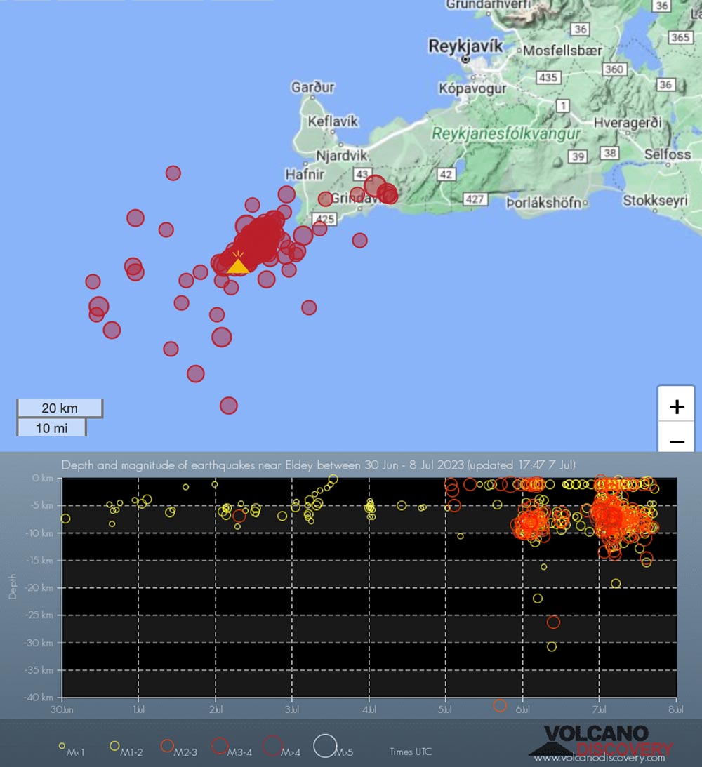
Letzte Erdbeben in der Nähe
| Uhrzeit | Mag. / Tiefe | Entfernung / Ort | |||
| 23. Apr. 05:26 (Reykjavik) | 2.4 10 km | 8.3 km westlich | Info | ||
| Montag, 22. April 2024 GMT (2 Beben) | |||||
| 22. Apr. 04:54 (Reykjavik) | 1.9 5.6 km | Info | |||
| 22. Apr. 04:53 (Reykjavik) | 3.1 5.8 km | 17 km nordöstlich | Info | ||
| Samstag, 20. April 2024 GMT (1 Beben) | |||||
| 20. Apr. 00:15 (Reykjavik) | 2.3 7.7 km | 9.6 km östlich | Info | ||
| Mittwoch, 10. April 2024 GMT (2 Beben) | |||||
| 10. Apr. 22:35 (Reykjavik) | 2.1 5.2 km | 22 km südlich | Info | ||
| 10. Apr. 22:35 (Reykjavik) | 2.0 3.7 km | Info | |||
Latest satellite images