Kontakt | RSS | EN | DE | EL | ES | FR | IT | RU

Heard Volcano

Updated: 20. Apr. 2024 00:51 GMT -
Stratovolcano 2745 m / 9,006 ft
Australia, Southern Indian Ocean, -53.11°S / 73.51°E
Aktueller Status: unruhig (2 von 5)
Last update: 26 Jan 2024 (eruption continues with lava flow)
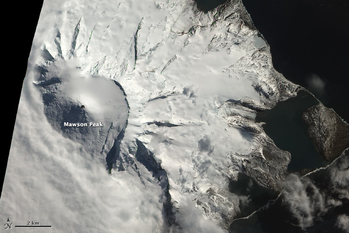
NASA Earth Observatory image of Hear Island taken on 13 Oct 2012 by Robert Simmon, using EO-1 ALI data from the NASA EO-1 team and USGS Global Visualization Viewer (NASA earth observatory http://earthobservatory.nasa.gov/NaturalHazards/view.php?id=79484)

Heard Island is the top of an active stratovolcano on the Kerguelen Plateau in the southern Indian Ocean, about 4000 km southwest of Western Australia. Part of Australian territory, along with McDonald Island to the west, Heard is one of Australia's two currently active volcanoes.
The volcano is frequently active, and occasional reports of eruptions date back to 1881. Since about 1980, remote sensing mostly via satellites has been able to detect more and frequent activity at the volcano.
The 368 sq km island with its highest point Mawson Peak at 2745 m forms the highest point of Australian territory outside Antarctica.
The uninhabited island was discovered by and named after Captain John Heard in 1853. Its remote location and typically extremely adverse weather and wind conditions make it difficult to access and only few expeditions have reached it. An Australian navy base existed on the island at Atlas Cove on the western side of Big Ben between December 1947 and March 1955.

[smaller] [larger]
Typische Aktivität: unspecified
Ausbrüche des Heard: 2019, 2018 (?), 2017, 2016, 2015, 2014, 2012-13, 2006-08, 2003-04, 2000-01, 1993, 1992 (May), 1992 (Jan) (?), 1985-87, 1954, 1953, 1950-52, 1910, 1881 (?)

Letzte Erdbeben in der Nähe

No recent earthquakes
UhrzeitMag. / TiefeEntfernung / Ort

Beschreibung

Heard Island on the Kerguelen Plateau in the southern Indian Ocean consists primarily of the emergent portion of two volcanic structures. The large glacier-covered composite basaltic-to-trachytic cone of Big Ben comprises most of the island, and the smaller Mt. Dixon volcano lies at the NW tip of the island across a narrow isthmus. Little is known about the structure of Big Ben volcano because of its extensive ice cover. The historically active Mawson Peak forms the island's 2745-m high point and lies within a 5-6 km wide caldera breached to the SW side of Big Ben. Small satellitic scoria cones are mostly located on the northern coast. Several subglacial eruptions have been reported in historical time at this isolated volcano, but observations are infrequent and additional activity may have occurred.
---
Smithsonian / GVP volcano information

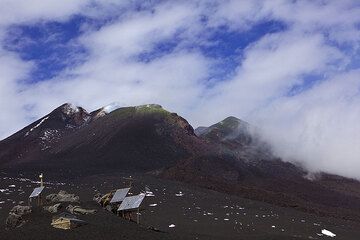
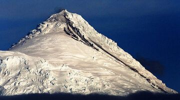
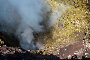
Heard Volcano Photos
Latest satellite images

heard satellite image sat1heard satellite image sat2
News
Fr, 26. Jan 2024, 07:42

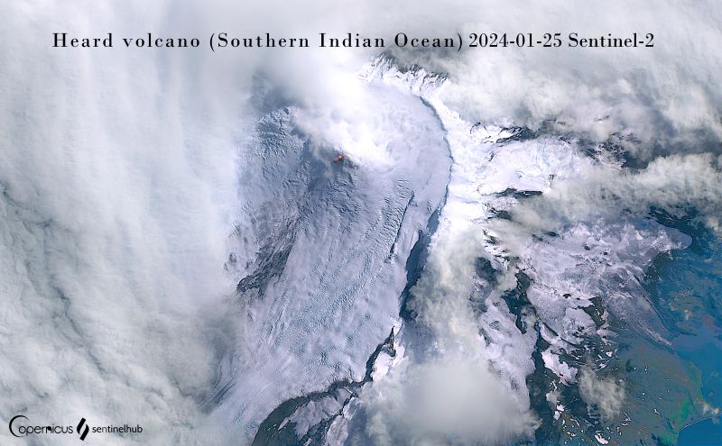
Heard volcano (Australia, Southern Indian Ocean): eruption continues with lava flow

The lava flow on the SW slope at Heard volcano as seen in the latest satellite image (image: Sentinel-2)
The effusive eruption of the volcano continues. Read all
Mi, 3. Jan 2024, 19:00

Heard volcano (Kerguelen Plateau) - Smithsonian / USGS Weekly Volcanic Activity Report for 27 December-2 January 2024 (Continuing Activity)

A 29 December satellite image of Heard Island's Big Ben volcano showed a thermal anomaly at the summit that was elongated to the SW. The anomaly narrowed and terminated at an area that was about 1 km from the summit, suggesting the presence of a lava flow. ... Read all

Auf dieser Seite:

App herunterladen
Volcanoes & Earthquakes - new app for Android
Android | iOS-Version

Mehr auf VolcanoDiscovery

Warum gibt es Werbung auf dieser Seite?

Unterstützen Sie unsere Arbeit!

Diese Webseite und die dazugehörigen Apps und Tools instandzuhalten und kostenlos Nachrichten zu Vulkanen, Erdbeben und anderen Themen bereitzustellen, verschlingt enorm viel Zeit und auch Geld.
Wenn Sie die Infos mögen und uns in der Arbeit dazu unterstützen wollen, würden wir uns über eine Spende (über PayPal oder mit Kreditkarte) sehr freuen.
Online Zahlung (Kreditkarte)
Damit können wir Ihnen auch in Zukunft neue Features entwickeln und Bestehende laufend verbessern.Vielen Dank!
Sources: VolcanoDiscovery / VolcanoAdventures and other sources as noted.
Use of material: Most text and images on our websites are owned by us. Re-use is generally not permitted without authorization. Contact us for licensing rights.
Volcanoes & Earthquakes
VolcanoDiscovery Home
Vulkane | Erdbeben | Fotos | News | App
Adventure & Study Travel
Reisen zu Vulkanen und Vulkangebieten: Wanderreisen, Studienreisen, Fotoreisen
Tours & Dates | FAQ | About us
Get our newsletter!
Company info
Kontakt | Impressum | AGB
Follow us
Follow us on facebook Follow us on Instagram Follow us on Twitter Visit our Youtube channel
EN | DE | EL | ES | FR | IT | RU
VolcanoDiscovery GmbH, Germany, Reg. nr.: HRB 103744, EU Tax Id: DE 297 465 123 owned and created by
Dr. Tom Pfeiffer, volcanologist, volcano photographer, tour organizer member of
IAVCEI
IAVCEI
Vulkanologische Gesellschaft
Volcanological Society
Ecotourism Greece
Ecotourism Greece
RUV insurance
Insured by R+V
VolcanoDiscovery © 2004- All Rights Reserved | Datenschutz