Kao Volcano
Updated: 24. Apr. 2024 01:53 GMT -
Stratovolcano 1030 m / 3,379 ft
Tonga, Tonga Islands, -19.67°S / -175.03°W
Aktueller Status: normal / ruhend (1 von 5)
Tonga, Tonga Islands, -19.67°S / -175.03°W
Aktueller Status: normal / ruhend (1 von 5)
[smaller] [larger]
Ausbrüche des Kao: unknown, no recent eruptions
Letzte Erdbeben in der Nähe
| Uhrzeit | Mag. / Tiefe | Entfernung / Ort | |||
Beschreibung
The highest and most spectacular volcano of the Tonga Islands, symmetrical Kao volcano rises steeply to 1030 m about 6 km north of Tofua Island. Kao is elongated in a NNE-SSW direction and, with the exception of a small flat area on the SSW coast, rises at angles exceeding 35 degrees to the summit, which has a series of small coalescing craters. The lower flanks of the basaltic-andesite volcano are densely jungled, but the upper slopes are almost vegetation free. No historical eruptions are known from Kao, and fresh-appearing lava flows are not seen, although the absence of sufficient time for erosion to produce deep gullies or high sea cliffs suggests a very recent origin.---
Smithsonian / GVP volcano information
Kao Volcano Photos
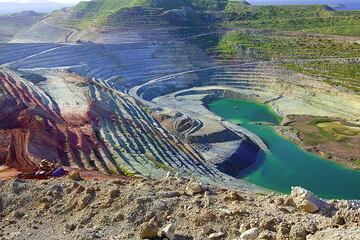
Das große Kaolin- und Bentonitbergwerk (Photo: Tom Pfeiffer)
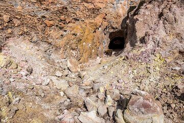
Kaolin, das sich durch fumarolische und hydrothermale Umwandlung gebildet hatte, wurde aus einer kleinen Mine am Lavadom von Kalamo abgebaut. (Photo: Tom Pfeiffer)
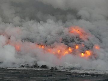
Tag 5: Ein Lied von Feuer und Wasser ... Lava, die ins Meer strömt, will neues Land schaffen, wird aber sofort von den starken Meereswellen angegriffen. Der nie endende K...
Latest satellite images