Kontakt | RSS | EN | DE | EL | ES | FR | IT | RU

Callaqui (Volcano)

Ice-capped Callaqui volcano is an elongated basaltic-andesite stratovolcano in central Chile Volcano. It has had a few small explosive eruptions in historic time, and it is known for its intense fumarolic activity.

Camiguin de Babuyanes (Volcano)

Camiguin de Babuyanes volcano is a small stratovolcano on the SW tip of the 22 km long Camiguin Island in the Babuyan archipelago, 35 km off the north tip of Luzon Island.
Note: A volcanic island called Camiguin is located off the north coast of Mindanao Island.

Campi Flegrei (Phlegrean Fields) (Volcano)

The Campi Flegrei ("burning fields") or Phlegrean Fields is a large, 13-km-wide nested caldera located under the western outskirts of the citiy of Naples and under the Gulf of Pozzuoli.
It contains many volcanic centers (cinder cones, tuff rings, calderas) that have been active during the past 30-40,000 years. The volcanic field has been the site of some extremely violent eruptions in the past, although the few ones that occurred during historic times were small events. Today, there is no sign of imminent reawakening of activity, although there are abundant signs of the presence of a still active magma chamber in the forms of solfataras, warm springs, gas emissions etc. In particular, the Campi Flegrei is infamous for its frequent episodes of major ground deformation in the form of large-scale up- and downlift of the ground (bradisism, see below).

Campi Flegrei Mar Sicilia (Volcano)

Campi Flegrei del Mar di Sicilia (Phlegraean Fields of the Sicily Sea) is composed of a group of submarine volcanoes SW of Sicily.

Cancanajag (Volcano)

Cancajanag volcano is a complex of lava domes located 6.5 km NNW of Lobi volcano on Leyte Island, Philippines. The age of its most recent eruptions is not known, but it was classified as potentially active by PHIVOLCS.

Carrán-Los Venados (Volcano)

Carrán-Los Venados volcano in central Chile is a group of about 50 basaltic to basaltic-andesite scoria cones, maars, and a small stratovolcano. The volcanic group is broadly aligned on a 17 km long ENE-WSW trending line ESE of Lago Ranco.
The volcano erupted 3 times in the 20th century, forming the Mirador scoria cone and two maars, Riñinahue and Carrán. These historical eruptions were at the intersection of the Liquine-Ofqui fault zone with the ENE-WSW alignment of volcanic centers.

Carrizozo (Volcano)

The massive Carrizozo lava flow is one of Earth's longest known lava flows that were erupted in the past 10,000 years. The basalt flow is 50 m thick, 75 km long, 1-5 km wide and was mainly fed by lava tubes.

Castillo de Guanapay (Ort)

Das Castillo de Santa Bárbara, auch Castillo de Guanapay, liegt auf der Kanarischen Insel Lanzarote in der Gemeinde und Stadt Teguise.

Cay (Volcano)

Volcán Cay is a probably still active stratovolcano in southern Chile, 15 km NE of Maca volcano and NW of the town of Puerto Aisén. Like Maca and Hudson volcanoes, Cay is one of the large composite central volcanoes in the South Andean Volcanic Zone.
Cay volcano is basaltic and dacitic in composition. It contains an explosion crater open to the east, and about a half dozen explosion craters and pyroclastic cones along a fissure trending SW of the summit.
Another 10 basaltic cinder cones are located along a second parallel fissure 5 km to the SE, which is part of the major regional Liquiñe-Ofqui fault zone.

Cayambe (Volcano)

Nevado Cayambe is a massive volcanic complex in northern Ecuador, 60 km NE of the city of Quito and only 15 km E of the 20,000 inhabitants city of Cayambe. The equator passes through its southern flank. The andesitic-dacitic volcano is located on the isolated western edge of the Cordillera Real in the Ecuadorian Andes, east of the Inter-Andean Valley.
The volcano is capped by extensive glaciers, which descend to 4200 m on the eastern Amazonian side. It contains 2 summit lava domes located about 1.5 km apart, the western of which is the highest. Several other lava domes are located on the upper flanks and have been the source of pyroclastic flows down the lower flanks of the volcano.
La Virgen is a prominent young cinder cone on the lower eastern flank, which erupted thick andesitic lava flows that reached 10 km to the east.
There is only one confirmed historic eruption, during 1785-86, but recent studies have shown that the volcano has produced frequent explosive eruptions during the past 4000 years.

Cayutué-La Viguería (Volcano)

Cayutué-La Viguería volcano is a volcanic field in southern Chile, south of Lake Todos los Santos. The field contains about 20 young basaltic maars and cinder cones, aligned NNE-SSW on the Liquiñe-Ofqui fault zone, a major regional N-S feature.

Ceboruco (Volcano)

Cereme (Volcano)

Ciremai (or Cereme) volcano close to the north coast of Java is a symmetric stratovolcano and among the most beautiful and largest of Java's active volcanoes. It contains a deep twin crater elongated in E-W direction.
Ciremai's historic eruptions were infrequent, and consited mainly in mild explosive activity and mud flows from the summit crater.

Cerro Auquihuato (Volcano)

Cerro Auquihuato volcano is a young, 380 m high cinder cone in southern Perú, located about 30 km NE of Sara Sara volcano and east of Río Ocona. The location on a high plateau is very remote and far from road access and little is known about the volcano.
Satellite images show a young lava flow with prominent channel structures. The flow extends 9 km south of the volcano.

Cerro Azul (Volcano)

Cerro Azul stratovolcano in Central Chile is located at the southern end of the Descabezado Grande-Cerro Azul group of volcanoes. Its steep summit cone contains a 500 m wide crater.
Cerro Azul is the site of one of the largest explosive eruptions in the 20th centuries. It erupted from the Quizapu vent on April 10-11 1932, producing a Plinian eruption column of 27-30 km (ca. 95,000 ft) height. The eruption formed a 600-700 m wide 150-m-deep crater and blanketed the region with ash.
Quizapu is one of Azul's major vents and located on the northern flank of Cerro Azul. It formed in 1846 during the first historical eruption at Cerro Azul, which was accompanied by voluminous dacitic lava flows that traveled both east into the Estero Barroso valley and west into the Río Blanquillo valley. Quizapu was also the site of the massive 1932 eruption.
La Resoloma Craters are 3 basaltic-andesite cinder cones on the W flank. They erupted Los Hornitos are cinder cones on the lower SW flank.

Note: there are 2 volcanoes with similar names: Volcan Azul in Nicaragua, and Cerro Azul in the Galapagos Islands.

Cerro Azul (Volcano)

Cerro Bayo (Volcano)

Cerro Bayo is a complex volcano on the northern Chile/Argentina border. The volcano contains a young cone exactly on the border with a 400 m wide crater which has erupted two 4 km long lava flows to the north and NW.
The youngest known product of the volcano are 2 dacitic lava flows that traveled to the north and were erupted from the summit crater located on the Chilean side.

Cerro Bravo (Volcano)

Cerro Bravo volcano is located 145 km NW of Bogota, Colombia, north of Nevado del Ruiz volcano.
It consists of dominantly dacitic lava-domes. In the past 4000 years, the volcano has had at least 7 violent (plinian) explosive eruptions, producing pumice layers and pyroclastic flows.

Cerro Cinotepeque (Volcano)

Cerro Cinotepeque volcano is a group of 4 young cinder cones on both sides of Río Lempa, about 40 km north of San Salvador city.
Cerro Cinotepeque (also spelled Cinotepec) lies south of the river, 2 other cones, Cerro Santiago and Cerro Mosquito, immediately north of the river. A fourth cone is located along the Río Gualchayo about 10 km farther north.

Cerro del Azufre (Volcano)

Cerro del Azufre ("sulphur peak") volcano is a large andesitic stratovolcano in northern Chile 20 km from the border with Bolivia. It is the largest and youngest volcanic center of a 50-km-long, NW-SE-trending chain of volcanoes south of Salar de Ascotán.
The volcano has 2 summits, the northern peak forming the summit and the lower southern peak (5700 m) belonging to an earlier stratovolcano, which extends towards the extinct Cerro Aguilucho volcano.
It is uncertain whether the volcano has erupted in the past 10,000 years. There are a number of fresh-looking lava domes and craters, but in this region erosion and weathering are so inefficient that such craters can look young, but are actually hundreds of thousands of years old.

Note: there is a volcano with a similar name - "Cordon del Azufre" in northern Chile.

Cerro del Leon (Volcano)

Cerro del Leon stratovolcano is located in northern Chile next to the massive Chao lava dome.

Cerro el Ciguatepe (Volcano)

Cerro el Ciguatepe volcano is located in the Nicaraguan interior highlands, east of the Nicaraguan depression and one of several Quarternary volcanoes in this area.
It contains a well-reserved 1.5 km wide summit crater, which contains a blocky lava dome and a young lava flow that has traveled from a breach in the SW side of the crater to the base of the cone.

Cerro el Condor (Volcano)

Cerro el Cóndor is a large stratovolcano located in NW Argentina. it is one of the few larger volcanoes which are completely inside Argentina.
The volcano was built on top of a 2.5-km-wide caldera and contains several ash cones and craters which are aligned on a NNW-SSE trend. There are several lava flows extending up to 10 km east towards the base of Peinado volcano.
There are many satellitic vents, including one on the east flank with a fresh-looking lava flow that traveled 8 km to the east. The young morphology and the pristine summit crater suggest a young, Holocene age for Cerro del Cóndor.

Cerro Negro (Volcano)

Cerro Negro, Central America's youngest volcano was born in April 1850 and is one of the region's most active volcanoes. It has been producing frequent strombolian eruptions, occasional lava fountains and lava flows, and powerful explosive eruptions every few decades.
Cerro Negro lies in a sparsely populated area and its eruptions have not caused significant damage nearby, but ash fall from its sometimes strong explosions have damaged farmland and houses in the populated areas of the Nicaraguan depression.

Cerro Negro de Mayasquer (Volcano)

Cerro Negro de Mayasquer (Chiles-Cerro Negro volcano) is an andesitic to dacitic stratovolcano on the Colombia-Ecuador border. It contains a caldera open to the west.
An historical eruption reported in 1936 is probably false and may have been from Reventador volcano. Solfataras are found on the shore of a small crater lake.

Cerro Nicholson (Volcano)

Cerro Nicholson volcano is a small isolated andesitic scoria cone in Southern Peru. It is located on a plain WSW of Chachani volcano and WNW of El Misti volcano.
The crater of the Cerro Nicholson cone has a youthful appearance and is full of fresh-looking volcanic bombs, suggesting a relatively young age. It is similar to the Andahua scoria cones farther to the north.

Cerro Overo (Volcano)

Cerro Overo is an isolated basaltic maar in northern Chile, located on the lower NE flank of Chiliques volcano, west of the Salar de Aguas Calientes, and 20 km north of Lascar volcano. The fresh morphology suggests a possible Holocene age. It contains a 600-m-wide and 80-m-deep crater.
Cerro Overo erupted the least silica-rich volcanic rocks (basalts) found in this part of the Central Andes.

Cerro Pantoja (Volcano)

Cerro Pantoja is an eroded dominantly basaltic volcano along the Chile-Argentina border. The only known activity within the past 10,000 years is a cinder cone on the Argentinian side.
Cerro Pantoja lies SSW of Lake Constancia located immediately west of the Argentinian border. The volcano has a dramatic steep-sided summit pinnacle.

Cerro Prieto (Volcano)

Cerro Prieto volcano is a small dacitic lava dome in the Cerro Prieto geothermal field at the northern end of the Gulf of California, 33 km south of Mexicali at the Mexican border or 175 km SE of San Diego.

Cerro Singuil (Volcano)

Cerro Singüil (also known as El Cerron) is a large scoria cone SE of Volcán Chingo in the interior valley of El Salvador near the Guatemalan border. The volcano has a well-preserved summit crater and belongs to a young volcanic field of cinder cones and explosion craters.

Cerros de Tocopuri (Volcano)

Cerros de Tocorpuri is a stratovolcano in northern Chile on the border with Bolivia. It contains a 1.2 km wide summit crater and a lava dome, Cerro La Torta, located on its western side.

Chacana (Volcano)

Chacana is an active stratovolcano 30 km SE of Quito, Ecuador. The volcano is one of the largest rhyolitic centers of the northern Andes and contains a large 32 km long and 24 km wide eroded caldera.
Historic activity consisted of lava flows in the 18th century.

Chachimbiro (Volcano)

Chachimbiro volcano is a large volcanic complex 25 km NW of the city of Ibarra in northern Ecuador.
There are no historic eruptions. The most recent activity took place from the Pitzantzi lava dome and produced a wide-spread ash deposit that extends NW.

Chaiten (Volcano)

Chao (Volcano)

The Chao lava dome in northern Chile near Calama town is one of the largest known lava domes in the world. It measures 14.5 km in length and 350-400 m in height.

Chichinautzin (Volcano)

Chikurachki (Volcano)

Chikurachki stratovolcano forms highest peak on Paramushir Island in the northern Kurile island arc just south of Kamchatka Peninsula. It is one of the region's most active volcanoes.
The volcano itself is a relatively small cone, compared to other volcanoes of the Kurile Islands, but it is built on top of the high-lying remnants of an older and now extinct predecessor volcano. The dominantlyc basaltic one has steep slopes with little erosion and a shallow summit crater of approximately 450 m in diameter. The upper part of Chikurachki's cone is red, caused by oxidized basaltic-to-andesitic scoria deposits.

Eruptions of Chikurachki volcano:
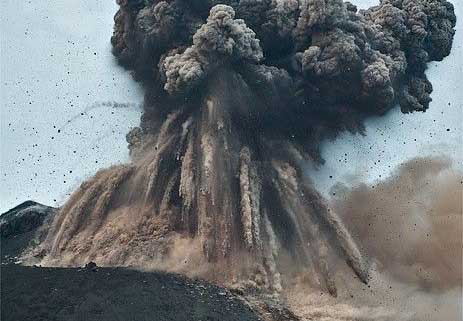
There are 2 principal types of eruptions from Chikurachki: 1) frequent strombolian (mildly explosive) eruptions, such as in 1958, 1961, 1964, 1973, 2002, 2003, and 2) (sub-)plinian (extremely violent and dangerous) explosive eruptions such as in 1853 and 1986.
The strombolian-type eruptions usually last between several days to few weeks, and produce ejections of incandescent lava reaching 100-500 m height above the crater, but can occasionally produce ash plumes of up to 3 km height.
Many eruptions from Chikurachki are accompanied by lava flows. Some have reached the sea and form capes on the NW coast, and there are young lava flows on the upper eastern flank.
Basaltic plinian eruptions are a globally rare phenomenon, but common at Chikurachki volcano, and it is estimated that they have occurred every 100–200 years. Such eruptions - similar to the Icelandic Grimsvötn's eruption in June 2011 - are capable of producing tall ash plumes reaching 10-20 km and pose a significant hazard to aviation in an area densely populated by flight routes from N-America to Asia.
Chiliques (Volcano)

Volcán Chiliques is a stratovolcano in northern Chile immediately south of Laguna Lejía. The volcano consists of a symmetrical cone rising 1000 m from the surrounding terrain and contains a 500 m wide crater. Several young lava flows are seen on its flanks and some might be younger than 10,000 years. The largest flow extends 5 km to the NW, but older flows have reached 10 km distance on the north flank towards Laguna Lejía.
In April 2002, first signs of a possible reawakening of the volcano were detected as new hot spots inside the crater.

Chimborazo (Volcano)

Chimborazo volcano is Ecuador's highest active volcano and the highest in the Northern Andean Volcanic Zone. The massive, ice-capped stratovolcano lies at the southwest end of the main Ecuadorian volcanic arc, the so-called "Avenida de los Volcanes" ("Avenue of Volcanoes") and is located ca. 150 km SSW of Quito and 28 km NW of the town of Riobamba.

Chimborazo had been thought to be extinct, but new studies have shown that it still is an active volcano. Although there are no historical eruptions,
Chimborazo erupted at least 7 times during the past 10,000 years. These eruptions produced pyroclastic surges that reached down to 3800 m elevation. The average time interval between single eruptions is about 1000 years and the last eruption occurred about 1400 years ago, which means that statistically, it is due for another one.

Due to its great height and its geologic history of explosive eruptions, and closeness to populated areas in Ambato and Riobamba basins, it should be considered a dangerous volcano.

Chinameca (Volcano)

Chinameca volcano (also known as El Pacayal) is a small stratovolcano next to the larger San Miguel volcano in eastern El Salvador. It is connected to San Miguel across a low saddle to the SE.
Chinameca is truncated by a 2-km-wide, steep-sided caldera, Laguna Seca el Pacayal. Coffee plantations cover most of the flanks of the volcano.

Chirinkotan (Volcano)

Chirinkotan volcano is a large, mostly submerged stratovolcano forming a small largely unvegetated and 3 km wide island in the Kuril Island chain. It is located at the far end of an E-W-trending volcanic chain that extends nearly 50 km west of the central part of the main Kuril Islands arc.
The volcano is one of the Kurile's most active. Historical eruptions included lava flows on the SE flank during an eruption in the 1880s and were observed by the English fur trader Captain Snow.

Chirip (Volcano)

Chirip volcano (also written as Chirippusan) is a twin volcano forming the Chirip peninsula which streches NW into the Okhotsk Sea from central Iturup Island, Kurile Island, 230 km north of Hokkaido, Japan.
The 2 stratovolcanoes are Chirip volcano in the N and Bogdan Khmelnitskii to the S. They overly an older volcanic edifice. The lavas erupted from both volcanoes are dominantly basaltic, which is unusual for subduction zone volcanoes.
Only 2 historic eruptions are known. The last eruption in 1860 occurred from a vent SE of the summit of Bogdan Khmelnitskii volcano.

Chirpoi (Volcano)

Chirpoi volcano forms a small island in the central Kurile Islands, Russia. It has a 8-9 km wide partially submerged caldera with several volcanic centers inside the caldera, including active Snow and Cerny volcanoes. The southern caldera rim emerges again on nearby Brat Chirpoey Island 2.5 km SE of Chirpoi.

Chokai (Volcano)

Chokai or Chokaisan volcano (鳥海山 Chōkai-san) is the largest volcano of NE Honshu.
It is a massive stratovolcano with a broad conical profile which is why it is called locally Akita-Fuji or Dewa-Fuji. Its height measures from the WNW elongated 15x20 km base about 2000 m.
The volcano is located about 60 km west behind the main volcanic front of the Honshu arc and towers above the Japan Sea.
Chokai consists of 2 overlapping volcanoes, the western and older volcano Nishi-Chokai and the younger eastern volcano Higashi-Chokai, forming the 2 distinct peaks. Historic records of eruptions, mostly phreatic explosions, go back to the 6th century AD.

Cinnamon Butte (Volcano)

Cinnamon Butte is one of a group of 3 young cinder cones long a WNW-ESE line immediately west of the Cascade crest and NE of Diamond Lake in Oregon, USA. The other two cones are Thirsty Point and Kelsay Point.

Clear Lake (Volcano)

Clear Lake volcanic field lies in the northern Coast Ranges, California, ca. 135 km north of San Francisco. The volcanic field consists of lava dome complexes, cinder cones, and maars of basaltic-to-rhyolitic composition. Mount Konocti, a dacitic lava dome on the south shore of Clear Lake, is the largest volcanic feature.
The area has intense gethermal activity, caused by a large, still hot silicic magma chamber about 14 km wide and 7 km beneath the surface. It provides the heat source for the Geysers, the world's largest producing geothermal field on the SW side of the volcanic field. Its geothermal power plants can generate approximately 2000 megawatts, enough to power two cities the size of San Francisco.
The latest volcanic activity happened about 10,000 years ago and formed maars and cinder cones along the shores of Clear Lake, the larges natural freshwater lake in California. Volcanism around Clear Lake is related to the complex San Andreas transform fault system.

Cleveland (Volcano)

The beautifully symmetrical Mount Cleveland stratovolcano forms the western half of the uninhabited Chuginadak Island in the central Aleutians, connected to the eastern half of the island by a narrow isthmus. It is one of the regions most active volcanoes, but at present has no seismic network. Monitoring of its activity is largely based on satellite observation.

Coatepeque (Volcano)

Coatepeque volcano is a large 7 x 10 km wide caldera 50 km west of San Salvador city. The caldera is elongated in SE-NW direction, with walls rising up to 800 m above the floor in its southwestern part. An up to 120 m deep and 5 km diameter lake occupies the eastern part of the caldera.
Hot springs occur near the lake shores, but there are no certain historical eruptions from Coatepeque.

Cochiquito (Volcano)

Cochiquito is part of a small group of young volcanoes (Cochiquito, Sillanegra and Ranquil del Sur ) north of the town of Buta Ranquil, Argentina, near where the Río Grande and Río Barrancas join to form the Río Colorado.
App herunterladen
Volcanoes & Earthquakes - new app for Android
Android | iOS-Version

Mehr auf VolcanoDiscovery

Warum gibt es Werbung auf dieser Seite?

Unterstützen Sie unsere Arbeit!

Diese Webseite und die dazugehörigen Apps und Tools instandzuhalten und kostenlos Nachrichten zu Vulkanen, Erdbeben und anderen Themen bereitzustellen, verschlingt enorm viel Zeit und auch Geld.
Wenn Sie die Infos mögen und uns in der Arbeit dazu unterstützen wollen, würden wir uns über eine Spende (über PayPal oder mit Kreditkarte) sehr freuen.
Online Zahlung (Kreditkarte)
Damit können wir Ihnen auch in Zukunft neue Features entwickeln und Bestehende laufend verbessern.Vielen Dank!
Sources: VolcanoDiscovery / VolcanoAdventures and other sources as noted.
Use of material: Most text and images on our websites are owned by us. Re-use is generally not permitted without authorization. Contact us for licensing rights.
Volcanoes & Earthquakes
VolcanoDiscovery Home
Vulkane | Erdbeben | Fotos | News | App
Adventure & Study Travel
Reisen zu Vulkanen und Vulkangebieten: Wanderreisen, Studienreisen, Fotoreisen
Tours & Dates | FAQ | About us
Get our newsletter!
Company info
Kontakt | Impressum | AGB
Follow us
Follow us on facebook Follow us on Instagram Follow us on Twitter Visit our Youtube channel
EN | DE | EL | ES | FR | IT | RU
VolcanoDiscovery GmbH, Germany, Reg. nr.: HRB 103744, EU Tax Id: DE 297 465 123 owned and created by
Dr. Tom Pfeiffer, volcanologist, volcano photographer, tour organizer member of
IAVCEI
IAVCEI
Vulkanologische Gesellschaft
Volcanological Society
Ecotourism Greece
Ecotourism Greece
RUV insurance
Insured by R+V
VolcanoDiscovery © 2004- All Rights Reserved | Datenschutz - Cookie Einstellungen