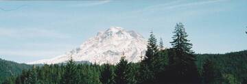
Mount Hood Volcano
Oregon (Canada and USA (mainland)), 45.37°N / -121.7°W
Aktueller Status: normal / ruhend (1 von 5)
Mt Hood 75 km ESE of Portland is Oregon's highest peak and one of the most prominent of the Cascades volcanoes. It is probably the only volcano in Oregon which has erupted in historic times (last confirmed activity in 1865-66).
Andesite-dacite lava domes form the glacially eroded summit complex.
The main hazard from Mt Hood are posed by pyroclastic flows and mud flows (lahars) in case of an eruption. These would travel downstream river beds radiating from the volcano and threaten communities in this area.
Flank failure and debris avalanche risk:
Scientist also warn that due to heavy alteration of rocks by fumarolic and hydrothermal activity large parts of the upper volcanic edifice are structurally unstable and could be prone to massive slope failure. This would trigger catastrophic debris flows, such as has happened at Mt St. Helens in 1980 and have happened in Mt Hood's geologic past as well. More than 100,000 years ago, a large collapse produced a debris avalanche and lahar that traveled north down the Hood River valley and crossed the Columbia River, and a smaller, but still sizeable event like this repeated itselfa about 1500 years ago.
Ausbrüche des Mount Hood: 1907(?), 1869(?), 1865-66, 1859, 1854(?), 1853(?), 1795 ± 5 yr, 1765 ± 5, 390 ± 150, 510 AD ± 150, 300 AD ± 200, 4940 BC ± 150
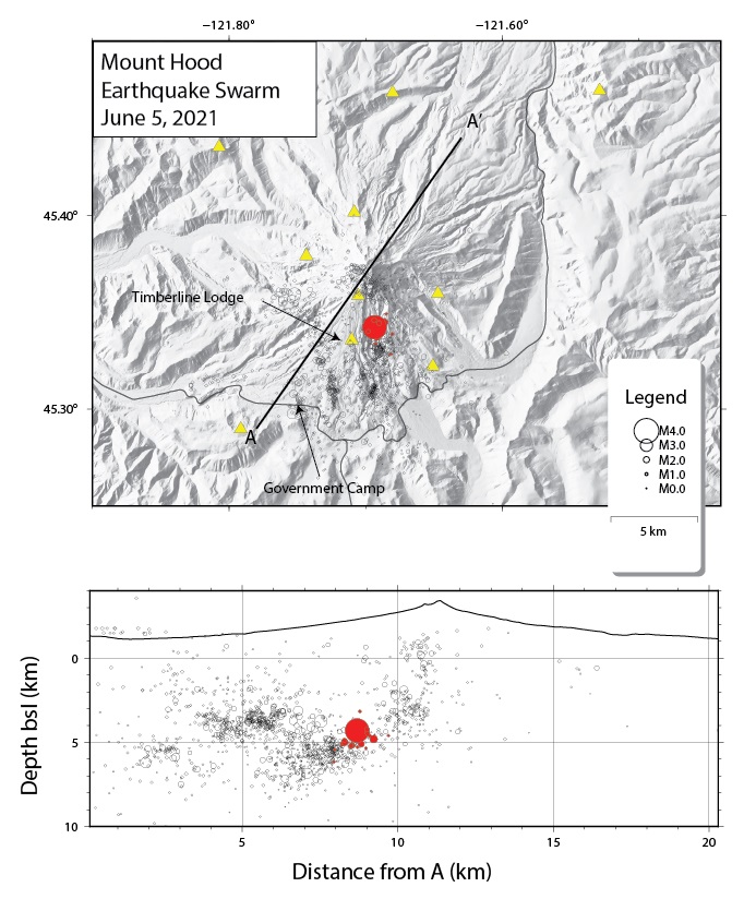
Letzte Erdbeben in der Nähe
| Uhrzeit | Mag. / Tiefe | Entfernung / Ort | |||
| 20. Apr. 08:28 (Los Angeles) | 0.2 5.6 km | Info | |||
| Donnerstag, 18. April 2024 GMT (2 Beben) | |||||
| 18. Apr. 16:21 (Los Angeles) | 1.7 7.6 km | 10.8 km südlich | Info | ||
| 17. Apr. 19:48 (Los Angeles) | 0.4 7.6 km | Info | |||
| Mittwoch, 17. April 2024 GMT (3 Beben) | |||||
| 17. Apr. 15:08 (Los Angeles) | 0.4 5.5 km | Info | |||
| 17. Apr. 14:01 (Los Angeles) | 0.7 4.7 km | Info | |||
| 17. Apr. 13:59 (Los Angeles) | 0.4 4.9 km | Info | |||
Beschreibung
Mt Hood volcano has had at least 4 major eruptive periods during the past 15,000 years. The last three occurred within the past 1800 years from vents high on the SW flank and produced deposits that were distributed primarily to the south and west along the Sandy and Zigzag rivers. The last eruptive period took place around 170-220 years ago, when growth of the Crater Rock lava dome was accompanied by pyroclastic flows and lahars down the White and Sandy rivers. The Sandy River lahar deposits extended to the west as far as the Columbia River and were observed by members of the 1804-1805 Lewis and Clark expedition within a few years of their emplacement. Minor 19th-century eruptions were witnessed from Portland.About 1,500 years ago, a moderate-size debris avalanche originating on the upper southwest flank of Mount Hood (see photograph) produced a lahar
that flowed down the Zigzag and Sandy River valleys. It swept over the entire valley floor in the Zigzag-Wemme-Wildwood area, and inundated a broad area near Troutdale, where the Sandy flows into the Columbia River—a total distance of about 90 kilometers (55 miles). More than 100,000 years ago, a much larger debris avalanche and related lahar flowed down the Hood River, crossed the Columbia River, and flowed several kilometers up the White Salmon River on the Washington side. Its deposit must have dammed the Columbia River at least temporarily.
---
Sources:
GVP Mt Hood information
VOLCANO HAZARDS IN THE MOUNT HOOD REGION, OREGON USGS Open File Report 97-89
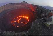
Mount Hood Volcano Photos
8. Oktober 2009 (Photo: volcanomike)
Latest satellite images