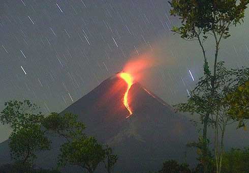
Romeral
Schichtvulkan 3858 m / 12,657 ft
Kolumbien, 5.21°N / -75.36°W
Aktueller Status: normal / ruhend (1 von 5)
Kolumbien, 5.21°N / -75.36°W
Aktueller Status: normal / ruhend (1 von 5)
Romeral volcano, located 16 km SE of the small town of Aranzazu, is the northernmost volcano in South America. The volcano is probably still active. It has produced 2 plinian eruptions about 8460 and 7340 years ago.
Interaktive Karte zeigen
[Karte verbergen ] [vergrößern]
Ausbrüche: 5950 BC ± 500 years (radiocarbon dated)
Letzte Erdbeben in der Nähe:
Zeit | Stärke / Tiefe | Entfernung / Lage | ||
Montag, 15. August 2022 GMT (1 Beben) | ||||
14. Aug. 2022 22:11 (GMT -5) (15. Aug. 2022 03:11 GMT) | 1.2 28 km | 92 km (57 mi) Colombia | ||
Freitag, 5. August 2022 GMT (1 Beben) | ||||
5. Aug. 2022 13:38 (GMT -5) (5. Aug. 2022 18:38 GMT) | 1.2 41 km | 90 km (56 mi) Colombia | ||
Mittwoch, 3. August 2022 GMT (2 Beben) | ||||
3. Aug. 2022 02:34 (GMT -5) (3. Aug. 2022 07:34 GMT) | 1.3 16 km | 60 km (37 mi) Cundinamarca, 23 km südwestlich von La Dorada, Caldas, Kolumbien | ||
3. Aug. 2022 01:18 (GMT -5) (3. Aug. 2022 06:18 GMT) | 1.5 19 km | 99 km (62 mi) 8.5 km nördlich von Villeta, Cundinamarca, Kolumbien |
Beschreibung
The andesitic-to-dacitic Romeral stratovolcano lies at the northern end of the Ruiz-Tolima volcanic chain, NW of Cerro Bravo volcano.

Siehe auch: Sentinel hub | Landsat 8 | NASA FIRMS