Tuluman (St. Andrew Strait) Volcano
Updated: 24. Apr. 2024 23:38 GMT -
complex volcano / submarine volcano 270 m / 886 ft
Admiralty Islands (Papua Neuguinea), -2.38°S / 147.35°E
Aktueller Status: normal / ruhend (1 von 5)
Admiralty Islands (Papua Neuguinea), -2.38°S / 147.35°E
Aktueller Status: normal / ruhend (1 von 5)
Tuluman is the principal volcanic vent of the mostly submerged St. Andrew Strait volcano, located in the Admiralty Islands north of Papua New Guinea and about 45 km SSE of Lorengau on Manus Island.
Tuluman volcano emerged above sea level and formed 2 new islands during eruptions which began in 1953 and lasted until 1957.
Lou island 1.5 km to the north is a second vent of the same volcanic complex. It erupted about 1700 and 2250 years ago.
[smaller] [larger]
Ausbrüche des Tuluman (St. Andrew Strait): 1953-57 (Tuluman), 1883 (Tuluman), 240 BC (Lou Island), 350 AD (Lou Island)
Letzte Erdbeben in der Nähe
| Uhrzeit | Mag. / Tiefe | Entfernung / Ort | |||
Beschreibung
The St. Andrew Strait volcano consists of overlapping Quaternary cones formed by rhyolitic lava flows and tephra on Lou and Tuluman Islands. The volcanic vents are aligned on a curved arc extending through the 12-km-long Lou Island.The Pam Lin and Pam Mandian Islands farther to the SE belong to the same arc and are known for their fresh rhyolitic obsidian similar to that found on Tuluman Island.
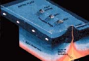
Tectonic context of Tuluman volcano
Tuluman volcano is located in an area with few earthquakes and is probably not associated with any tectonic plate boundary. It can be described as an intra-plate volcano.
Lou Island
Located a 1.5 km north of Tuluman volcano, 12 km long Lou Island belongs to the same volcano. It is one of the main sources of obsidian which was traded by the Lapita peoples of ancient melanesia. its volcanic rocks are rhyolites rich in silica. There are 12 vents on the island, forming cones with craters containing lava flows.
Sources:
- Smithsonian / GVP St. Andrew Strait volcano information
- R. W. Johnson and I. E. Smith (1974) "Volcanoes and rocks of St Andrew Strait, Papua New Guinea", Australian Journal of Earth Sciences, v. 21 (3), pp. 333-351
Ausbrüche des Vulkans Tuluman (St. Andrew Strait)
1954-57 Tuluman eruption: a new island is born
Tuluman volcano emerged above sea level during an eruption starting on 26 June 1953. The eruption was occurring in 6 main stages at 7 different principal vents and ended around 28 January 1957.
In the course of the eruption, several temporary islands and floating masses of pumice were formed, most of which have been subsequently eroded.
The climax of the eruption was from February - May 1955.
Vent 1 was active 1.3 km SSE of Lou Island. It formed an island for 2 months, but wave erosion later reduced it a submarine shoal.
Vents 2,4,5: 3 closely spaced vents combined to form a new island 1.5 km south of Lou Island. The island reached a maximum length of 1 km and remains as Tuluman Island.
Vent 3 was formed an irregular small island 1.3 km south of Lou Island. The new island reached a maximum length of 400 m and a remnant of it is still visible above the sea.
Vent 6 remained submerged, located about 300 m south of vent 5.
Vents 7 and 8 were subaerial vents active on Tuluman island after its formation at the end of the eruption, producing ash and steam explosions and a small lava flow, between November 1956-Jan 1957. ...mehr Infos


