Tungurahua Volcano
Updated: 23. Apr. 2024 14:26 GMT -
Stratovolcano 5023 m (16,479 ft)
Ecuador, -1.47°S / -78.44°W
Aktueller Status: normal / ruhend (1 von 5)
Ecuador, -1.47°S / -78.44°W
Aktueller Status: normal / ruhend (1 von 5)
Last update: 12 Okt 2023 (Smithsonian / USGS Weekly Volcanic Activity Report)
Tungurahua is one of South America's most active volcanoes. Since 2000, a new lava dome has been growing in its summit crater. Tungurahua's activity has been characterized by frequent powerful ash explosions, producing ash plumes of several kilometers height as well as dangerous pyroclastic flows. Part of the population around its base has been evacuated.
[smaller] [larger]
Ausbrüche des Tungurahua: 1534, 1557, 1640(?), 1641, 1644(?), 1646(?), 1757(?), 1773, 1776, 1777(?), 1781(?), 1857, 1885(?), 1886-88, 1900(?), 1916-25, 1944, 2000 - 2016, 2017 (?)
Letzte Erdbeben in der Nähe
| Uhrzeit | Mag. / Tiefe | Entfernung / Ort | |||
Beschreibung
The steep-sided andesitic-dacitic stratovolcano towers more than 3 km above its northern base and consists of three major volcanic edifices sequentially constructed since about 100,000 years ago over a basement of metamorphic rocks.Tungurahua II was built within the past 14,000 years following the collapse of the initial edifice. Tungurahua II itself collapsed about 3000 years ago and produced a large debris-avalanche deposit and a horseshoe-shaped caldera open to the west, inside which the modern glacier-capped stratovolcano (Tungurahua III) was constructed.
Historical eruptions have all originated from the summit crater. They have been accompanied by strong explosions and sometimes by pyroclastic flows and lava flows that reached populated areas at the volcano's base. Prior to a long-term eruption beginning in 1995 that caused the temporary evacuation of the city of Baños at the foot of the volcano, the last major eruption had occurred from 1916 to 1918, although minor activity continued until 1925.
Tungurahua Volcano Photos

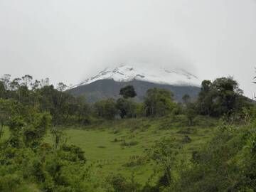
Tungurahua, Ecuador. Oktober 2012 (Weg der pyroklastischen Ströme weiter ins Tal in Richtung Dorf Pondoa). (Photo: volcanomike)
Tungurahua, Ecuador. Oktober 2012 (Weg der pyroklastischen Ströme auf der rechten Flanke). (Photo: volcanomike)
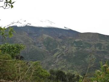
Tungurahua, Ecuador. Oktober 2012 (Weg der pyroklastischen Ströme auf der rechten Flanke). (Photo: volcanomike)
Latest satellite images