Επαφή | RSS | EN | DE | EL | ES | FR | IT | RU

El Chichón ηφαίστειο

Τελευταία ανανενώση: 4 Ιουνίου 2023 14:03 GMT -
Lava domes 1150 m / 3,773 ft
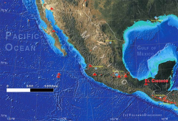
Southern Mexico, 17.36°N / -93.23°W
Current status: normal or dormant (1 out of 5)

El Chichón volcano in southern Mexico forms a broad symmetrical cone with a diameter of 10 km at itsbase and is capped by a 600 m wide crater containing a 80 m high andesitic lava dome.
El Chichón became famous for its large eruption in 1982 that affected the world's climate for the following years with a measurable cooling effect caused by the large amounts of SO2 aerosols ejected into the atmosphere.

Διαδραστικός χάρτης
Typical eruption style: Εκρηκτικός
El Chichón ηφαίστειο εκρήξεις: 1982 (Plininan eruption on 28 March), 1850(?)
radiocarbon-dated: 1360 ± 100, 1190 ± 150, 780 AD ± 100, 590 AD ± 100, 480 AD ± 200, 190 AD ± 150, 20 BC ± 50, 700 BC ± 200, 1340 BC ± 150, 2030 BC ± 100, 6510 BC ± 75 years

Latest nearby earthquakes

ΏραMag. / ΒάθοςΑπόσταση/Τοποθεσία
Σάββατο, 3 Ιουνίου 2023 GMT (1 σεισμός)
3 Ιου 2023 16:22 (GMT -6) (3 Ιου 2023 22:22 GMT)
3.3

15 km
29 km (18 mi)
39 km βορειοανατολικά από Berriozabal, Chiapas, Μεξικό
Τετάρτη, 24 Μαΐου 2023 GMT (1 σεισμός)
24 Μαΐ 2023 15:44 (GMT -6) (24 Μαΐ 2023 21:44 GMT)
3.8

55 km
21 km (13 mi)
Chiapas, 37 km νότια από Huimanguillo, Tabasco, Μεξικό

Background

El Chichón is a small trachyandesitic tuff cone and lava dome complex that occupies an isolated part of the Chiapas region in SE México far from other Holocene volcanoes. Prior to 1982, this relatively unknown volcano was heavily forested and of no greater height than adjacent nonvolcanic peaks. The largest dome, the former summit of the volcano, was constructed within a 1.6 x 2 km summit crater created about 220,000 years ago.
2 other large craters are located on the SW and SE flanks; a lava dome fills the SW crater, and an older dome is located on the NW flank. More than ten large explosive eruptions have occurred since the mid-Holocene. The powerful 1982 explosive eruptions of high-sulfur, anhydrite-bearing magma destroyed the summit lava dome and were accompanied by pyroclastic flows and surges that devastated an area extending about 8 km around the volcano. The eruptions in 1982 created a new 1-km-wide, 300-m-deep crater that now contains an acidic crater lake.


See also: Sentinel hub | Landsat 8 | NASA FIRMS

No news in this list.

Location of El Chichón volcano
Try our free app!
Volcanoes & Earthquakes - new app for Android
Android | iOS version

Περισσότερα για VolcanoDiscovery

Support us - Help us upgrade our services!

We truly love working to bring you the latest volcano and earthquake data from around the world. Maintaining our website and our free apps does require, however, considerable time and resources.
We need financing to increase hard- and software capacity as well as support our editor team. We're aiming to achieve uninterrupted service wherever an earthquake or volcano eruption unfolds, and your donations can make it happen! Every donation will be highly appreciated. If you find the information useful and would like to support our team in integrating further features, write great content, and in upgrading our soft- and hardware, please make a donation (PayPal or Online credit card payment).

Planned features:
  • Improved multilanguage support
  • Tsunami alerts
  • Faster responsiveness
Thanks to your past donations, these features have been added recently:
  • Design upgrade
  • Detailed quake stats
  • Additional seismic data sources
Download and Upgrade the Volcanoes & Earthquakes app to get one of the fastest seismic and volcano alerts online:
Android | IOS
Thank you!
Stop Russia's Agression - Support Ukraine
Significant parts of this website use brilliant open-source software developed by Ukrainians. Russia's unprovoked war has killed tens of thousands, displaced millions, and the beautiful country of Ukraine is being destroyed. We cannot be silent even if the topic of this website has nothing to do with politics.
If you like to support Ukraine from abroad:
Ukrainians recommend the Come Back Alive charity. For other options, see StandWithUkraine.
Sources: VolcanoDiscovery / VolcanoAdventures and other sources as noted.
Use of material: Most text and images on our websites are owned by us. Re-use is generally not permitted without authorization. Contact us for licensing rights.
Volcanoes & Earthquakes
VolcanoDiscovery Home
Ηφαίστεια | Σεισμοί | Photos | News | App
Adventure & Study Travel
Tours to Volcanoes and Volcanic Areas: walking tours, photo tours, study tours
Tours & Dates | FAQ | About us
Get our newsletter!
Company info
Contact | Legal info | Terms & conditions
Follow us
Follow us on facebook Follow us on Instagram Follow us on Twitter Visit our Youtube channel
EN | DE | EL | ES | FR | IT | RU
VolcanoDiscovery GmbH, Germany, Reg. nr.: HRB 103744, EU Tax Id: DE 310 395 322 owned and created by
Dr. Tom Pfeiffer, volcanologist, volcano photographer, tour organizer member of
IAVCEI
Volcanological Society
Ecotourism Greece
Insured by R+V
VolcanoDiscovery © 2004- All Rights Reserved | Privacy - cookie settings