Hekla Volcano
Updated: 19 Απριλίου 2024 10:54 GMT -
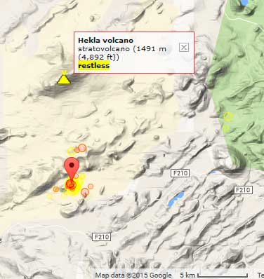
stratovolcano 1491 m (4,892 ft)
Ισλανδία, 63.99°N / -19.67°W
Current status: normal or dormant (1 out of 5)
Ισλανδία, 63.99°N / -19.67°W
Current status: normal or dormant (1 out of 5)
Last update: 15 Dec 2021
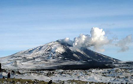
Hekla in eruption in March 2000 with the large black lava flow in the foreground from that eruption.
1491-m-high Hekla is one of Iceland's most prominent, most known and active volcanoes. It has frequent eruptions that start with an explosive onset producing eruption plumes, then lava fountains and culminate in large lava flows. Most of the volcano's flanks are covered by extensive lava flows from historical eruptions, dating back to 1104 AD.
[smaller] [larger]
Hekla volcano eruptions: 1104 (large, Plinian eruption), 1158, 1206, 1222, 1300, 1341, 1389, 1440(?), 1510, 1554, 1597, 1636-37, 1693, 1725, 1766-68, 1845-46, 1878, 1913, 1947-48, 1970, 1980, 1981, 1991, 2000
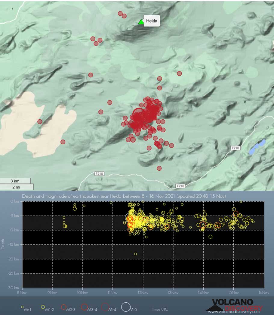
Latest nearby earthquakes
| Ώρα | Mag. / Βάθος | Απόσταση / Τοποθεσία | |||
| 18 Απρ 15:40 (Reykjavik) | 1.1 0 km | 27 km δυτικά | Περ. | ||
| Κυριακή, 14 Απριλίου 2024 GMT (1 σεισμός) | |||||
| 14 Απρ 20:40 (Reykjavik) | 1.5 7.9 km | 16 km νότια | Περ. | ||
| Δευτέρα, 8 Απριλίου 2024 GMT (1 σεισμός) | |||||
| 8 Απρ 20:39 (Reykjavik) | 1.4 1.3 km | 13 km δυτικά | Περ. | ||
| Τετάρτη, 17 Απριλίου 2024 GMT (2 σεισμοί) | |||||
| 17 Απρ 15:51 (Reykjavik) | 0.9 1.6 km | 22 km βόρεια | Περ. | ||
| 17 Απρ 01:07 (Reykjavik) | 0.7 7 km | 21 km δυτικά | Περ. | ||
| Τρίτη, 16 Απριλίου 2024 GMT (1 σεισμός) | |||||
| 16 Απρ 19:28 (Reykjavik) | 0.7 8.2 km | 18 km δυτικά | Περ. | ||
Background
Hekla is located near the southern end of the eastern rift zone. It sits on a rift-transform junction, and has produced basaltic andesites, in contrast to the tholeiitic basalts typical of Icelandic rift zone volcanoes. Hekla's tephras are generally rich in flourine, which is very hazardous to grazing animals.The elongated shape of the volcano is caused by a 5.5-km-long fissure, Heklugjá, that cuts across the volcano and is often active along its full length during major eruptions. Repeated such eruptions, oblique to most rifting structures in the eastern volcanic zone, have created Hekla's elongated ENE-WSW profile.
Frequent large explosive eruptions during historical times have deposited tephra throughout Iceland and provide important time markers that can be used to date eruptions from other volcanoes in Iceland.
Hekla Volcano Photos
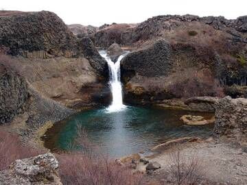
Καταρράκτης Gjárfoss στο βασαλτικό φαράγγι Gjáin κοντά στο ηφαίστειο Hekla, Ισλανδία (Photo: Janka)
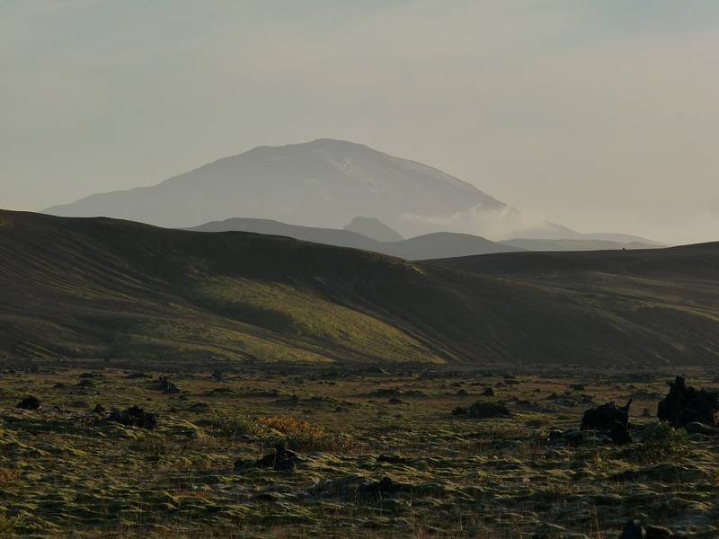
Τα περιγράμματα του όρους Χέκλα υλοποιούνται στο μουντό βραδινό φως πίσω από μια ηφαιστειακή κορυφογραμμή. Κοντά στο Hrauneyjalón, νότιο όριο τω (Photo: Ingrid)...
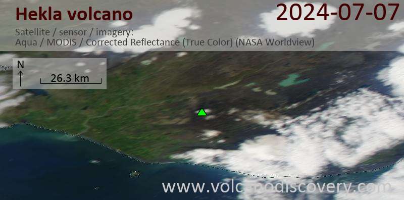
Latest satellite images