Tana Volcano
Updated: 25 Απριλίου 2024 15:25 GMT -
Stratovolcanoes 1170 m / 3,839 ft
United States, Aleutian Islands, 52.83°N / -169.77°W
Current status: normal or dormant (1 out of 5)
United States, Aleutian Islands, 52.83°N / -169.77°W
Current status: normal or dormant (1 out of 5)
[smaller] [larger]
Tana volcano eruptions: unknown, no recent eruptions
Latest nearby earthquakes
| Ώρα | Mag. / Βάθος | Απόσταση / Τοποθεσία | |||
| 20 Απρ 19:00 (Adak) | 1.3 0.1 km | Περ. | |||
| Κυριακή, 14 Απριλίου 2024 GMT (2 σεισμοί) | |||||
| 14 Απρ 08:18 (Adak) | 1.5 9.2 km | 15 km νοτιοανατολικά | Περ. | ||
| 14 Απρ 06:00 (GMT -8) | 2.4 9.4 km | 29 km νοτιοανατολικά | Περ. | ||
| Σάββατο, 13 Απριλίου 2024 GMT (2 σεισμοί) | |||||
| 13 Απρ 03:31 (Adak) | 0.9 16 km | Περ. | |||
| 12 Απρ 20:19 (Adak) | 1.7 12 km | 17 km νοτιοανατολικά | Περ. | ||
| Παρασκευή, 12 Απριλίου 2024 GMT (1 σεισμός) | |||||
| 12 Απρ 20:32 (GMT +0) | 1.9 8.7 km | 21 km νοτιοανατολικά | Περ. | ||
Background
The Tana volcanic complex forming the eastern half of the dumbbell-shaped Chuginadak Island, opposite the dramatic conical Cleveland stratovolcano, is composed of two prominent E-W-trending volcanoes. The complex shows evidence of glacial erosion, but the observation on satellite imagery of highly irregular coastlines forming peninsulas west of Applegate Cove on the NW side of the complex and Concord Point on the south side imply lava flows of mid- to late-Holocene age (Nye 2007, pers. comm.). Prominent lava flow levees are visible near Concord Point, where a low-silica rhyolite sample was obtained. The undissected cone and youthful crater forming the western summit also imply a post-glacial age, and youthful cinder cones also lie east of the isthmus between Cleveland and Tana volcanoes.---
Smithsonian / GVP volcano information
Tana Volcano Photos
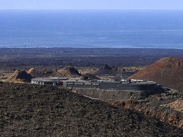
Το κέντρο μαζικού τουρισμού του Islote de Hilario. Στο Montanas de fuego ("βουνά της φωτιάς"). Εθνικό πάρκο Timanfaya. (Photo: Tobias Schorr)...

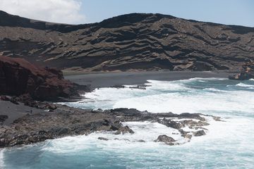
Ηφαιστειακή ακτή Los Hervideros, Montanas del fuego στο παρασκήνιο, Lanzarote Isl., Κανάρια Νησιά (Photo: WNomad)
Lanzarote 2016 - Charco de los clicos Pt.1: Ένα παράδειγμα υδροηφαιστείου - ο κρατήρας του ηφαιστείου Montaña de Golfo (Photo: Ayasha27)...
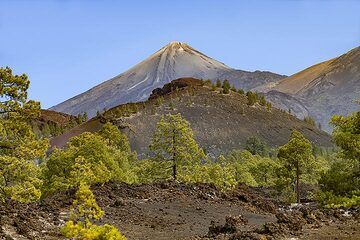
Άποψη από τη Montaña Sámara προς το τεράστιο ηφαίστειο Teide στο νησί της Τενερίφης. (Photo: Tobias Schorr)
Latest satellite images