Amak Volcano
Updated: 11 dic. 2024 08:43 GMT -
Stratovolcano 488 m / 1,601 ft
United States, Aleutian Islands, 55.42°N / -163.15°W
Current status: normal or dormant (1 out of 5)
United States, Aleutian Islands, 55.42°N / -163.15°W
Current status: normal or dormant (1 out of 5)
[smaller] [larger]
Erupciones del volcán Amak: 1796
Latest nearby earthquakes
Background
Amak, the easternmost of the Aleutian Islands, is a small island stratovolcano that like Bogoslof, lies north of the main Aleutian volcanic front. Amak is located about 50 km NW of Frosty volcano on the western tip of the Alaska Peninsula. The summit of the small, roughly 1 cu km Amak volcano is only 488 m above sea level. Blocky lava flows with prominent levees were emplaced during historical eruptions from 1700-1710 and in 1796 (Marsh, in Wood and Kienle 1990). The flows radiate from a well-defined central crater and cover much of the central part of the island. Earlier volcanism perhaps 4000-5000 years ago consisted of the emission of thin, platy andesitic lava flows. A flat alluvial plain on the south flank contains a flat-bottomed crater that may be a maar.---
Smithsonian / GVP volcano information
Amak Volcano Photos
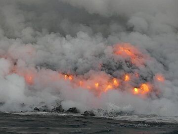
Día 5: Una canción de fuego y agua... La lava que se vierte en el océano quiere crear nueva tierra pero es inmediatamente atacada por las fuertes olas del océano. ¡La bat...
Latest satellite images
Amak Volcano Maps
Below is a selection of maps showing the location and surroundings of the volcano at various resolutions based on aerial-imagery / terrain maps. Feel free to use them for non-commercial purposes on your blog or website as long as you credit them with a link back to this page (click to copy it).
Satellite/aerial-type map of Amak volcano (world scale)
Terrain-type map of Amak volcano (world scale)
Satellite/aerial-type map of Amak volcano (region scale large)
Terrain-type map of Amak volcano (region scale large)
Satellite/aerial-type map of Amak volcano (region scale medium)
Terrain-type map of Amak volcano (region scale medium)
Satellite/aerial-type map of Amak volcano (region scale small)
Terrain-type map of Amak volcano (region scale small)
Satellite/aerial-type map of Amak volcano (local scale large)
Terrain-type map of Amak volcano (local scale large)
Satellite/aerial-type map of Amak volcano (local scale medium)
Terrain-type map of Amak volcano (local scale medium)
Satellite/aerial-type map of Amak volcano (local scale small)
Terrain-type map of Amak volcano (local scale small)
Satellite/aerial-type map of Amak volcano (scale of 10s of km)
Terrain-type map of Amak volcano (scale of 10s of km)
Satellite/aerial-type map of Amak volcano (scale of 20-40 km)
Terrain-type map of Amak volcano (scale of 20-40 km)
Satellite/aerial-type map of Amak volcano (scale of approx. 10-20 km)
Terrain-type map of Amak volcano (scale of approx. 10-20 km)
Satellite/aerial-type map of Amak volcano (scale of 5-10 km)
Satellite/aerial-type map of Amak volcano (scale of few kilometers)