Contact | RSS | EN | DE | EL | ES | FR | IT | RU

Cagua Volcano

Updated: 25 abr. 2024 11:56 GMT -
stratovolcano 1133 m / 3,717 ft
Isla de Luzón (Filipinas), 18.22°N / 122.12°E
Current status: normal or dormant (1 out of 5)

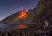
Cagua is an active stratovolcano at the NE tip of northern Luzon Island, Philippines. It has a circular summit crater of 1.5 km diameter, with steep, 60-m-high walls, and is locally known as the "Fire Mountain". The volcano might have erupted in 1907, when strong fumarole activity was noted. A phreatic explosion in 1860 may have generated pyroclastic flows.
At present, there are thermal areas near the summit crater and on the NW and NNE flanks.

[smaller] [larger]
Typical eruption style: explosive
Erupciones del volcán Cagua: 1907 (?), 1860

Latest nearby earthquakes

No hay terremotos recientes
Fecha / HoraRevista / Prof.Distancia / Ubicación

Background

Mount Cagua volcano belongs to the Babuya segment where it is part of a N-S line of the active volcanoes, east of the older, now extinct volcanic range of Northern Luzon.
The lavas of Cagua are basaltic and andesitic in composition and belong to the calcalkaline series.
The volcano has been formed in 3 phases:

1) Effusive eruptions feeding basaltic-andesite and basaltic lava flows between 1.5 and 1.2 Million years ago.
2) Explosive eruptions with thick andesitic pyroclastic flows in the interval from 600,000 - 300,000 years ago. These deposits covered the entire volcano.
3) Recent phreatomagmatic activity producing ash flows.

Latest satellite images

Cagua satellite image sat1Cagua satellite image sat2

No news in this list.

En esta página:

Try our free app!
Volcanoes & Earthquakes - new app for Android
Android | iOS version

Más en VolcanoDiscovery

Why is there advertising on this site?

Support us - Help us upgrade our services!

We truly love working to bring you the latest volcano and earthquake data from around the world. Maintaining our website and our free apps does require, however, considerable time and resources.
We need financing to increase hard- and software capacity as well as support our editor team. We're aiming to achieve uninterrupted service wherever an earthquake or volcano eruption unfolds, and your donations can make it happen! Every donation will be highly appreciated. If you find the information useful and would like to support our team in integrating further features, write great content, and in upgrading our soft- and hardware, please make a donation (PayPal or Online credit card payment).

Planned features:Thanks to your past donations, these features have been added recently:
Download and Upgrade the Volcanoes & Earthquakes app to get one of the fastest seismic and volcano alerts online:
Android | IOS
Thank you!
Sources: VolcanoDiscovery / VolcanoAdventures and other sources as noted.
Use of material: Most text and images on our websites are owned by us. Re-use is generally not permitted without authorization. Contact us for licensing rights.
Volcanoes & Earthquakes
VolcanoDiscovery Home
Volcanes | Sismos | Fotos | News | App
Adventure & Study Travel
Tours to Volcanoes and Volcanic Areas: walking tours, photo tours, study tours
Tours & Dates | FAQ | About us
Get our newsletter!
Company info
Contact | Legal info | Terms & conditions
Follow us
Follow us on facebook Follow us on Instagram Follow us on Twitter Visit our Youtube channel
EN | DE | EL | ES | FR | IT | RU
VolcanoDiscovery GmbH, Germany, Reg. nr.: HRB 103744, EU Tax Id: DE 297 465 123 owned and created by
Dr. Tom Pfeiffer, volcanologist, volcano photographer, tour organizer member of
IAVCEI
IAVCEI
Vulkanologische Gesellschaft
Volcanological Society
Ecotourism Greece
Ecotourism Greece
RUV insurance
Insured by R+V
VolcanoDiscovery © 2004- All Rights Reserved | Privacy - Cookie Settings