Pagan Volcano
Updated: 19 abr. 2024 08:25 GMT -
stratovolcanoes 570 m / 1,870 ft
Mariana Islands, 18.13°N / 145.8°E
Current status: normal or dormant (1 out of 5)
Mariana Islands, 18.13°N / 145.8°E
Current status: normal or dormant (1 out of 5)
Last update: 8 jun 2022 (Smithsonian / USGS Weekly Volcanic Activity Report)
Pagan volcano consists of 2 stratovolcanoes (North and South Pagan) connected by a narrow isthmus and forms the largest and one of the most active of the Mariana Islands. It is located 173 nautical miles north of Saipan.
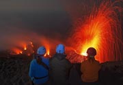
Nearly all historical eruptions of Pagan, which were recorded since the 17th century, were from North Pagan volcano. The largest historic eruption was in 1981 and prompted the evacuation of the sparsely populated island.
[smaller] [larger]
Erupciones del volcán Pagan: 2012, 2011, 2010, 2009, 2006, 1993, 1992, 1988, 1987, 1981-85, 1929-30 (?), 1925, 1923, 1917, 1909, 1873?, 1864, 1825 ± 5 years, 1800 ± 50 years, 1669, 1340 ± 100 years
Latest nearby earthquakes
| Fecha / Hora | Revista / Prof. | Distancia / Ubicación | |||
Background
Both North and South Pagan stratovolcanoes were constructed within calderas, 7 and 4 km in diameter, respectively. The 570-m-high Mount Pagan at the NE end of the island rises above the flat floor of the northern caldera, which may have formed less than 1000 years ago.South Pagan is a 548-m-high stratovolcano with an elongated summit containing 4 distinct craters.
(from: Smithsonian / GVP)
Erupciones del volcán Pagan
2011 activity
Small ash emissions were reported from Pagan volcano at the end of August 2011.
Small ash emissions were reported from Pagan volcano at the end of August 2011.
2010 eruptions
An ash eruption was reported from Pagan on 6 May 2010.
An ash eruption was reported from Pagan on 6 May 2010.
2009 ash eruptions
Activity was noted in April and August 2009. "Black ash" and steam were observed on 16 April 2009. Crew aboard a NOAA research ship observed continuous emissions from the N crater during 21-22 April.
A small ash eruption probably occurred at Pagan volcano on 15 Aug 2009, as an ash plume drifting NW and a hot spot were observed by satellite.
2006-07 activity
In December 2006 ash eruptions occurred at Pagan volcano and continued into January. Up to a cm per day of ash were reported accumulating 3 km SW of the summit. ...más info
In December 2006 ash eruptions occurred at Pagan volcano and continued into January. Up to a cm per day of ash were reported accumulating 3 km SW of the summit. ...más info
1993 eruptions
Intermittent ash eruptions occurred at Pago volcano from January to March 1993. Frequent ash eruptions produced plumes reaching 1-2 km height. ...más info
Intermittent ash eruptions occurred at Pago volcano from January to March 1993. Frequent ash eruptions produced plumes reaching 1-2 km height. ...más info
Latest satellite images