Contact | RSS | EN | DE | EL | ES | FR | IT | RU

Alid Volcano

Updated: 20 avril. 2024 03:51 GMT -
Stratovolcano 904 m / 2,966 ft
Eritrea, 14.88°N / 39.92°E
Condition actuelle: normal / en sommeil (1 sur 5)

[smaller] [larger]
Style éruptif tipique: unspecified
Eruptions du volcan Alid: unknown, no recent eruptions

Derniers séismes proches

No recent earthquakes
HeureMag. / ProfondeurDistance / Lieu

Introduction

Alid is an isolated, dissected volcano in the central Danakil depression. The volcano is elongated in an E-W direction perpendicular to the orientation of the Alid graben. Alid consists of a structural dome of uplifted sedimentary rocks, capped by basaltic-to-rhyolitic lava flows, that rises 700 m above the graben floor. Late-stage rhyolitic eruptions during the late Pleistocene ejected rhyolitic pumice. Steep-sided lava flows drape the flanks of the structural dome, which was produced by intrusion of a silicic magma body. A 2 x 3 km graben cuts the top of the dome, and the crater that produced the plinian eruption occupies the western third of the summit depression. Vast lava fields of probable Holocene age originating from fissure vents bank up against the flanks of Alid to the NW and SE. Small cones and craters that were the source of the flows are localized along NNW-trending fissures. Fumarolic activity continues from broad areas on the northern summit and flank.
---
Smithsonian / GVP volcano information

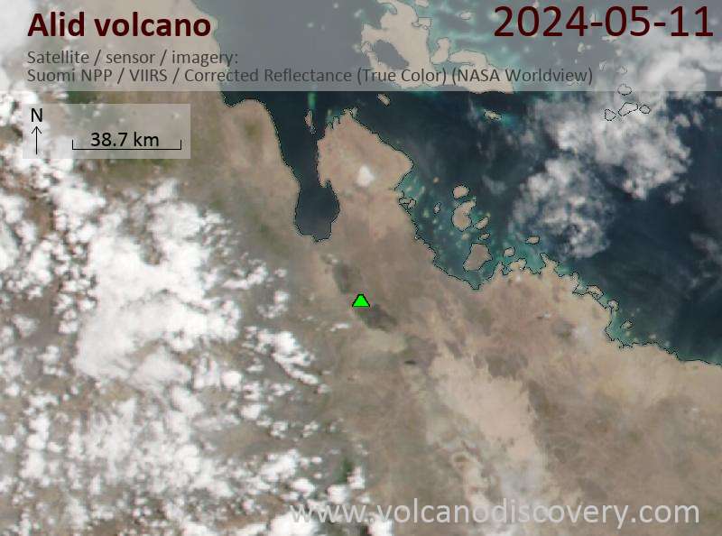
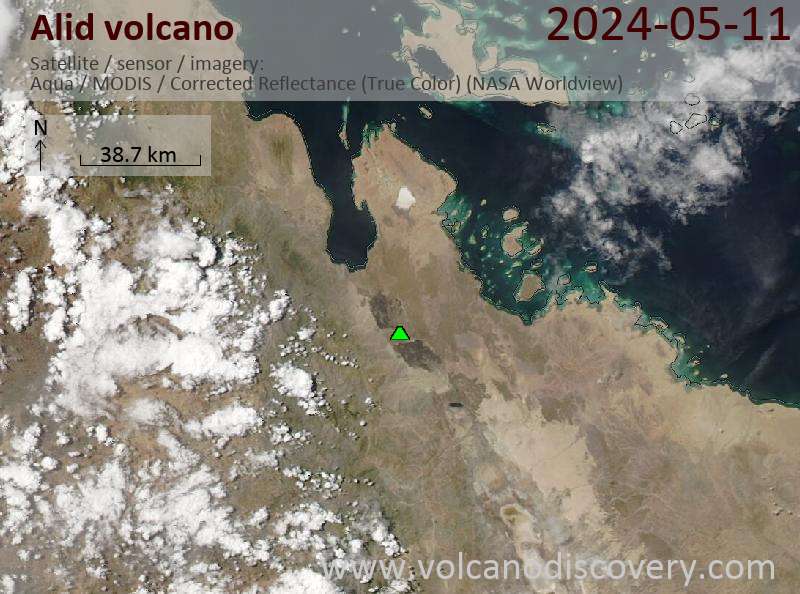
Latest satellite images

alid satellite image sat1alid satellite image sat2
Actualités

No news in this list.

Sur cette page:

Découvrez notre app gratuite !
Volcanoes & Earthquakes - new app for Android
Android | Version iOS

Plus sur VolcanoDiscovery

Why is there advertising on this site?

Support us - Help us upgrade our services!

We truly love working to bring you the latest volcano and earthquake data from around the world. Maintaining our website and our free apps does require, however, considerable time and resources.
We need financing to increase hard- and software capacity as well as support our editor team. We're aiming to achieve uninterrupted service wherever an earthquake or volcano eruption unfolds, and your donations can make it happen! Every donation will be highly appreciated. If you find the information useful and would like to support our team in integrating further features, write great content, and in upgrading our soft- and hardware, please make a donation (PayPal or Online credit card payment).

Planned features:Thanks to your past donations, these features have been added recently:
Download and Upgrade the Volcanoes & Earthquakes app to get one of the fastest seismic and volcano alerts online:
Android | IOS
Thank you!
Copyright: VolcanoDiscovery ou autres sources indiquées.
Utilisation des documents: Les textes, les images et les vidéos de ce site internet sont protégées par copyright. Toute reproduction et tout usage sans accord préalable ne sont pas autorisés. Si vous désirez acquérir pour certains documents (photos, vidéos, textes ou autres) le droit de reproduction, d'édition et, plus généralement, de toute utilisation destinée à un usage public, qu'elle soit commerciale ou pas, vous êtes priés de nous contacter.
Volcanoes & Earthquakes
VolcanoDiscovery Home
Volcans | Séismes | Photos | Actualités | App
Adventure & Study Travel
Tours to Volcanoes and Volcanic Areas: walking tours, photo tours, study tours
Voyages |
Get our newsletter!
Company info
Contact | Mentions légales | Terms & conditions
Follow us
Follow us on facebook Follow us on Instagram Follow us on Twitter Visit our Youtube channel
EN | DE | EL | ES | FR | IT | RU
VolcanoDiscovery GmbH, Germany, Reg. nr.: HRB 103744, EU Tax Id: DE 297 465 123 owned and created by
Dr. Tom Pfeiffer, volcanologist, volcano photographer, tour organizer member of
IAVCEI
IAVCEI
Vulkanologische Gesellschaft
Volcanological Society
Ecotourism Greece
Ecotourism Greece
RUV insurance
Insured by R+V
VolcanoDiscovery © 2004- All Rights Reserved | Privacy