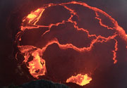
Grímsnes Volcano
Updated: 23 avril. 2024 21:11 GMT -
Crater rows 214 m (702 ft)
Islande, 64.03°N / -20.87°W
Condition actuelle: normal / en sommeil (1 sur 5)
Islande, 64.03°N / -20.87°W
Condition actuelle: normal / en sommeil (1 sur 5)
Grímsnes is a relatively small volcanic system located SE of Thingvallavatn lake east of an en echelon group of volcanic fields extending across the Reykjanes Peninsula.
[smaller] [larger]
Eruptions du volcan Grímsnes: none during historic times
Derniers séismes proches
| Heure | Mag. / Profondeur | Distance / Lieu | |||
| 22 avril 13:02 (Reykjavik) | 2.1 7.3 km | 20 km au sud-ouest | Info | ||
| lundi, 15 avril 2024 GMT (1 séisme) | |||||
| 15 avril 16:54 (Reykjavik) | 2.8 3.5 km | 23 km à l'ouest | Info | ||
| mercredi, 10 avril 2024 GMT (2 séismes) | |||||
| 10 avril 08:32 (Reykjavik) | 2.4 4.6 km | 24 km à l'ouest | Info | ||
| 10 avril 08:29 (Reykjavik) | 2.2 4.4 km | 24 km à l'ouest | Info | ||
| jeudi, 18 avril 2024 GMT (1 séisme) | |||||
| 18 avril 12:18 (Reykjavik) | 1.5 4.4 km | 9.4 km au sud-est | Info | ||
| samedi, 13 avril 2024 GMT (1 séisme) | |||||
| 13 avril 21:11 (Reykjavik) | 1.5 7.4 km | 27 km au sud-ouest | Info | ||
Introduction
Grímsnes lava flows cover 54 sq km and were erupted from a group of 11 fissures that produced a series of NE-SW-trending crater rows. The eruptions of the basaltic Grímsnes lavas were restricted to a relatively short interval between about 6500 and 5500 years ago.Latest satellite images