Graciosa Volcano
Updated: 24 apr. 2024 17:35 GMT -
stratovolcano 402 m
Azzorre (Portogallo), 39.02°N / -27.97°W
Current status: normal or dormant (1 out of 5)
Azzorre (Portogallo), 39.02°N / -27.97°W
Current status: normal or dormant (1 out of 5)
The SE end of Graciosa, the northernmost of the central Azorean islands, contains a small 0.9 x 1.6 km caldera with active fumaroles.
[smaller] [larger]
Eruzioni del vulcano Graciosa: 2000-4000 years ago
Latest nearby earthquakes
| Data / ora | Mag. / Prof. | Distanza / Ubicazione | |||
Background
The 402-m-high SE caldera rim is the high point of the small 4 x 8 km island. The caldera has been the source of eruptions producing significant tephra falls, pyroclastic flows, lahars, and lava flows. An important fumarole field is located in a volcanic cave inside the caldera, and a submarine fumarole occurs off the NW coast of Graciosa. Scoria cones erupted along several widely spaced NE-SW-trending fissures fed a youthful lava field that forms the NW end of the island. The most recent eruption from Pico Tomao, NW of the caldera, produced a lava flow that reached the eastern coast NW of the village of Praia.-------------------------------------
Source: Smithsonian GVP
Graciosa Volcano Photos
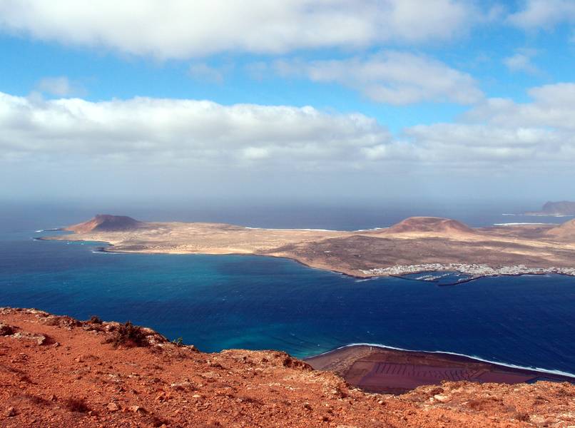
Vista sull'isola di La Graciosa, situata a nord di Lanzarote, Isole Canarie (Photo: Janka)
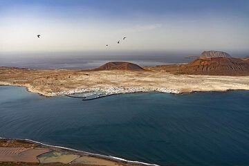
L'isola La Graciosa vicino a Lanzarote. (Photo: Tobias Schorr)
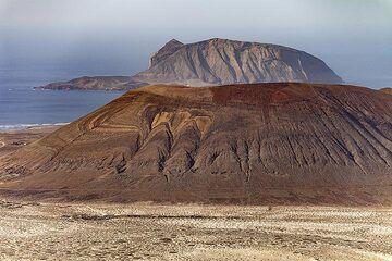
Crateri sull'isola La Graciosa. (Photo: Tobias Schorr)
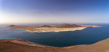
Vista panoramica dell'isola La Graciosa. (Photo: Tobias Schorr)
Latest satellite images