Contatti | RSS | EN | DE | EL | ES | FR | IT | RU

Irazu Volcano

Updated: 19 apr. 2024 20:08 GMT -
Stratovolcano 3432 m / 11,260 ft
Costa Rica, 9.98°N / -83.85°W
Current status: normal or dormant (1 out of 5)
Last update: 22 dic 2021 (Smithsonian / USGS Weekly Volcanic Activity Report)

Irazú (3432 m) immediately east of the capital San José is Costa Rica's highest and one of its most active volcanoes. Tephra fall (ash) during the last major eruption of Irazú in 1963-65 caused heavy damage to infrastructure and life in San José and its surroundings.

[smaller] [larger]
Typical eruption style: Explosive.
Eruzioni del vulcano Irazu: 1726, 1775(?), 1821(?), 1822, 1823, 1826(?), 1842, 1844(?), 1847, 1864, 1875, 1882(?), 1909(?), 1914(?), 1917-21, 1924, 1928, 1930, 1933, 1939-40, 1963-65, 1977, 1994

Latest nearby earthquakes

Data / oraMag. / Prof.Distanza / Ubicazione
12 apr 02:37 (Costa Rica)
2.9

4 km
7.5 km a est Costa Rica: 4 km al Norte de Capellades, Alvarado.
Info
sabato, 6 aprile 2024 GMT (2 sismi)
6 apr 15:56 (Costa Rica)
3.1

11 km
21 km a nord Costa Rica
Info
6 apr 11:25 (Costa Rica)
4.6

10 km
23 km a nord ovest Costa Rica: 17 km al Oeste de Guapiles, Pococi. 19 reportsInfo
giovedì, 11 aprile 2024 GMT (2 sismi)
11 apr 04:16 (Costa Rica)
2.7

73 km
20 km a sud ovest Costa Rica: 3 km al Norte de Tobosi, El Guarco.
Info
11 apr 03:04 (Costa Rica)
2.7

8 km
22 km a sud Cartago, 28 km a sud-est da San José, San Jose, Costa Rica
Info
martedì, 16 aprile 2024 GMT (1 sismo)
15 apr 23:43 (Costa Rica)
2.6

4 km
22 km a nord est Costa Rica: 8 km al Oeste de Alegria, Siquirres.  I FELT IT
Info

Background

Irazú is a massive stratovolcano covering more than 500 sq km with at least 10 flank cones on the southern flank, all being older than at least 14,000 years when a massive lava flow (the "Ceravantes" flow) was erupted.
All known eruptions from Irazú during the past 10,000 years have been explosive and originated from the summit craters that show a migration to the W over time. The historically active crater contains a small acid lake of changing size and color.
---
Source: GVP, Smithsonian Institution

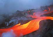
Irazu Volcano Photos

Latest satellite images

Irazu satellite image sat1Irazu satellite image sat2
Wed, 4 Nov 2020, 06:00

Irazu volcano (Costa Rica) - Smithsonian / USGS Weekly Volcanic Activity Report for 4 November-10 November 2020 (Continuing Activity)

OVSICORI-UNA reported that Irazú's seismic network recorded a significant landslide in the W part of the volcano on 4 November along with a lahar. A small thermal anomaly was detected in MODIS (Moderate Resolution Imaging Spectroradiometer) satellite data. ... Read all
Wed, 26 Aug 2020, 06:00

Irazu volcano (Costa Rica) - Smithsonian / USGS Weekly Volcanic Activity Report for 26 August-1 September 2020 (Continuing Activity)

OVSICORI-UNA reported that Irazú's seismic network recorded land movement 1.2 km SW of the SW crater rim in a high area used for radio and television antennas. Landslides in the area had been observed since 2014, but activity accelerated in the previous months. The number of events indicating landslides began to exponentially increase particularly after 20 August. ... Read all

Su questa pagina:

Try our free app!
Volcanoes & Earthquakes - new app for Android
Android | iOS version

Piu su VolcanoDiscovery

Why is there advertising on this site?

Support us - Help us upgrade our services!

We truly love working to bring you the latest volcano and earthquake data from around the world. Maintaining our website and our free apps does require, however, considerable time and resources.
We need financing to increase hard- and software capacity as well as support our editor team. We're aiming to achieve uninterrupted service wherever an earthquake or volcano eruption unfolds, and your donations can make it happen! Every donation will be highly appreciated. If you find the information useful and would like to support our team in integrating further features, write great content, and in upgrading our soft- and hardware, please make a donation (PayPal or Online credit card payment).

Planned features:Thanks to your past donations, these features have been added recently:
Download and Upgrade the Volcanoes & Earthquakes app to get one of the fastest seismic and volcano alerts online:
Android | IOS
Thank you!
Sources: VolcanoDiscovery / VolcanoAdventures and other sources as noted.
Use of material: Most text and images on our websites are owned by us. Re-use is generally not permitted without authorization. Contact us for licensing rights.
Volcanoes & Earthquakes
VolcanoDiscovery Home
Vulcani | Earthquakes | Photos | News | App
Adventure & Study Travel
Tours to Volcanoes and Volcanic Areas: walking tours, photo tours, study tours
Tours & Dates | FAQ | About us
Get our newsletter!
Company info
Contact | Legal info | Terms & conditions
Follow us
Follow us on facebook Follow us on Instagram Follow us on Twitter Visit our Youtube channel
EN | DE | EL | ES | FR | IT | RU
VolcanoDiscovery GmbH, Germany, Reg. nr.: HRB 103744, EU Tax Id: DE 297 465 123 owned and created by
Dr. Tom Pfeiffer, volcanologist, volcano photographer, tour organizer member of
IAVCEI
IAVCEI
Vulkanologische Gesellschaft
Volcanological Society
Ecotourism Greece
Ecotourism Greece
RUV insurance
Insured by R+V
VolcanoDiscovery © 2004- All Rights Reserved | Privacy - Cookie Settings