Pitcairn Vulcano
Updated: 22 apr. 2025 21:51 GMT -
Shield
Pitcairn Island, United Kingdom, -25.07°S / -130.11°W 

Summit height: 313 m / 1027 ft
Current status: (probably) extinct (0 out of 5)
[smaller] [larger]
Eruzioni del vulcano Pitcairn: None during the past 10,000 years
Less than few million years ago (Pleistocene)
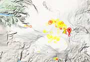
Latest nearby earthquakes
Data e ora | Mag / Prof. | Distanza / Posizione |
---|
Background
Located at the SE end of the Duke of Gloucester-Gabbier Islands chain, Pitcairn is a small island remnant of a shield volcano with a dissected caldera. Potassium-Argon dates range from 0.95-0.45 million years ago (Duncan et al. 1974).---
Source: Smithsonian / GVP volcano information
Ultime immagini satellitari
Pitcairn Vulcano Mappe
Below is a selection of maps showing the location and surroundings of the volcano at various resolutions based on aerial-imagery / terrain maps. Feel free to use them for non-commercial purposes on your blog or website as long as you credit them with a link back to this page (click to copy it).

Satellite/aerial-type map of Pitcairn volcano (world scale)

Terrain-type map of Pitcairn volcano (world scale)

Satellite/aerial-type map of Pitcairn volcano (region scale large)

Terrain-type map of Pitcairn volcano (region scale large)

Satellite/aerial-type map of Pitcairn volcano (region scale medium)

Terrain-type map of Pitcairn volcano (region scale medium)

Satellite/aerial-type map of Pitcairn volcano (region scale small)

Terrain-type map of Pitcairn volcano (region scale small)

Satellite/aerial-type map of Pitcairn volcano (local scale large)

Terrain-type map of Pitcairn volcano (local scale large)

Satellite/aerial-type map of Pitcairn volcano (local scale medium)

Terrain-type map of Pitcairn volcano (local scale medium)

Satellite/aerial-type map of Pitcairn volcano (local scale small)

Terrain-type map of Pitcairn volcano (local scale small)

Satellite/aerial-type map of Pitcairn volcano (scale of 10s of km)

Terrain-type map of Pitcairn volcano (scale of 10s of km)

Satellite/aerial-type map of Pitcairn volcano (scale of 20-40 km)

Terrain-type map of Pitcairn volcano (scale of 20-40 km)

Satellite/aerial-type map of Pitcairn volcano (scale of approx. 10-20 km)

Terrain-type map of Pitcairn volcano (scale of approx. 10-20 km)

Satellite/aerial-type map of Pitcairn volcano (scale of 5-10 km)

Satellite/aerial-type map of Pitcairn volcano (scale of few kilometers)