Contact | RSS | EN | DE | EL | ES | FR | IT | RU

Taal Volcano

Updated: 25 apr. 2024 03:44 GMT -
caldera 311 m / 1,020 ft
Luzon, Philippines, 14°N / 120.99°E
Current status: restless (2 out of 5)
Last update: 24 apr 2024 (Smithsonian / USGS Weekly Volcanic Activity Report)
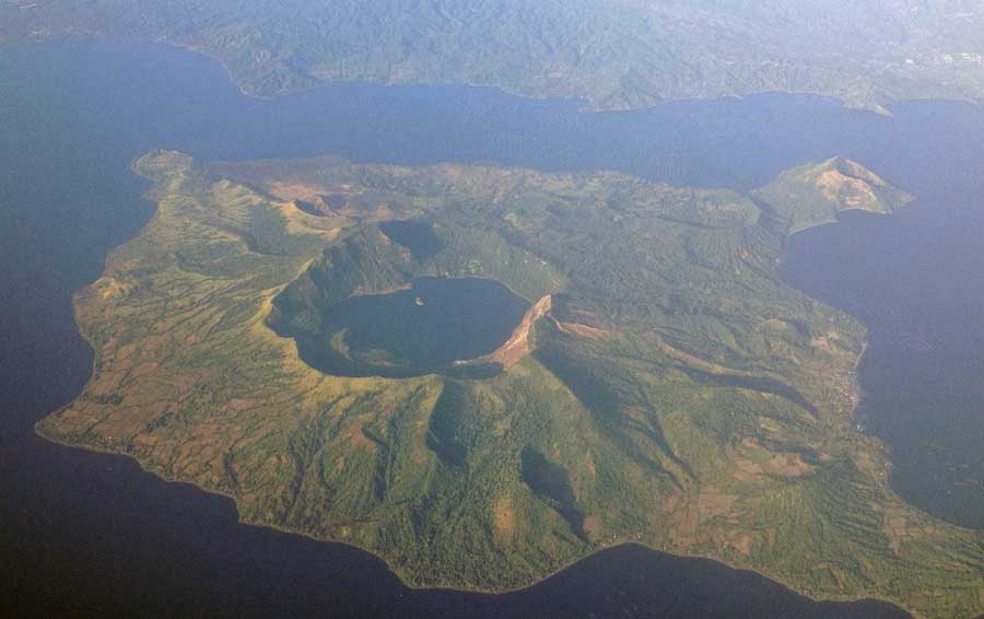
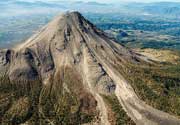
Aerial photo of Taal Volcano on December 22, 2012 (image: Mike Gonzalez, Wikimedia Commons, see text for link)

Taal volcano with its lake-filled 15x20 km wide Talisay (Taal) caldera is a beautiful caldera volcano, but also one of the most active and dangerous volcanoes of the Philippines. Taal has had some of the country's largest and deadliest eruptions: At least 6 eruptions during the recorded history of Taal since 1572 claimed fatalities, mostly from powerful pyroclastic flows, as well as tsunamis produced in the crater lake.

[smaller] [larger]
Typical eruption style: Explosive
Eruzioni del vulcano Taal: 2020, 1977, 1976, 1970, 1969, 1968, 1967, 1966, 1965, 1911, 1904, 1903, 1885(?), 1878, 1874, 1873, 1842, 1825, 1808, 1790, 1754, 1749, 1731, 1729, 1716, 1715, 1709, 1707, 1645, 1641, 1635, 1634, 1609, 1591, 1572

Latest nearby earthquakes

Non terremoti recenti
Data / oraMag. / Prof.Distanza / Ubicazione

Background

The Taal caldera is largely filled by Lake Taal, whose 267 sq km surface lies only 3 m above sea level. The maximum depth of the lake is 160 m, and contains several eruptive centers submerged beneath the lake. All historic eruptions took place from the 5-km-wide volcanic island in the northern-central part of the lake.
The island is formed by overlapping stratovolcanoes, cinder cones and tuff rings (maars). Historic eruptions have seen the constant change and growth of the island.
Taal caused one of the worst volcano disasters in history: its eruption in 1911 killed 1334 people and caused ash fall as far as Manila city. Due to its devastating potential, Taal was declared one of the "Decade Volcanoes" in the Decade Volcanoes program of the 1990s in order to incentive study and monitoring of the volcano. Taal is today one of the most closely monitored volcanoes in the region. An increase in seismic activity under Taal was recorded in November 2006, followed by an increase in hot water springs in the crater in April 2007.

Aerial image of Taal Volcano Island credit: TheCoffee (Mike Gonzalez), CC BY-SA 3.0, via Wikimedia Commons

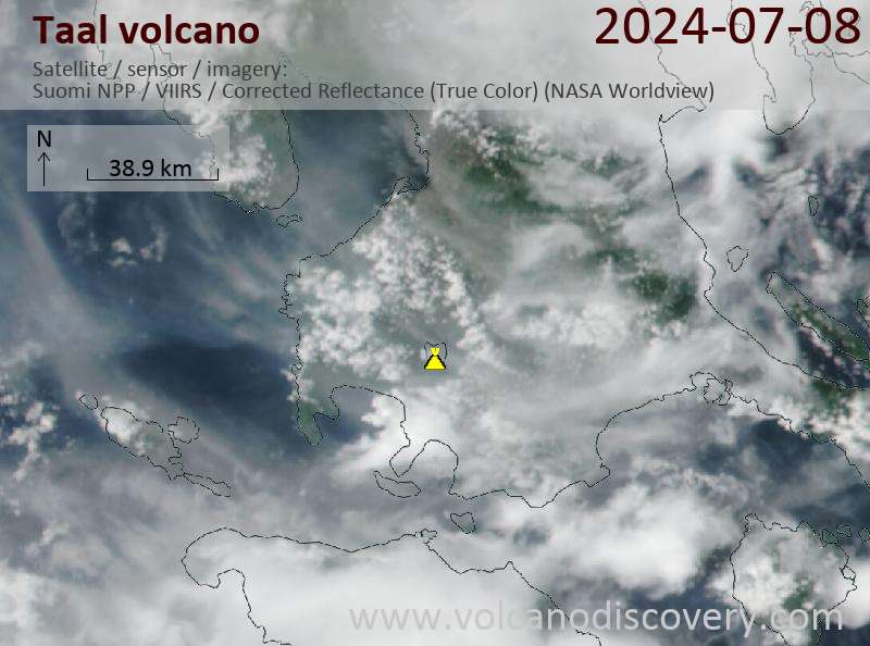
Latest satellite images

Taal satellite image sat1Taal satellite image sat2
Wed, 24 Apr 2024, 14:00

Taal volcano (Luzon, Philippines) - Smithsonian / USGS Weekly Volcanic Activity Report for 17 April-23 April 2024 (New Activity / Unrest)

PHIVOLCS reported that sulfur dioxide emissions at Taal had decreased the last week and averaged 2,104 tonnes per day (t/d) on 18 April; despite the decrease averages in 2024 remained high at 9,698 t/d. Short-lived phreatic events were recorded during 0850-0852, 0909-0912, 1102-1107, and 1710-1714 on 20 April based on seismic data and webcam images. White steam plumes rose 300-600 m above Main Crater and drifted WSW, SW, and NW. ... Read all
Sat, 20 Apr 2024, 18:16

Taal volcano (Luzon Island, Philippines): minor phreatic bursts today

Small phreatic burst at Taal volcano today (image: PHIVOLCS)
The observatory PHIVOLCS recorded several small phreatic bursts from the Main Crater Lake within the Taal caldera at 11:02 and 17:10 local time today. ... Read all

Su questa pagina:

Try our free app!
Volcanoes & Earthquakes - new app for Android
Android | iOS version

Piu su VolcanoDiscovery

Why is there advertising on this site?

Support us - Help us upgrade our services!

We truly love working to bring you the latest volcano and earthquake data from around the world. Maintaining our website and our free apps does require, however, considerable time and resources.
We need financing to increase hard- and software capacity as well as support our editor team. We're aiming to achieve uninterrupted service wherever an earthquake or volcano eruption unfolds, and your donations can make it happen! Every donation will be highly appreciated. If you find the information useful and would like to support our team in integrating further features, write great content, and in upgrading our soft- and hardware, please make a donation (PayPal or Online credit card payment).

Planned features:Thanks to your past donations, these features have been added recently:
Download and Upgrade the Volcanoes & Earthquakes app to get one of the fastest seismic and volcano alerts online:
Android | IOS
Thank you!
Sources: VolcanoDiscovery / VolcanoAdventures and other sources as noted.
Use of material: Most text and images on our websites are owned by us. Re-use is generally not permitted without authorization. Contact us for licensing rights.
Volcanoes & Earthquakes
VolcanoDiscovery Home
Vulcani | Earthquakes | Photos | News | App
Adventure & Study Travel
Tours to Volcanoes and Volcanic Areas: walking tours, photo tours, study tours
Tours & Dates | FAQ | About us
Get our newsletter!
Company info
Contact | Legal info | Terms & conditions
Follow us
Follow us on facebook Follow us on Instagram Follow us on Twitter Visit our Youtube channel
EN | DE | EL | ES | FR | IT | RU
VolcanoDiscovery GmbH, Germany, Reg. nr.: HRB 103744, EU Tax Id: DE 297 465 123 owned and created by
Dr. Tom Pfeiffer, volcanologist, volcano photographer, tour organizer member of
IAVCEI
IAVCEI
Vulkanologische Gesellschaft
Volcanological Society
Ecotourism Greece
Ecotourism Greece
RUV insurance
Insured by R+V
VolcanoDiscovery © 2004- All Rights Reserved | Privacy - Cookie Settings