Contatti | RSS | EN | DE | EL | ES | FR | IT | RU

Tinakula Volcano

Updated: 18 apr. 2024 02:18 GMT -
stratovolcano 851 m / 2,792 ft
Santa Cruz Islands, Solomon Islands, -10.38°S / 165.8°E
Current status: erupting (4 out of 5)
Last update: 22 mar 2024 (eruption continues with lava flows from summit vent)
The northern side of Tinakula volcano with its "Sciara del Fuoco" below the crater at the right. Photo by Donn Tolia, 2002 (Geological Survey of the Solomon Islands, courtesy of CSIRO)

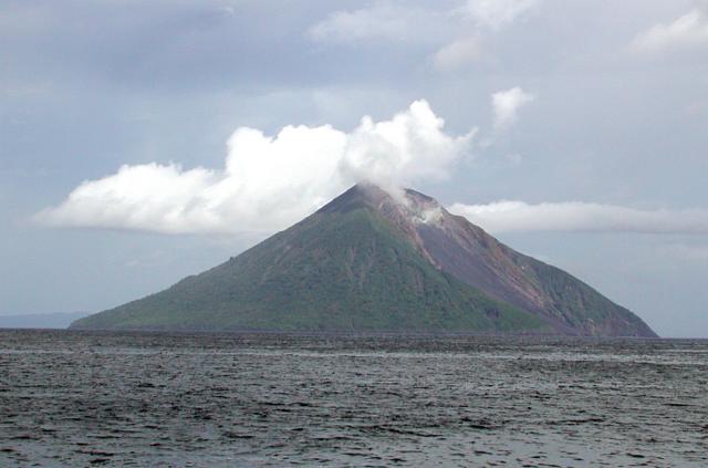
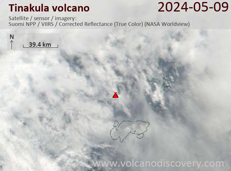
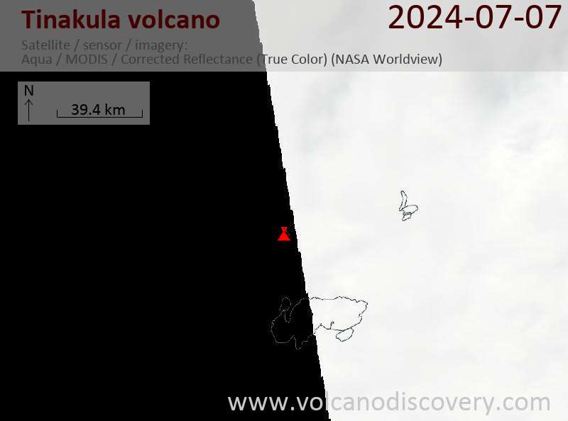
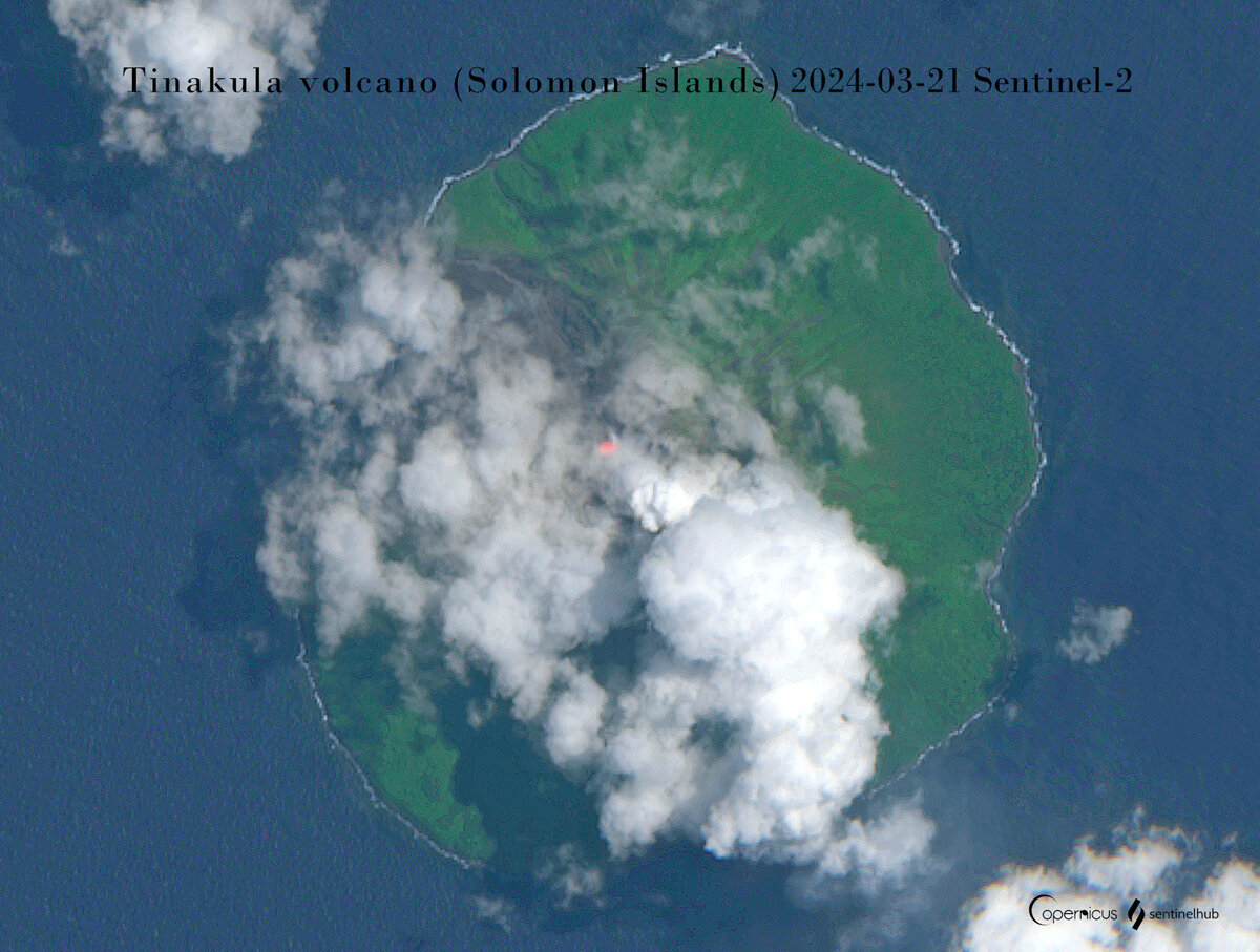
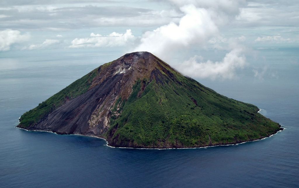
Tinakula volcano is located at the NW end of the Santa Cruz islands in the Solomon Islands. It forms a small 3.5 km wide and steep island, which is the upper 25% of a very active stratovolcano that rises more than 3 km from the sea floor. Tinakula is very similar to Stromboli volcano in Italy.
Tinakula's active summit crater is often in strombolian activity and the glowing bombs it ejects often roll down down a steep slope of loose ash and scoria extending to the sea on the SW side of the island.
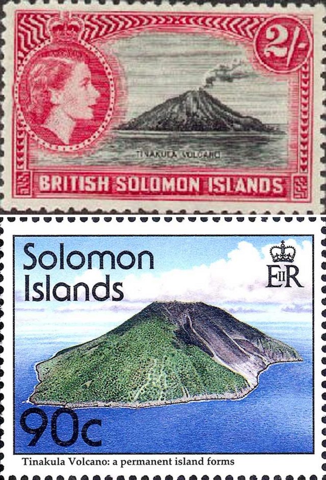
The small 3.5 km wide Tinakula Island was inhabited until 1971 when a major eruption and a tsunami occurred and prompted people to abandon the island.
Tinakula has been frequently active since it was first discovered by the Spanish explorer Álvaro de Mendaña de Neira in 1595.

[smaller] [larger]
Typical eruption style: strombolian
Eruzioni del vulcano Tinakula: 2019 (?), 2012, 2008-2011, 2006-07, 2002 (?), 2001-02, 2002 (April)-2001, 1999, 1995, 1989-90, 1984-85, 1971, 1965-66, 1955 (?), 1951, 1909, 1897, 1886, 1871, 1869, 1857, 1855, 1840?, 1797, 1768, 1595

Latest nearby earthquakes

Non terremoti recenti
Data / oraMag. / Prof.Distanza / Ubicazione

Background

The mainly andesitic Tinakula volcano resembles Stromboli volcano in having a breached summit crater half-open to one side. It extends from the 851-m-high summit to below sea level. Landslides enlarged this scarp in 1965 and created an embayment on the NW coast.
Frequent historical eruptions have originated from a cone constructed within the large breached crater. These have left the upper flanks of the volcano and the steep apron of lava flows and volcaniclastic debris within the breach unvegetated.
The flank cone of Mendana is located on the SE side, named after the first western observer of an eruption of the volcano.

Eruzioni del vulcano Tinakula


1971 eruption & tsunami
A major eruption of Tinakula began on 6 September 1971, when a large explosion occurred from the summit crater that produced 2 pyroclastic flows on the E and W sides of the volcano and was followed by a tsunami 30 minutes later. A second explosion, also followed by a tsunami occurred on 7 Sep.
The explosive activity at the summit was followed by an effusive phase that opened a fissure vent about half way up in the western wall of the landslide scar below the summit craters. A lava flow from this fissure reached the sea.
At the same time, intense strombolian activity continued from the summit and built up a new summit cone. Incandescent blocks were observed reaching several 100 m above the crater.
The activity increased towards the end of September and in October and ended in December. Most of the population (160 inhabitants) was evacuated. ...Ulteriori info

1840 eruption and fatalities
An powerful eruption occurred at Tinakula around 1840, producing pyroclastic flows on all sides of the island, killing its inhabitants.

Latest satellite images

Tinakula satellite image sat1Tinakula satellite image sat2
Fri, 22 Mar 2024, 05:39

Tinakula volcano (Solomon Islands): eruption continues with lava flows from summit vent

A heat radiation at the summit of Tinakula volcano on 21 March (image: Sentinel-2)
The effusive eruption at the volcano continues. ... Read all
Wed, 20 Mar 2024, 15:00

Tinakula volcano (Santa Cruz Islands) - Smithsonian / USGS Weekly Volcanic Activity Report for 13 March-19 March 2024 (Continuing Activity)

A thermal anomaly extending from the summit of Tinakula down the W flank to the coast was identified in satellite images on 11 March. Images acquired on 6 and 16 March were cloudy or mostly cloudy. ... Read all
Stamps from the British Solomon Islands showing Tinakula (www.iomoon.com).
Tinakula volcano with its sciara del fuoco (image: Lance McC, date unknown but before 12/2009, via Panoramio / Volcano HotSpot blog)

Su questa pagina:

Try our free app!
Volcanoes & Earthquakes - new app for Android
Android | iOS version

Piu su VolcanoDiscovery

Why is there advertising on this site?

Support us - Help us upgrade our services!

We truly love working to bring you the latest volcano and earthquake data from around the world. Maintaining our website and our free apps does require, however, considerable time and resources.
We need financing to increase hard- and software capacity as well as support our editor team. We're aiming to achieve uninterrupted service wherever an earthquake or volcano eruption unfolds, and your donations can make it happen! Every donation will be highly appreciated. If you find the information useful and would like to support our team in integrating further features, write great content, and in upgrading our soft- and hardware, please make a donation (PayPal or Online credit card payment).

Planned features:Thanks to your past donations, these features have been added recently:
Download and Upgrade the Volcanoes & Earthquakes app to get one of the fastest seismic and volcano alerts online:
Android | IOS
Thank you!
Sources: VolcanoDiscovery / VolcanoAdventures and other sources as noted.
Use of material: Most text and images on our websites are owned by us. Re-use is generally not permitted without authorization. Contact us for licensing rights.
Volcanoes & Earthquakes
VolcanoDiscovery Home
Vulcani | Earthquakes | Photos | News | App
Adventure & Study Travel
Tours to Volcanoes and Volcanic Areas: walking tours, photo tours, study tours
Tours & Dates | FAQ | About us
Get our newsletter!
Company info
Contact | Legal info | Terms & conditions
Follow us
Follow us on facebook Follow us on Instagram Follow us on Twitter Visit our Youtube channel
EN | DE | EL | ES | FR | IT | RU
VolcanoDiscovery GmbH, Germany, Reg. nr.: HRB 103744, EU Tax Id: DE 297 465 123 owned and created by
Dr. Tom Pfeiffer, volcanologist, volcano photographer, tour organizer member of
IAVCEI
IAVCEI
Vulkanologische Gesellschaft
Volcanological Society
Ecotourism Greece
Ecotourism Greece
RUV insurance
Insured by R+V
VolcanoDiscovery © 2004- All Rights Reserved | Privacy - Cookie Settings