Yantarni Volcano
Updated: 23 apr. 2024 19:51 GMT -
Stratovolcano 1345 m / 4,413 ft
United States, Alaska Peninsula, 57.02°N / -157.19°W
Current status: normal or dormant (1 out of 5)
United States, Alaska Peninsula, 57.02°N / -157.19°W
Current status: normal or dormant (1 out of 5)
[smaller] [larger]
Eruzioni del vulcano Yantarni: 800 BC ± 500 years
Latest nearby earthquakes
| Data / ora | Mag. / Prof. | Distanza / Ubicazione | |||
| 16 apr 02:51 (Anchorage) | 3.0 8.9 km | 29 km a nord ovest | Info | ||
Background
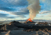
Yantarni is a small andesitic stratovolcano located between Aniakchak caldera and Chiginadak volcanoes that was not discovered until 1979. A large breached crater on the NE side, which was formed by collapse of the summit about 2000-3500 years ago, contains a lava dome that marks the volcano's 1345 m high point. This eruption, which resembled that of Mount St. Helens in 1980, began with a debris avalanche produced by the edifice collapse that was accompanied by a possible lateral blast and followed by the emplacement of 1 cu km of pyroclastic flows related to growth of the summit lava dome. No historical eruptions have been documented from Yantarni.---
Smithsonian / GVP volcano information
Latest satellite images