El Misti Volcano
Updated: Apr 25, 2024 20:12 GMT -
stratovolcano 5822 m / 19,101 ft
Peru, -16.29°S / -71.41°W
Current status: normal or dormant (1 out of 5)
Peru, -16.29°S / -71.41°W
Current status: normal or dormant (1 out of 5)
Last update: 6 Mar 2024 (Smithsonian / USGS Weekly Volcanic Activity Report)
The majestic El Misti volcano is Peru's most known and one of its most active volcanoes. It is an andesitic symmetrical stratovolcano that dominates the town of Arequipa, only 16 km to the SW, and its proximity to Peru's second largest city as well its history of explosive eruptions make it one of the world's most dangerous volcanoes.
[smaller] [larger]
El Misti volcano eruptions: 1985(?), 1870(?), 1869(?), 1831(?), 1830(?), 1826(?), 1787, 1784, 1677, 1599(?), 1542(?), 1454 ± 16, 1350 ± 50, 760 AD ± 100, 90 AD ± 300, 80 BC ± 75, 310 BC ± 100, 2230 BC ± 200, 3510 BC ± 150, 4020 BC ± 200, 5390 BC ± 75, 7190 BC ± 150
Latest nearby earthquakes
| Time | Mag. / Depth | Distance / Location | |||
Background
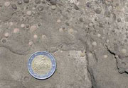
Similar to Vesuvius in Italy, the present-day El Misti was built within a small 1.5 x 2 km wide summit caldera that formed between about 13,700 and 11,300 years ago. It has 2 concentric summit craters. The outer crater measures 830 m in diameter and contains a 450 m wide scoria cone with the inner crater on its top.There were several large explosive eruptions in the past few 1000 years, and more than 20 subplinian to plinian eruptions within the past 50,000 years, that caused heavy tephra fall and pyroclastic flows traveling up to 12 km.
All historic eruptions had been small explosive events from the summit cone that only affected the upper areas of the volcano, covering it with ash and scoria, and an ash fall field that extends up to 20 km.
Eruptions of El Misti volcano
1997 fumarole temperature measurements
In December 1997 scientists measured fumarole tempratures of 220 deg C in the crater of El Misti volcano.
In December 1997 scientists measured fumarole tempratures of 220 deg C in the crater of El Misti volcano.
April 1984 gas emissions
In early April 1984, gas and steam emissions increased at the crater of El Misti, creating a plume of 1 km height. Scientists who tried to collect samples on 29 April were prevented by doing so due to the high levels of irritating gasses (SO2 ?).
In early April 1984, gas and steam emissions increased at the crater of El Misti, creating a plume of 1 km height. Scientists who tried to collect samples on 29 April were prevented by doing so due to the high levels of irritating gasses (SO2 ?).
1985: new fumaroles
On 7 and 8 August 1985 geologists observed vigorous new fumaroles on the N side inside El Misti's crater. Highly pressurized gasses escaped with lots of noise from 6 new vents and red (liquid?) and yellow (solid) sulphur deposits were observed in and around the vents.
(USGS/GVP monthly reports)
On 7 and 8 August 1985 geologists observed vigorous new fumaroles on the N side inside El Misti's crater. Highly pressurized gasses escaped with lots of noise from 6 new vents and red (liquid?) and yellow (solid) sulphur deposits were observed in and around the vents.
(USGS/GVP monthly reports)
1971 gas emissions
Elevated gas and steam emissions occurred from the crater of El Misti volcano in 1971.
Elevated gas and steam emissions occurred from the crater of El Misti volcano in 1971.
1949: new fumaroles
New fumarolic activity resumed in El Misti's crater in 1949.
New fumarolic activity resumed in El Misti's crater in 1949.
310 BC (sub)plinian eruption
The last major eruption of El Misti was about 2000-2300 years ago. It deposited a significant pumice layer which is 30 cm thick at 13 km distance from the volcano and extends 25 km SW. A similar event today would be a major hazard for the city of Arequipa.
The last major eruption of El Misti was about 2000-2300 years ago. It deposited a significant pumice layer which is 30 cm thick at 13 km distance from the volcano and extends 25 km SW. A similar event today would be a major hazard for the city of Arequipa.
Latest satellite images