Cay Volcano
Updated: Apr 18, 2024 05:41 GMT -
stratovolcano 2090 m / 6,857 ft
Southern Chile and Argentina (South America), -45.06°S / -72.98°W
Current status: normal or dormant (1 out of 5)
Southern Chile and Argentina (South America), -45.06°S / -72.98°W
Current status: normal or dormant (1 out of 5)
Volcán Cay is a probably still active stratovolcano in southern Chile, 15 km NE of Maca volcano and NW of the town of Puerto Aisén. Like Maca and Hudson volcanoes, Cay is one of the large composite central volcanoes in the South Andean Volcanic Zone.
Cay volcano is basaltic and dacitic in composition. It contains an explosion crater open to the east, and about a half dozen explosion craters and pyroclastic cones along a fissure trending SW of the summit.
Another 10 basaltic cinder cones are located along a second parallel fissure 5 km to the SE, which is part of the major regional Liquiñe-Ofqui fault zone.
[smaller] [larger]
Cay volcano eruptions: none in historic times
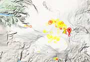
Latest nearby earthquakes
| Time | Mag. / Depth | Distance / Location | |||
Background
The volcanoes of the South Andean Volcanic Zone are typically calkalkalineand the result of the subduction of the Nazca Plate under the South America Plate. Cay volcano is located between the Guafo and Guamblin fracture zones.
Sources:
- Smithsonian / GVP volcano information
- D'Orazio et al (2003) "The Quaternary calc-alkaline volcanism of the Patagonian Andes close to the Chile triple junction: geochemistry and petrogenesis of volcanic rocks from the Cay and Maca volcanoes (~45.8°S, Chile)", Journal of South American Earth Sciences, Volume 16, Issue 4, Pages 219-242
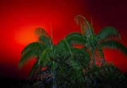
Cay Volcano Photos
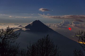
Agua volcano near Antigua, Guatemala, with erupting Pacaya in the right background (Photo: Tom Pfeiffer)
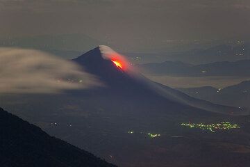
Pacaya volcano with its lava flows seen from Acatenango volcano. (Photo: Tom Pfeiffer)
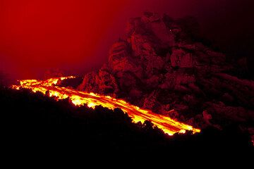
Lava flow at Pacaya volcano (Photo: Tom Pfeiffer)
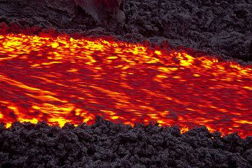
Zoom onto the lava flow at Pacaya volcano (Guatemala) in 2010 (Photo: Tom Pfeiffer)
Latest satellite images