Contact | RSS | EN | DE | EL | ES | FR | IT | RU

Namarunu Volcano

Updated: Apr 19, 2024 23:03 GMT -
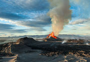
Shield volcano 817 m / 2,680 ft
Kenya, 1.98°N / 36.43°E
Current status: normal or dormant (1 out of 5)

[smaller] [larger]
Typical eruption style: unspecified
Namarunu volcano eruptions: 6550 BC ± 1000 years

Latest nearby earthquakes

No recent earthquakes
TimeMag. / DepthDistance / Location

Background

The largely Pliocene Namarunu trachytic shield volcano is topped by parasitic cones and lava flows of upper Pleistocene and Holocene age. Voluminous basaltic effusive and explosive activity took place during the early Holocene on the lower northern, eastern, and southern flanks along the axis of the East African Rift, producing fissure-controlled subaerial basaltic scoria cones and lava flows, and partially or completely sublacustral tuff cones, tuff rings, and pillow lavas. Fluid olivine basalts were also erupted from a breached scoria cone forming the summit of Namarunu. The youngest eruptions postdated the drying out of Lake Sugata about 3000 years ago. Some could be as recent as the historical eruptions at The Barrier volcano to the north (Dunkley et al., 1993). Hot springs are located on some of the young volcanic cones on the rift valley floor and on the eastern side of the rift along the base of the Tirr Tirr Plateau.
---
Smithsonian / GVP volcano information

Latest satellite images

namarunu satellite image sat1namarunu satellite image sat2

No news in this list.

On this page:

Try our free app!
Volcanoes & Earthquakes - new app for Android
Android | iOS version

More on VolcanoDiscovery

Why is there advertising on this site?

Support us - Help us upgrade our services!

We truly love working to bring you the latest volcano and earthquake data from around the world. Maintaining our website and our free apps does require, however, considerable time and resources.
We need financing to increase hard- and software capacity as well as support our editor team. We're aiming to achieve uninterrupted service wherever an earthquake or volcano eruption unfolds, and your donations can make it happen! Every donation will be highly appreciated. If you find the information useful and would like to support our team in integrating further features, write great content, and in upgrading our soft- and hardware, please make a donation (PayPal or Online credit card payment).

Planned features:Thanks to your past donations, these features have been added recently:
Download and Upgrade the Volcanoes & Earthquakes app to get one of the fastest seismic and volcano alerts online:
Android | IOS
Thank you!
Sources: VolcanoDiscovery / VolcanoAdventures and other sources as noted.
Use of material: Most text and images on our websites are owned by us. Re-use is generally not permitted without authorization. Contact us for licensing rights.
Volcanoes & Earthquakes
VolcanoDiscovery Home
Volcanoes | Earthquakes | Photos | Volcano News | App
Adventure & Study Travel
Tours to Volcanoes and Volcanic Areas: walking tours, photo tours, study tours
Tours & Dates | FAQ | About us
Get our newsletter!
Company info
Contact | Legal info | Terms & conditions
Follow us
Follow us on facebook Follow us on Instagram Follow us on Twitter Visit our Youtube channel
EN | DE | EL | ES | FR | IT | RU
VolcanoDiscovery GmbH, Germany, Reg. nr.: HRB 103744, EU Tax Id: DE 297 465 123 owned and created by
Dr. Tom Pfeiffer, volcanologist, volcano photographer, tour organizer member of
IAVCEI
IAVCEI
Vulkanologische Gesellschaft
Volcanological Society
Ecotourism Greece
Ecotourism Greece
RUV insurance
Insured by R+V
VolcanoDiscovery © 2004- All Rights Reserved | Privacy - Cookie Settings