Sarychev Peak Volcano
Updated: Apr 16, 2024 13:00 GMT -
stratovolcano 1496 m (4,908 ft)
Central Kuriles (Kuril Islands), 48.09°N / 153.2°E
Current status: normal or dormant (1 out of 5)
Central Kuriles (Kuril Islands), 48.09°N / 153.2°E
Current status: normal or dormant (1 out of 5)
Last update: 14 Dec 2021
Sarychev volcano is one of the most active volcanoes in the Kuril Island chain streching between Kamchatka and Japan. Large explosive eruptions occured between 11-19 June 2009, sending huge ash coulds to altitudes of up to 14 km, and forcing many flights with routes accross the northern Pacific to be cancelled or diverted.
[smaller] [larger]
Sarychev Peak volcano eruptions: 2019 (?), 2010 (?), 2009 (12 June, subplinian eruption), 1989, 1986, 1976, 1965, 1960, 1954, 1946, 1932?, 1930, 1928, 1927, 1923, 1878, 1805, 1760
Latest nearby earthquakes
| Time | Mag. / Depth | Distance / Location | |||
Background
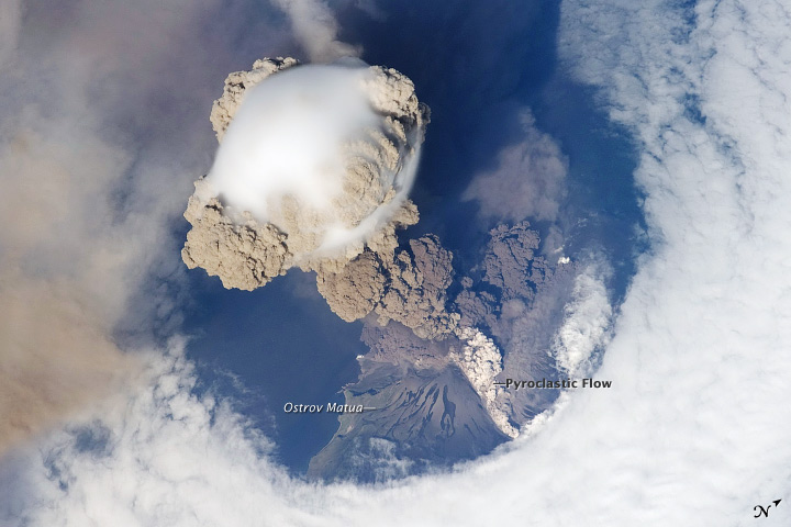
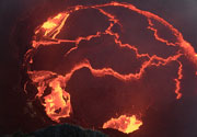
Sarychev Peak, one of the most active volcanoes of the Kuril Islands, occupies the NW end of Matua Island in the central Kuriles. The andesitic central cone was constructed within a 3-3.5 km wide caldera, whose rim is exposed only on the SW side. A dramatic 250-m-wide, very steep-walled crater with a jagged rim caps the volcano. The substantially higher SE rim forms the 1496 m high point of the island. Fresh-looking lava flows descend all sides of Sarychev Peak and often form capes along the coast. Much of the lower-angle outer flanks of the volcano are overlain by pyroclastic-flow deposits. Eruptions have been recorded since the 1760's and include both quiet lava effusion and violent explosions.The largest historical eruption of Sarychev Peak began on June, 11, 2009 and produced ash plumes rising to up to 14 kms and pyroclastic flows that reached the sea. The ash plumes drifting westwards at altitudes typical for commercial airplanes forced many flights with routes accross the northern Pacific to be cancelled or diverted.
Eruptions of Sarychev Peak volcano
2009 subplinian eruption
Sarychev volcano has a spectacular eruption on 12-15 June 2009. A powerful explosion produced an sub-plinian eruption column 12-18 km tall which injected large amounts of ash into the stratosphere. The plume extended 200 km to the south-west and 105 km to the south-east. The eruption was mainly observed through satellites, because Sarychev is not monitored with ground-based instruments. The eruption intensified on 14 June, when the column reached 40,000 ft (13 km), and on 15 June, when it peaked at 54,000 ft (18 km) altitude.
Sarychev volcano has a spectacular eruption on 12-15 June 2009. A powerful explosion produced an sub-plinian eruption column 12-18 km tall which injected large amounts of ash into the stratosphere. The plume extended 200 km to the south-west and 105 km to the south-east. The eruption was mainly observed through satellites, because Sarychev is not monitored with ground-based instruments. The eruption intensified on 14 June, when the column reached 40,000 ft (13 km), and on 15 June, when it peaked at 54,000 ft (18 km) altitude.
1989 eruption
A new eruption began at Sarychev volcano on 14 January 1989. The eruption was preceded by a magnitude 6.2 earthquake near nearby Simushir Island.
A new eruption began at Sarychev volcano on 14 January 1989. The eruption was preceded by a magnitude 6.2 earthquake near nearby Simushir Island.
1986 eruption
During an overflight on 2 November 1986, a lava flow was observed extending 150 m south of the crater.
During an overflight on 2 November 1986, a lava flow was observed extending 150 m south of the crater.
1976 eruption
Ash emissions were observed from Sarychev Peak in September 1976.
Ash emissions were observed from Sarychev Peak in September 1976.
1960 eruption
A series of explosions destroyed the old lava dome. Ash plumes extended 300 km to the NNE. At the end of the eruption, lava flows occurred.
A series of explosions destroyed the old lava dome. Ash plumes extended 300 km to the NNE. At the end of the eruption, lava flows occurred.
1954 eruption
Small ash eruptions occurred from Sarychev volcano.
Small ash eruptions occurred from Sarychev volcano.
1946 eruption
A large eruption occurred in 1946. Big bombs were ejected as far as 7 km from the crater and the height of the ash emissions reached more than 6 km.
A large eruption occurred in 1946. Big bombs were ejected as far as 7 km from the crater and the height of the ash emissions reached more than 6 km.
1930 eruption
The eruption in 1930 was a large explosive event lasting 13 hours.
The eruption in 1930 was a large explosive event lasting 13 hours.
1928 eruption
The eruption of Sarychev in 1928 was explosive.
The eruption of Sarychev in 1928 was explosive.
1878-1879 eruption
During the eruption in 1878-79, a lava flow was erupted.
During the eruption in 1878-79, a lava flow was erupted.
1760 eruption
The eruption in 1760 was one of the largest of Sarychev Peak in historic times.
The eruption in 1760 was one of the largest of Sarychev Peak in historic times.
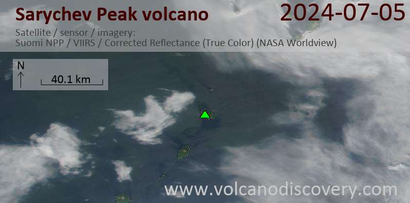
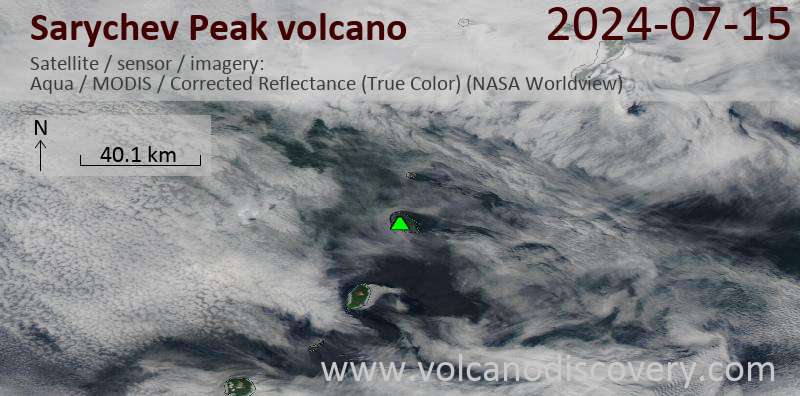
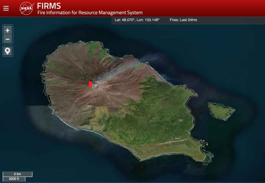
Latest satellite images