Связаться | RSS | EN | DE | EL | ES | FR | IT | RU

Nevis Peak Volcano

Updated: 16 апр 2024 07:52 GMT -
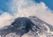
Stratovolcano 985 m / 3,232 ft
West Indies, St. Kitts and Nevis, 17.15°N / -62.58°W
Current status: normal or dormant (1 out of 5)

[smaller] [larger]
Typical eruption style: unspecified
Nevis Peak volcano eruptions: unknown, no recent eruptions

Latest nearby earthquakes

Нет недавних землетрясений
ВремяМагнитуда / ГлубинаРасстояние / Местоположение

Background

The conical island of Nevis, lying across a narrow channel from St. Kitts (St. Christopher) Island, is a composite cone with overlapping summit craters. An unnamed lava dome is located NE of the rims of the two craters. Nevis Peak, the 985 m high point of the island, is located on the outer crater rim. The inner crater truncates the western rim of the earlier crater and is widely breached on the west side. A small lava dome was emplaced within the inner crater in recent pre-Columbian time, and pyroclastic flows and mudflows were deposited on the lower slopes of the cone. Four lava domes were constructed on the flanks of the volcano. Madden's Mount and Butlers Mountain were built on the NE and eastern flanks, respectively; Mount Lily lies on the NW coast and Saddle mountain on the southern coast. No historical eruptions are known from Nevis, and the youngest dated eruption was about 100,000 years ago. Active fumaroles and hot springs are found on the island (the most recent of these formed in 1953 and remains active), and seismic swarms have occurred on several occasions during the 20th century.
---
Smithsonian / GVP volcano information

Latest satellite images

nevispeak satellite image sat1nevispeak satellite image sat2

На этой странице:

Попробуйте наше бесплатное приложение!
Volcanoes & Earthquakes - new app for Android
Android | версия iOS

Подробнее о VolcanoDiscovery

Why is there advertising on this site?

Support us - Help us upgrade our services!

We truly love working to bring you the latest volcano and earthquake data from around the world. Maintaining our website and our free apps does require, however, considerable time and resources.
We need financing to increase hard- and software capacity as well as support our editor team. We're aiming to achieve uninterrupted service wherever an earthquake or volcano eruption unfolds, and your donations can make it happen! Every donation will be highly appreciated. If you find the information useful and would like to support our team in integrating further features, write great content, and in upgrading our soft- and hardware, please make a donation (PayPal or Online credit card payment).

Planned features:Thanks to your past donations, these features have been added recently:
Download and Upgrade the Volcanoes & Earthquakes app to get one of the fastest seismic and volcano alerts online:
Android | IOS
Thank you!
Sources: VolcanoDiscovery / VolcanoAdventures and other sources as noted.
Use of material: Most text and images on our websites are owned by us. Re-use is generally not permitted without authorization. Contact us for licensing rights.
Volcanoes & Earthquakes
VolcanoDiscovery Home
Вулканы | Землетрясения | Photos | News | App
Adventure & Study Travel
Tours to Volcanoes and Volcanic Areas: walking tours, photo tours, study tours
Tours & Dates | FAQ | About us
Get our newsletter!
Company info
Contact | Legal info | Terms & conditions
Follow us
Follow us on facebook Follow us on Instagram Follow us on Twitter Visit our Youtube channel
EN | DE | EL | ES | FR | IT | RU
VolcanoDiscovery GmbH, Germany, Reg. nr.: HRB 103744, EU Tax Id: DE 297 465 123 owned and created by
Dr. Tom Pfeiffer, volcanologist, volcano photographer, tour organizer member of
IAVCEI
IAVCEI
Vulkanologische Gesellschaft
Volcanological Society
Ecotourism Greece
Ecotourism Greece
RUV insurance
Insured by R+V
VolcanoDiscovery © 2004- All Rights Reserved | Privacy - Cookie Settings