Ontake-san Volcano
Updated: 19 апр 2024 09:08 GMT -
complex volcano 3063 m / 10,049 ft
Хонсю (Япония), 35.89°N / 137.48°E
Current status: normal or dormant (1 out of 5)
Хонсю (Япония), 35.89°N / 137.48°E
Current status: normal or dormant (1 out of 5)
Last update: 29 июн 2022 (Smithsonian / USGS Weekly Volcanic Activity Report)
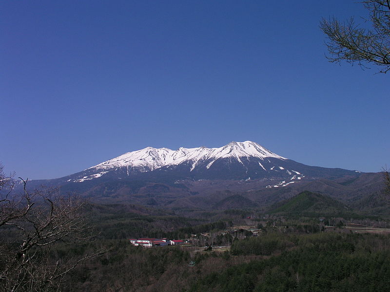
Mt.Ontake, viewed from Kuzo Pass of Route 361 (pictrure: Atsushi Ueda / Wiki Commons)
On-take, or correctly Ontake-san (御嶽山), is a massive stratovolcano and the second highest in Japan. It is located at the southern end of the Northern Japan Alps.
Its first historic eruption occurred in 1979. A landslide in 1984 was not related to an eruption and produced a debris avalanche and lahar running down valleys south and east of the volcano.
On-take volcano is one of the holy mountains of Japan and the destination for religious pilgrimage since 1792.
[smaller] [larger]
Ontake-san volcano eruptions: 27 Sep 2014, 2007, 1979-80, 774 AD
Latest nearby earthquakes
| Время | Магнитуда / Глубина | Расстояние / Местоположение | |||
Background
On-take's summit cone was built in a largely buried 4 x 5 km caldera. It lies at the southern end of the Norikura volcanic zone, which extends northward through Norikura volcano to Yake-dake volcano.The older volcanic complex of Ontake consists of at least 4 major stratovolcanoes that were constructed from about 680,000 to about 420,000 years ago, after which On-take was inactive for more than 300,000 years.
The broad, elongated summit of the younger edifice is cut by a series of small explosion craters along a NNE-trending line. Several phreatic eruptions from On-take post-date the roughly 7300-year-old Akahoya tephra from Kikai caldera.
---
Source: On-take volcano information from Smithsonian / GVP
Ontake-san Volcano Photos
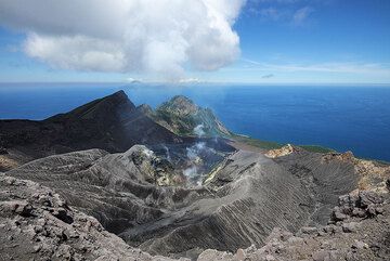
Вид на действующий кратер вулкана Суваносэ-дзима, вулкан Онтакэ (вид на северо-восток) (Photo: Tom Pfeiffer)...
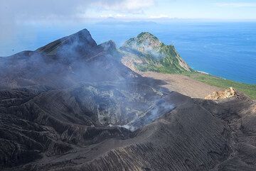
Вид на кратер вулкана Онтакэ на острове Суваносэ-дзима; Остров Накано-дзима на заднем плане на северо-востоке. (Photo: Tom Pfeiffer)...
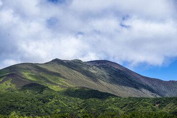
Вид на гребень островного вулкана, гору Онтакэ. (Photo: Tom Pfeiffer)
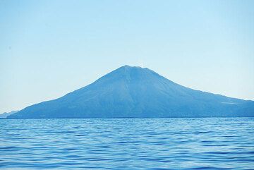
Вид на стратовулкан Онтакэ вулкана Накано-дзима, соседа Суваносэ-дзимы на северо-востоке. Из кратера на вершине можно увидеть газовый шлей (Photo: Tom Pfeiffer)...
Извержения вулкана Ontake-san
1979 first historic eruption
Around 5:00 on 28 October 1979 the first historic eruption of On-take volcano occurred from a fissure on the southwestern slope of the main peak, Kengamine.
The eruption produced a tephra column of 1500 meters and there was ashfall in Maebashi City 150 km away. A 30 m diameter crater and 9 small craters on a NW-SE lline were formed above the eruptive fissure.
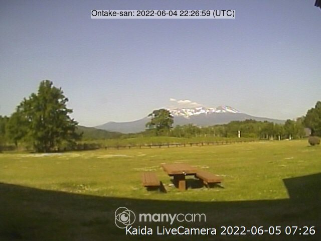
Latest satellite images