


St. Paul Volcano
Updated: 23 апр 2024 06:45 GMT -
Stratovolcano 268 m / 879 ft
France, Southern Indian Ocean, -38.72°S / 77.53°E
Current status: normal or dormant (1 out of 5)
France, Southern Indian Ocean, -38.72°S / 77.53°E
Current status: normal or dormant (1 out of 5)
[smaller] [larger]
St. Paul volcano eruptions: 1793
Latest nearby earthquakes
| Время | Магнитуда / Глубина | Расстояние / Местоположение | |||
Background
The uninhabited triangular island of St. Paul is located near the axis of the East Indian Ocean Ridge, 80 km south of Amsterdam Island. St. Paul is composed of a older tuff cone surmounted by a basaltic stratovolcano with a 1.8-km-wide caldera. The entire NE half of the volcano was submerged following collapse along a NW-trending fault. This breached the central caldera, leaving an 80-m-deep bay connected to the ocean by a narrow channel only a few meters deep. Geothermal areas are located near the 268-m-high caldera rim and along the margins of the caldera bay. The only recorded historical eruption took place in 1793 from a vent on the lower SW flank.---
Smithsonian / GVP volcano information
St. Paul Volcano Photos
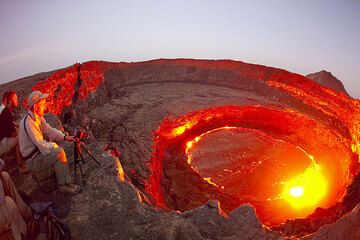
Клод, Оливье и пол смотреть деятельность лавовые озера. (Photo: Tom Pfeiffer)
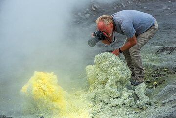
...а Пола плевать на дым. (Photo: Tom Pfeiffer)
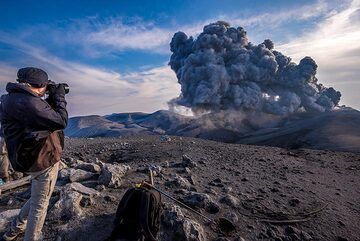
Пол фотографирует извержение (Photo: Tom Pfeiffer)
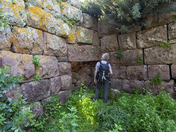
Павел у древнего входа в акрополь Палиокастро в Вафи на полуострове Метана. (Photo: Tobias Schorr)
Latest satellite images


