San Martín Volcano
Updated: Apr 25, 2024 17:17 GMT -
Shield volcano 1650 m / 5,413 ft
Mexico, 18.57°N / -95.17°W
Current status: normal or dormant (1 out of 5)
Mexico, 18.57°N / -95.17°W
Current status: normal or dormant (1 out of 5)
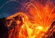
San Martín volcano (Volcan de San Martín Tuxtla) is a broad basaltic shield volcano that rises above the Gulf of Mexico, and is part of the Tuxtla volcanic field. It has a 1 km wide summit caldera containing 2 smaller scoria cones which formed during the violent 1793 summit eruption that produced wide-spread ash fall and lava flows traveling 3.5 km from the summit.
There are more than 250 flank cones dotted on the flanks of the volcano indicating frequent flank eruptions. The largest historic eruptions were in 1664 and 1793. At present, there is fumarolic activity in the summit caldera.
[smaller] [larger]
San Martín volcano eruptions: 1932(?), 1797(?)-1805(?), 1796, 1793, 1664
Latest nearby earthquakes
| Time | Mag. / Depth | Distance / Location | |||


