Contact | RSS | EN | DE | EL | ES | FR | IT | RU

Santo Tomas Volcano

Updated: Apr 19, 2024 15:11 GMT -
Stratovolcano(es) 3542 m / 11621 ft
Guatemala, 14.71°N / -91.48°W
Current status: (probably) extinct (0 out of 5)

[smaller] [larger]
Typical eruption style: unspecified
Santo Tomas volcano eruptions: None during the past 10,000 years
Less than few million years ago (Pleistocene)

Latest nearby earthquakes

No recent earthquakes
TimeMag. / DepthDistance / Location

Background

Volcán Santo Tomás (also known as Volcán Pecul) is a large eroded stratovolcano located across a valley SE of Santa María volcano. The summit is capped by late-Quaternary andesitic tephra. A winding ridge connects it to Volcán de Zunil, 4.5 km NE, a stratovolcano that forms the topographic high point of the Santo Tomás-Zunil complex. Solfataras and thermal springs are located on the ridge's W side. Volcán de Zunil is located on the SW rim of the 4-km-wide, 600-m-deep Tzanjuyub caldera, which is breached to the S by the Río Masa. Several dacitic-rhyolitic lava domes are located on the caldera's N flank and the NW flank of Volcán de Zunil. The youngest dome, Cerro Zunil, was last active about 84,000 years ago (K-Ar dating). No Holocene eruptions at Santo Tomás are known, although the volcano was included in the Catalog of Active Volcanoes of the World (Mooser et al., 1958) based on its geothermal activity.
---
Source: Smithsonian / GVP volcano information

Santo Tomas Volcano Photos
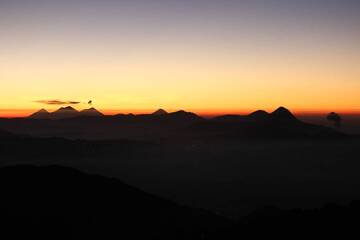
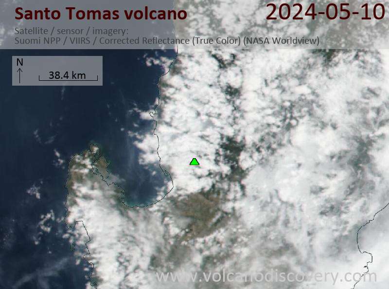
Latest satellite images

santotomas satellite image sat1santotomas satellite image sat2
News

No news in this list.

On this page:

Try our free app!
Volcanoes & Earthquakes - new app for Android
Android | iOS version

More on VolcanoDiscovery

Why is there advertising on this site?

Support us - Help us upgrade our services!

We truly love working to bring you the latest volcano and earthquake data from around the world. Maintaining our website and our free apps does require, however, considerable time and resources.
We need financing to increase hard- and software capacity as well as support our editor team. We're aiming to achieve uninterrupted service wherever an earthquake or volcano eruption unfolds, and your donations can make it happen! Every donation will be highly appreciated. If you find the information useful and would like to support our team in integrating further features, write great content, and in upgrading our soft- and hardware, please make a donation (PayPal or Online credit card payment).

Planned features:Thanks to your past donations, these features have been added recently:
Download and Upgrade the Volcanoes & Earthquakes app to get one of the fastest seismic and volcano alerts online:
Android | IOS
Thank you!
Sources: VolcanoDiscovery / VolcanoAdventures and other sources as noted.
Use of material: Most text and images on our websites are owned by us. Re-use is generally not permitted without authorization. Contact us for licensing rights.
Volcanoes & Earthquakes
VolcanoDiscovery Home
Volcanoes | Earthquakes | Photos | Volcano News | App
Adventure & Study Travel
Tours to Volcanoes and Volcanic Areas: walking tours, photo tours, study tours
Tours & Dates | FAQ | About us
Get our newsletter!
Company info
Contact | Legal info | Terms & conditions
Follow us
Follow us on facebook Follow us on Instagram Follow us on Twitter Visit our Youtube channel
EN | DE | EL | ES | FR | IT | RU
VolcanoDiscovery GmbH, Germany, Reg. nr.: HRB 103744, EU Tax Id: DE 297 465 123 owned and created by
Dr. Tom Pfeiffer, volcanologist, volcano photographer, tour organizer member of
IAVCEI
IAVCEI
Vulkanologische Gesellschaft
Volcanological Society
Ecotourism Greece
Ecotourism Greece
RUV insurance
Insured by R+V
VolcanoDiscovery © 2004- All Rights Reserved | Privacy - Cookie Settings