Terre de Bas Volcano
Updated: Apr 24, 2024 20:31 GMT -
Stratovolcano(es) 274 m / 899 ft
Guadeloupe, France, 15.87°N / -61.63°W
Current status: (probably) extinct (0 out of 5)
Guadeloupe, France, 15.87°N / -61.63°W
Current status: (probably) extinct (0 out of 5)
[smaller] [larger]
Terre de Bas volcano eruptions: None during the past 10,000 years
Less than few million years ago (Pleistocene)
Latest nearby earthquakes
| Time | Mag. / Depth | Distance / Location | |||
| Apr 20, 10:49 pm (Guadeloupe) | 1.0 7.3 km | Info | |||
| Saturday, April 20, 2024 GMT (1 quake) | |||||
| Apr 20, 07:14 am (Guadeloupe) | 2.7 34 km | 27 km (17 mi) to the E | Info | ||
| Friday, April 19, 2024 GMT (1 quake) | |||||
| Apr 19, 03:13 am (Guadeloupe) | 1.2 8.9 km | 3.3 km (2.1 mi) to the SE | Info | ||
| Thursday, April 18, 2024 GMT (2 quakes) | |||||
| Apr 18, 09:48 am (Guadeloupe) | 0.9 7.7 km | Info | |||
| Apr 18, 05:00 am (Guadeloupe) | 2.3 8.9 km | 0.9 km (0.5 mi) to the S | Info | ||
| Wednesday, April 17, 2024 GMT (1 quake) | |||||
| Apr 17, 06:26 am (Guadeloupe) | 1.2 1.9 km | 4 km (2.5 mi) to the E | Info | ||
Background
Terre de Bas Island, located in the Les Santes Islands off the southern coast of Basse Terre, were active about 1.9-0.6 million years ago (Komorowski et al., 2005).---
Source: Smithsonian / GVP volcano information
Terre de Bas Volcano Photos
-80 m a.s.l. We have reached the flat bootom of the Danakil depression. A large, fresh-looking lava flow covers much of the area here. The extension and sinking of the ea...
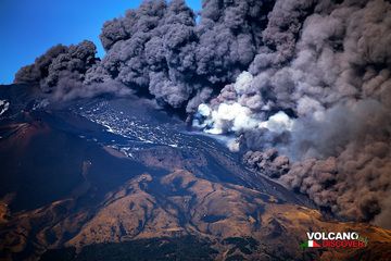
Dense ash plumes are being emitted from the summit crater and fissures which just have opened up at their base, accompanied by violent earth tremors. (Photo: Emanuela / V...
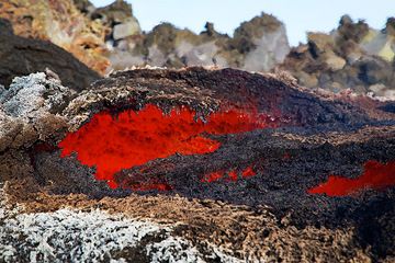
Thin lava roof that has formed above the channel a bit further downslope where the lava flow again flows underground. (Photo: Emanuela / VolcanoDiscovery Italia)
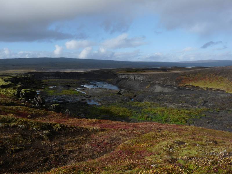
Autumn colours around a river valley carved into basaltic flows near Hrauneyjalón, southern boundary of the Icelandic Highlands (12 Septmeber 2014) (Photo: Ingrid)
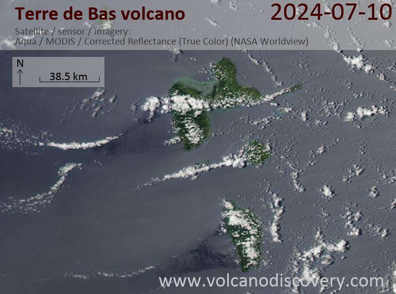
Latest satellite images